Starting point: Orešnik (660 m)
Time of walking: 1 h 30 min
Difficulty: easy marked way
Altitude difference: 504 m
Altitude difference po putu: 504 m
Map: Pohorje 1:50.000
Recommended equipment (summer):
Recommended equipment (winter): ice axe, crampons
Views: 13.899
 | 2 people like this post |
Access to the starting point:
From Velenje or Dravograd, drive to Slovenj Gradec and take the Kope and Legan exit at the roundabout on the main road Dravograd - Velenje. The road then soon leads to the next junction, where you continue straight on towards Gradišče. The road then leads to a crossroads marked "farms". Here, turn right and follow the road to the next crossroads, where you turn right again and go uphill. Continue for a short distance to the next crossroads, where you turn sharp right uphill. After a few tens of metres the road comes to the "farm" Hriberšek, after which the road turns sharp left. Continue for a short distance and then the route described above begins behind the torrent we have just crossed. There are no parking places at the starting point, but a parking place has been arranged a little further away at the Vinišnik picnic area.
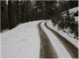
Path description:
From the starting point, continue along the road, and after a few minutes' walk, the road crosses a marked path. Leave the road here and turn left up cart track, which climbs steeply at first and then moderately through the forest. Follow this path for a good half an hour until it leads to a road. Here is the junction of four roads and our footpath, which just crosses the junction. The path then continues through the wods and climbs cart track surrounded by spruce wods. A little higher, you reach the Lampret "farm", after which you cross the road again. The path continues almost horizontally to the place where the signs for Kremžarjev direct us to the right steeply upwards. The steepness quickly gives way and the path leads us to an undistinguished ridge where there is a crossroads and an interesting half-open, half-glass chapel. Here we continue to the right in the direction of Kremžarjevega vrha (left hut 3 minutes). The path continues to climb slightly while crossing the scenic slope, where we open a beautiful view towards Košenjaku. Just below the summit, the path goes into the forest which, even at the summit, is not abandoned after a few minutes of further walking.

Pictures:
 1
1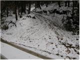 2
2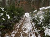 3
3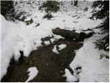 4
4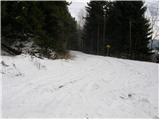 5
5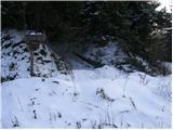 6
6 7
7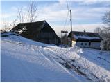 8
8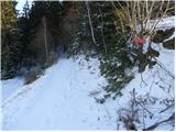 9
9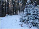 10
10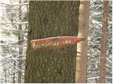 11
11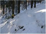 12
12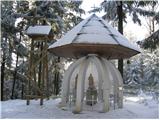 13
13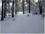 14
14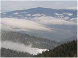 15
15 16
16
Discussion about the trail Orešnik - Kremžarjev vrh
|
| marinka6710. 12. 2014 |
Ali morda kdo ve, kaka je povezava s Kremžarjevega vrha na kočo Planinc? Koliko časa se hodi in ali je označeno? O tej koči nič ne najdem na tem portalu, bi pa morda šli ta vikend.
Hvala.
|
|
|
|
| Janezs11. 12. 2014 |
Pot je solidno označena,traja okrog 1 h.Koča Planinc,pa mislim,daje odprta za vikende in praznike. Mogoče bo ti še kdo, napisal bolj sveže podatke.
|
|
|