border crossing Remšnik - Sveti Pankracij (Radelca)
Starting point: border crossing Remšnik (735 m)
| Lat/Lon: | 46,6523°N 15,3079°E |
| |
Time of walking: 25 min
Difficulty: easy marked way
Altitude difference: 165 m
Altitude difference po putu: 165 m
Map: Pohorje - izletniška karta 1:50.000
Recommended equipment (summer):
Recommended equipment (winter): ice axe, crampons
Views: 767
 | 1 person likes this post |
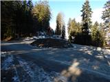
Access to the starting point:
a) From Dravograd, drive towards Maribor, but only as far as the village of Vas, where you turn left towards Remšnik. Then climb up to the above-mentioned village, where shortly before the parish church of St. George, take a sharp left. Continue past the homesteads of Kajzar and Helbel, continuing along the right-hand road, and then past the homesteads of Prelank, where you go left, and Korenk, which you pass on the left-hand side. There are some more crossings, where you continue straight ahead at the crossroads. When you reach the state border, park at a suitable place on the roadside. The border crossing point Remšnik is a few 100 m further on.
b) From Maribor, drive towards Dravograd, but only as far as Brezno, where you turn right towards Brezni Vrh and Remšnik. At a higher point, leave the road towards Remšnik and continue straight towards Brezno Vrho. Just a few metres further on, bear slightly right, then pass the farmsteads of Hager, Podržavnik, Kompar, Breznik, where you turn left towards Austria, then a few more crossings and you reach the border crossing with Austria. Turn left here and drive for about 500 m to the next crossroads, where you can park at a suitable place.
Path description:
From the starting point, follow the footpath that branches off the road at the signpost for the state border. The path leads westwards and climbs through the forest and along the state border. A little further on, we get some views of the Slovenian side, and higher up, when the path leads us out of the forest, we get some views of the Austrian side. There is a shorter, steeper climb along the upper part of the meadow and we reach the Church of St Pancras.
Description and pictures refer to 2018 (December).
Pictures:
 1
1 2
2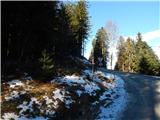 3
3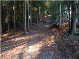 4
4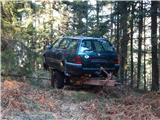 5
5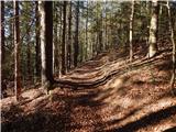 6
6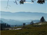 7
7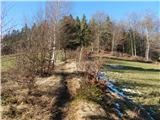 8
8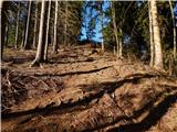 9
9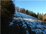 10
10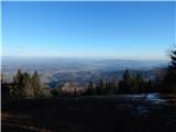 11
11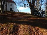 12
12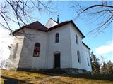 13
13 14
14
Discussion about the trail border crossing Remšnik - Sveti Pankracij (Radelca)