Okrog (Lazar) - Bajturn (Zaplaški hrib) (on ridge)
Starting point: Okrog (Lazar) (320 m)
| Lat/Lon: | 45,9711°N 14,9897°E |
| |
Name of path: on ridge
Time of walking: 1 h 30 min
Difficulty: easy marked way
Altitude difference: 289 m
Altitude difference po putu: 350 m
Map:
Recommended equipment (summer):
Recommended equipment (winter):
Views: 433
 | 2 people like this post |
Access to the starting point:
a) From the Ljubljana - Novo mesto motorway, take the exit Trebnje East and then continue driving towards Velika Loka. After the settlement of Zidani Most, you will reach the settlement of Štefan pri Trebnjem, where you will take a sharp left in the direction of Zaplaz. After a few kilometres on a partly winding road, you reach Čatež, from where the road starts to descend towards the Mirna River. When you reach the valley, first cross the bridge over the Dušica stream and continue straight ahead. A little further on, you reach the next crossroads, where the main road turns left and the road to Gornji Ravne branches off to the right. Here again, continue on the main road, and before the main road crosses the bridge over the Mirna River, turn left into a small parking area located between the river, the road and the trailhead.
b) From Trebnje or Mokronog drive to Mirna and from there drive to Litija. Towards Litija, drive to a sharp right turn, and from there turn left towards Cirnik and Selska Gora. After Cirnik the road gradually starts to descend. When you reach the river Mirna, first cross the bridge and then turn right at the crossroads. From the crossroads, drive for another 100 metres, then before the main road crosses the bridge over the Mirna River, turn left into a small parking area located between the river, the road and the trailhead.
c) Drive to Šmartno pri Litiji and from there continue to Gabrovka. After Moravče pri Gabrovki, after the transformer, turn slightly right towards the petrol station. Continue along the valley of the river Mirna, passing the road turnoff towards the settlement of Tlaka. When the road first turns to the right bank of the Mirna after the turn-off, park in the roadside parking lot.
Path description:
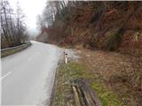
From the starting point, focus on the initially overgrown path, which climbs above the road, continues steeply above it for a short time, and then turns slightly more to the right, where it leads us above the hayfield. The path then passes into the woods, where it initially leads us over some more fallen trees, and then continues crosswise along cart track. When the cart track leads us out of the forest, it descends slightly and joins the road leading to the nearby Dule homestead.
Continue through the courtyard, then the road ends behind the house and the path continues on the less grassy cart track, which leads across a hay field. A little further on, the path turns right, climbs a little more, and then joins the wider cart track, which is followed to the left. Cart track leads us along the upper edge of the hayfield for a few minutes, then into the woods, where at a nearby crossroads we reach the Levstik Trail from Litija to Čatež.
Follow the path to the left, and follow it down two serpentine descents to a small stream, which you cross, and then continue through the forest. As you walk through the forest, the path leads you past several information boards on the Levstik Trail, and then, a little beyond a wooden cross, you emerge from the forest, where you cross the next small stream. At the hunting observatory, continue left in the direction of the pilgrims' trail, then cross the woods to the asphalt road that leads through the village of Čatež, a few minutes away. Follow the road to the right and quickly reach a large parking lot behind the fire station.
From the parking lot, near which is also the destination of the Levstik Trail from Litija to Čatež, first climb up to the parish church of St Michael in Čatež, and from there, after the church, continue to the right and, at the Tončkov dom Inn, return to the main road, which you will reach at a marked crossroads. The trail will take you up to the parish church of St Michael in Čatež, and from there continue to the right. Continue up the main road, which leads past the bus station and the tourist map, and then, after 100 metres, turn right onto the steep road in the direction of Zaplaza. The road quickly bends to the left and leads to the edge of the forest, where there is a marked crossroads. The right path leads to Zagrič and also to Bajturn and Zaplaz, and we continue along the asphalt road for a few more 10 steps, and then the sign for the pilgrims' path directs us to a grassy path, which takes us up to the church at Zaplaz in a few minutes, with beautiful views.
From the church, walk to the other side and enter the large parking lot.
From the parking lot at Zaplaz, continue westwards to reach a marked crossroads at the end of the parking lot.
Continue straight ahead (the chapel with healing water on the right and Bajturn on the northern slope), passing the nearby farmhouse on the right. Behind the house, cart track immediately leads us to a beautiful lookout point, from which we have a beautiful view towards Dolenjska and the surrounding hills. Further on, cart track turns into a forest and climbs moderately along a ridge, and we notice a large number of information boards along the way. Slightly beyond the weather forecasting stone, at a small crossroads, continue slightly left (if you continue slightly right, you join the path on the northern slope), and the gently sloping path, which even descends slightly at times, leads you past a creche and a hunting lodge. At the crossroads behind the crossing, go slightly right and climb steeply. When the path returns to the ridge, it turns left and lays down. From here it is only a few minutes of gentle ascent and the forest path leads us to a wooded summit.
Description and pictures refer to the situation in 2016 (March).

Pictures:
 1
1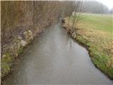 2
2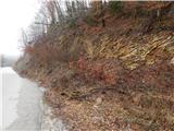 3
3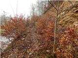 4
4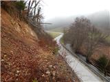 5
5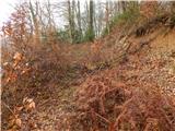 6
6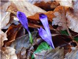 7
7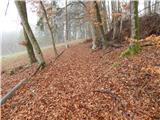 8
8 9
9 10
10 11
11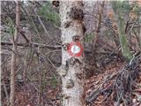 12
12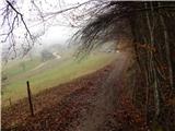 13
13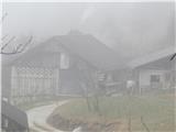 14
14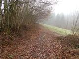 15
15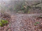 16
16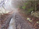 17
17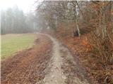 18
18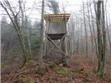 19
19 20
20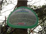 21
21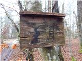 22
22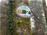 23
23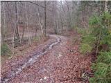 24
24 25
25 26
26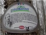 27
27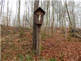 28
28 29
29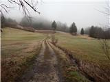 30
30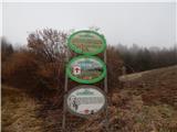 31
31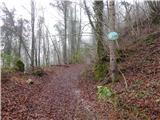 32
32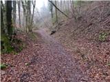 33
33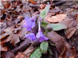 34
34 35
35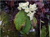 36
36 37
37 38
38 39
39 40
40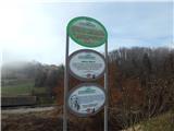 41
41 42
42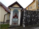 43
43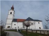 44
44 45
45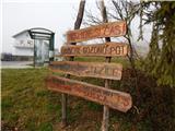 46
46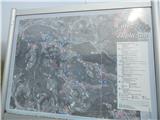 47
47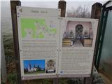 48
48 49
49 50
50 51
51 52
52 53
53 54
54 55
55 56
56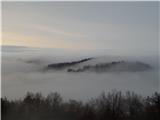 57
57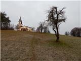 58
58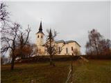 59
59 60
60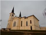 61
61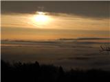 62
62 63
63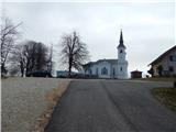 64
64 65
65 66
66 67
67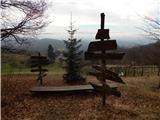 68
68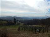 69
69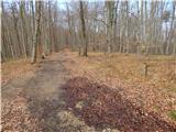 70
70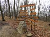 71
71 72
72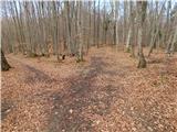 73
73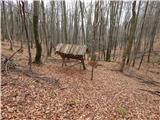 74
74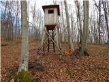 75
75 76
76 77
77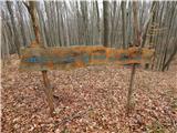 78
78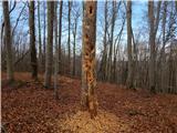 79
79 80
80 81
81
Discussion about the trail Okrog (Lazar) - Bajturn (Zaplaški hrib) (on ridge)