Neustift im Stubaital - Hoher Burgstall (south path via Starkenburger Hütte)
Starting point: Neustift im Stubaital (994 m)
| Lat/Lon: | 47,10916°N 11,30609°E |
| |
Name of path: south path via Starkenburger Hütte
Time of walking: 4 h 15 min
Difficulty: partly demanding marked way
Altitude difference: 1617 m
Altitude difference po putu: 1617 m
Map: Innsbruck und Umgebung, 31/5 1:50.000; Outdooractive Stubai Wanderkarte
Recommended equipment (summer): helmet
Recommended equipment (winter): ice axe, crampons
Views: 312
 | 5 people like this post |
Access to the starting point:
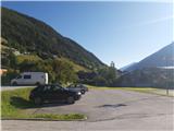
From Ljubljana, take the motorway past Salzburg towards Munich. At the Dreieck Inntal multi-level junction, take the A93 towards Innsbruck/Kufstein/Brenner. On your return to Austria, continue to the Innsbruck-Mitte exit. Here, do not turn towards Innsbruck, but continue on the A13 motorway towards the Brenner Pass. Turn off the motorway at exit 10-Schönberg and follow the comfortable road through the Stubai Valley to Neustift im Stubaital. Here you can park at the information centre, in the pay parking lots in the centre of the village or a little higher up on the asphalt road from which you continue on the road to Hoher Burgstall.
An alternative is to drive through northern Itali: in this case, take the A2 motorway from central Slovenia to one of the border crossings with Austria and continue to Lienz. Here you continue on the 100 road and pass the Prato alla Drava crossing into Itali. In Itali, follow the SS49 all the way to the junction with the A22 motorway in the direction of the Brenner Pass. After the pass, continue in the direction of Innsbruck to the Schönberg exit. From there, follow the route described above.
Path description:
From the centre of Neustift, follow the signs to the ascending asphalt road. Follow this until a signpost above the village directs you onto a narrower path towards the Starkenburger Hütte, which turns into the woods past a pleasant bench. Pay attention to the name of the path that will now lead you to the summit - it is marked with a red circle on the signposts; you can also reach the Starkenburger Hütte by the "blue", flatter path that runs along the mountain road*.
The trail then alternates between moderately steep forest slopes and shorter strips of grassy flats, from which there are fine views towards Stubai Alps, in particular the Habicht and Serlesa groups. The route is obvious and well marked throughout. After about two hours' walking, you reach a large clearing where sheep graze regularly, and just a little higher up you meet the road again, which follows a more level path. Here, continue straight ahead to the west, crossing a slightly steeper strip of woodland.
After a half hour's walk from the crossroads, we are in the open, with the Starkenburger Hütte and the Hoher Burgstall cliffs to the north above us. The route passes through attractive surroundings and the views towards the eastern and southern Stubai Alps are becoming increasingly beautiful. After crossing the protective fence, you climb up to the high mountain road just below the Starkenburger Hütte; from here you can reach the hut by road or more directly by an unmarked path which follows a mountain spring on the last climb up to the hut.
The hut offers magnificent views of the Stubai Alps; from here you can see all the "7 peaks of the Stubai". To reach Hoher Burgstall, whose cross on the summit can already be seen at the hut, descend to the end of the mountain road and follow the signs which take you past two forks in the hills and over the top slopes of the mountain. On the summit shoulder, we pass from the grassy glades under the rocky head of the Hoher Burgstall. There are three places where ropes help us to the top, but nowhere are the passages too difficult or exposed. Just below the summit, we are joined by a path that passes Sennjochhütte from the north. From here, it is only a short walk to the summit with its large cross.
For orientation around the area, I recommend picking up a good free map "Outdooractive Stubai Wanderkarte", which can be obtained from the tourist centre in Neustift.
* High mountain trails in Tyrol are marked with blue (easy), red (medium) and black (difficult/very difficult) markings. However, it should be borne in mind that trails that would be marked as "easy" in our country without too much circumstance are often marked as "medium". This is also the case for the present 'red' ascent to the Starkenburger Hütte, which is both technically and mentally easy, but only slightly steeper and more direct than the alternative 'blue' route.

Pictures:
 1
1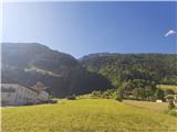 2
2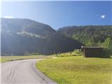 3
3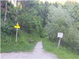 4
4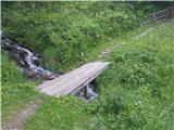 5
5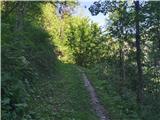 6
6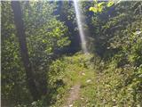 7
7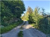 8
8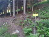 9
9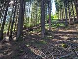 10
10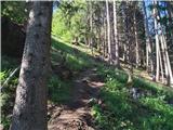 11
11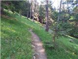 12
12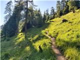 13
13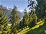 14
14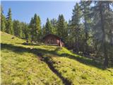 15
15 16
16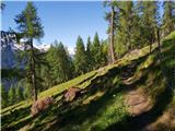 17
17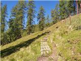 18
18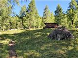 19
19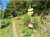 20
20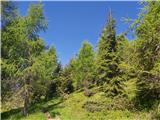 21
21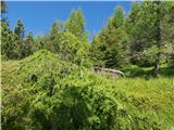 22
22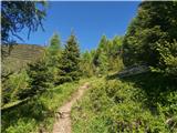 23
23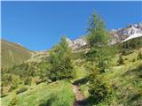 24
24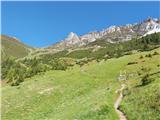 25
25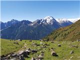 26
26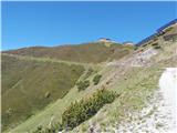 27
27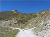 28
28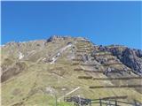 29
29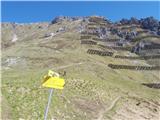 30
30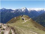 31
31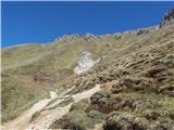 32
32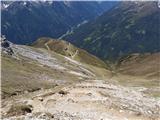 33
33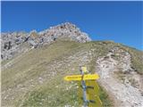 34
34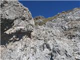 35
35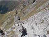 36
36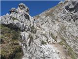 37
37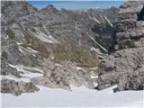 38
38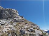 39
39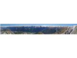 40
40
Discussion about the trail Neustift im Stubaital - Hoher Burgstall (south path via Starkenburger Hütte)