Nemilje - Sveti Mohor (Zabrekve)
Starting point: Nemilje (510 m)
| Lat/Lon: | 46,2553°N 14,2249°E |
| |
Time of walking: 1 h 20 min
Difficulty: easy unmarked way
Altitude difference: 442 m
Altitude difference po putu: 450 m
Map: Škofjeloško in Cerkljansko hribovje 1:50.000
Recommended equipment (summer):
Recommended equipment (winter):
Views: 7.975
 | 1 person likes this post |
Access to the starting point:
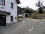
a) From Ljubljana, take the old road to Kranj, then follow the main road to the bridge over the Sava River. Just before the bridge, we leave the main road and continue straight ahead towards Besnice. Continue through Rakovica, Spodnja and Zgornja Besnica, Njivica, and we follow the partly winding road to Nemilje, where we turn left at the inn at Raspoki in the direction of "Selca via Topolje". The road then loses its asphalt surface and leads us across a large meadow to the edge of the forest, where, on the opposite side of the NOB grave, we park in a suitable space by the roadside.
b) From Jesenice or Bled, take the motorway towards Ljubljana, and we follow it to the Kranj - West exit. Continue on the old regional road towards Ljubljana, and we follow it to Kranj, where we turn right towards Besnice, just after the bridge over the Sava River. Continue through Rakovica, Spodnja and Zgornja Besnica, Njivica, and we follow the partly winding road to Nemilje, where we turn left at the inn at Raspoki in the direction "Selca via Topolje". The road then loses its asphalt surface and leads us across a large meadow to the edge of the forest, where, on the opposite side of the NOB grave, we park in a suitable space by the roadside.
c) The starting point can also be reached from Železniki by passing through the villages Rudno and Dražgoše towards Kranj. When you reach the village Nemilje turn right and continue driving in the direction "Selca via Topolje". The road then loses its asphalt surface and crosses a large meadow to the edge of the forest, where, on the opposite side of the NOB grave, we park in a suitable space on the roadside.
Path description:
From the starting point, continue along the macadam road, which climbs gently to moderately at times along the Lipnik stream. The way forward leads us past a small cave, beyond which we quickly reach a larger clearing, in the middle of which stands a feeding station for animals. Only a few 10 metres further on, the road returns to the forest, and we see on the right-hand side cart track, which turns sharply to the right off the road. We take the cart track, and soon we see the first marking alongside it, which points us left into the bank. Next, we climb a little steeper through the forest, and the path quickly lays down and leads us to a macadam road, which we just cross. We continue our ascent along the marked footpath, but it starts to disappear between the cart tracks and the bushes. We continue to follow with great difficulty the old and occasionally quite rare markings which lead us up the slope quite steeply. During the ascent, we cross a cart track or tractor logging trail a few times, and we try to follow the path in roughly the same direction.
Higher up, we reach an asphalt road, and we follow it to the left and keep on in the direction of Sveti Mohor. We continue following the asphalt road, which leads us over increasingly scenic slopes to a place where a partly grassy cart track turns sharply to the right. Take the above-mentioned cart track, which immediately turns semicircularly to the left, then crosses a dirt road and leads us over a scenic slope into the lane of the forest, where it completely lays down. We continue through the forest for a short time, then we reach the top slope of the mountain, where the path from Besnice or St. Jošto joins us from the left.
Continue straight ahead and after less than 5 minutes of further walking you will reach the top with the Church of St. Mohorja.

Pictures:
 1
1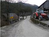 2
2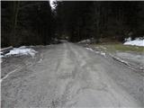 3
3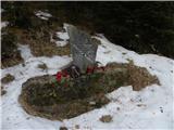 4
4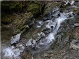 5
5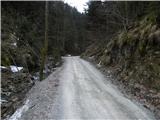 6
6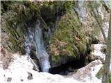 7
7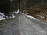 8
8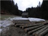 9
9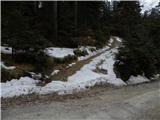 10
10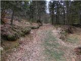 11
11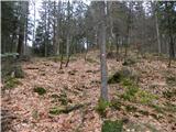 12
12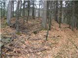 13
13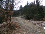 14
14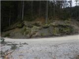 15
15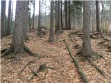 16
16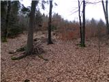 17
17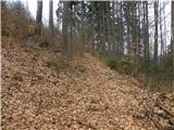 18
18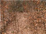 19
19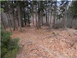 20
20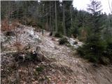 21
21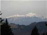 22
22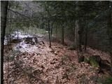 23
23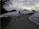 24
24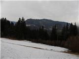 25
25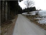 26
26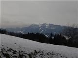 27
27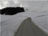 28
28 29
29 30
30 31
31 32
32 33
33 34
34 35
35 36
36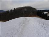 37
37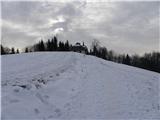 38
38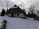 39
39 40
40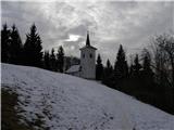 41
41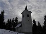 42
42 43
43
Discussion about the trail Nemilje - Sveti Mohor (Zabrekve)