Molnarjev breg - Planina Osredek
Starting point: Molnarjev breg (1200 m)
| Lat/Lon: | 46,2803°N 14,5359°E |
| |
Time of walking: 45 min
Difficulty: easy marked way
Altitude difference: -100 m
Altitude difference po putu: 50 m
Map: Kamniške in Savinjske Alpe 1:50.000
Recommended equipment (summer):
Recommended equipment (winter): ice axe, crampons
Views: 12.530
 | 1 person likes this post |
Access to the starting point:
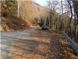
a) From the motorway Ljubljana - Jesenice take the exit Vodice, then continue to the first semaphore crossing in Vodice, where you turn left towards Cerkelj na Gorenjskem and Brnik. When you reach the main roundabout at Spodnji Brnik, continue driving in the direction of Cerkeliai and the ski resort Krvavec. At the end of Cerklje na Gorenjskem, leave the main road, which continues towards Velesovo and Visoke, and turn slightly right onto the road towards the ski resort Krvavec. Continue to the village of Grad, where signs for Ambrož pod Krvavcem direct you to the right on a steep asphalt road (straight ahead to the lower station of the round-cabin cable car to Krvavec and Štefanja Gora). When the steepness of the steep road eases slightly, you will come to a junction, where you will continue to the left in the direction of Ambrož pod Krvavcem (straight ahead to the settlements of Ravne, Apno and Šenturška Gora). A little further on, the road descends a little and then climbs over slopes that are sometimes quite scenic. Higher up, you reach Ambrož pod Krvavcem, where you pass the church of St Ambrose and the tourist farm Pr Ambružarju on the left. From the tourist farm onwards, the road passes into wods and climbs relatively steeply. When you reach the left-hand serpentine, you are at the starting point, where you can park at a suitable place, at a small crossroads.
b) From the motorway Jesenice - Ljubljana, take the exit Kranj - East, then continue towards Brnik, Komenda and Mengeš. When you reach the main roundabout at Spodnji Brnik, continue driving towards Cerkeliai and the ski resort Krvavec. At the end of Cerklje na Gorenjskem, leave the main road, which continues towards Velesovo and Visoke, and turn slightly right onto the road towards the ski resort of Krvavec. Continue to the village of Grad, where signs for Ambrož pod Krvavcem direct you to the right on a steep asphalt road (straight ahead to the lower station of the circular cable car to Krvavec and Štefanja Gora). When the steepness of the steep road eases slightly, you will come to a crossroads, where you will continue to the left in the direction of Ambrož pod Krvavcem (straight ahead to the settlements of Ravne, Apno and Šenturška Gora). A little further on, the road descends a little and then climbs over slopes that are sometimes quite scenic. Higher up, you reach Ambrož pod Krvavcem, where you pass the church of St Ambrose and the tourist farm Pr Ambružarju on the left. From the tourist farm onwards, the road passes into wods and climbs relatively steeply. When you reach the left-hand serpentine, you are at the starting point, where you can park at a suitable place, at a small crossroads.
Path description:
From the starting point, follow the forest road that crosses the slopes of Molnar's Bank. Follow the road as it climbs slightly and then reaches a small crossroads where you continue slightly left along the upper road (the lower road or cart track soon ends), along which you can also see markings. There is a few minutes of cross-country climbing, along a road from which we occasionally get some views. A little further on the road splits again, and this time we take the upper left road, from which a steep cart track branches off to the left only a few 10 steps further on. Continue along the road, which you follow to the right-hand bend.
From the bend, continue straight ahead on a marked footpath which continues cross-wise through the wods. In the forest you quickly reach a marked crossroads where you continue downhill to the right in the direction of mountain pasture Osredek and Kamniški vrh (the upper path leads to Kamniški vrh and bypasses mountain pasture Osredek, but it is also possible to continue towards Kriška mountain pasture). A slightly steeper descent follows, then cross the road you have recently left and continue descending. Lower down in the forest, the path turns left and lays down. After a few minutes of crossing, you come out of the forest at mountain pasture Osredek, where there are a few wooden huts.

Pictures:
 1
1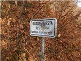 2
2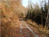 3
3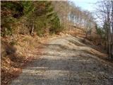 4
4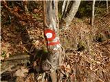 5
5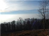 6
6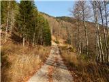 7
7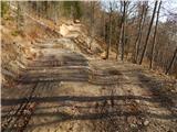 8
8 9
9 10
10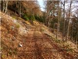 11
11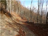 12
12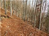 13
13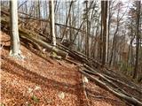 14
14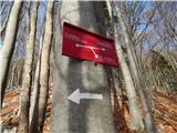 15
15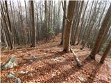 16
16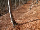 17
17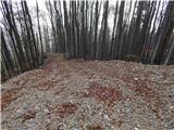 18
18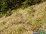 19
19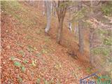 20
20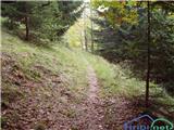 21
21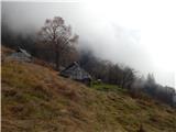 22
22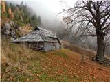 23
23 24
24
Discussion about the trail Molnarjev breg - Planina Osredek
|
| velkavrh17. 04. 2011 |
Danes opravil ta krajši pohod. Res se lahko avto pusti na ovinku asfaltirane ceste, ki gre naprej proti Krvavcu. Sedaj je pri Kmečkem turizmu Pri Ambrožarju tabla, ki dovoljuje vožnjo do konca asfalta do planine Jezerca, kar je še lani od tu bilo prepovedano. Zelo pohvalno! Jaz sem sicer pohod malo podaljšal, ker sem šel peš od Škerjančevega iz Stiške vasi. Ne bi se srtinjal, da je to zahtevna pot. Res je kmalu, ko se konča gozdna pot navzdol malo strmo, vendar nič posebnega. Pred strmim delom lahko zavijemo levo, kjer gre grebenska pot do Kamniškega vrha. Jaz sem šel po njej in se potem nad planino spustil navzdol na samo planino. Vračal se se pa po opisani. Res primerno tudi za sprehod s psom. Za manjše otroke pa res ni priporočljivo.
|
|
|
|
| Raina17. 04. 2011 |
Napaka v nadmorski višini izhodišča in poseldično napačna višinska razlika?
|
|
|
|
| Tadej17. 04. 2011 |
Raina, hvala za opozorilo. Sem popravil.
|
|
|
|
| velkavrh11. 08. 2012 |
Šel na to kratko, ampak kljub temu prijetno pot. Na planini je od pomladi skrinjica z žigom in vpisno knjigo. Trenutno se med tednom ne more po tej poti, ker je pot zaprta zaradi izdelave vleke za spravilo lesa. Table z zaporo so z obeh strani. Lahko se gre samo med vikendom. Od Ambroža gremo na planino Osredek med tednom lahko samo na Pokovša.
|
|
|
|
| velkavrh16. 08. 2013 |
V ponedeljek zjutraj sem šel bolj na sprehod kot na resno turo. Če sem že v Stiški vasi rad skočim še do Ambroža in potem na planino Osredek. Suša se zelo pozna-izvir pod planino komaj še kaplja.Planina ni pokošena-samo potke.Je pa vse pohojeno kot bi srne iskaale določeno travo.Srečal pa sem pohodnika, ki je na tisti jasici pred planino nabiral zdravilna zelišča.
|
|
|
|
| nataša725. 08. 2013 |
Včeraj sta na planini Osredek rila bager in buldožer. Padale so smreke. Planina je razrita do neprepoznavnosti. 
|
|
|
|
| velkavrh27. 08. 2013 |
Na planino zahajam kar peš običajno iz Stiške vasi od Škerjančevega in bil sem gor pred enajstimi dnevi in ni mi čisto jasno kaj se je z planino zgodilo. Bila je tako lepa, neokrnjena, polna planinskega cvetja, metuljev in izvirček je bolj na tanko curljal. Če je to res kar vidim na slikcah, je to vsekakor planini narajena nepopravjiva škoda in tako ravnanje odločno obsojam!
|
|
|