Molnarjev breg - Kamniški vrh
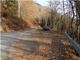
Starting point: Molnarjev breg (1200 m)
| Lat/Lon: | 46,2803°N 14,5359°E |
| |
Time of walking: 1 h 30 min
Difficulty: easy marked way
Altitude difference: 59 m
Altitude difference po putu: 200 m
Map: Kamniške in Savinjske Alpe 1:50.000
Recommended equipment (summer):
Recommended equipment (winter): ice axe, crampons
Views: 65.821
 | 4 people like this post |
Access to the starting point:
a) From the motorway Ljubljana - Jesenice take the exit Vodice, then continue to the first semaphore crossing in Vodice, where you turn left towards Cerkelj na Gorenjskem and Brnik. When you reach the main roundabout at Spodnji Brnik, continue driving in the direction of Cerkeliai and the ski resort Krvavec. At the end of Cerklje na Gorenjskem, leave the main road, which continues towards Velesovo and Visoke, and turn slightly right onto the road towards the ski resort Krvavec. Continue to the village of Grad, where signs for Ambrož pod Krvavcem direct you to the right on a steep asphalt road (straight ahead to the lower station of the round-cabin cable car to Krvavec and Štefanja Gora). When the steepness of the steep road eases slightly, you will come to a junction, where you will continue to the left in the direction of Ambrož pod Krvavcem (straight ahead to the settlements of Ravne, Apno and Šenturška Gora). A little further on, the road descends a little and then climbs over slopes that are sometimes quite scenic. Higher up, you reach Ambrož pod Krvavcem, where you pass the church of St Ambrose and the tourist farm Pr Ambružarju on the left. From the tourist farm onwards, the road passes into wods and climbs relatively steeply. When you reach the left-hand serpentine, you are at the starting point, where you can park at a suitable place, at a small crossroads.
b) From the motorway Jesenice - Ljubljana, take the exit Kranj - East, then continue towards Brnik, Komenda and Mengeš. When you reach the main roundabout at Spodnji Brnik, continue driving towards Cerkeliai and the ski resort Krvavec. At the end of Cerklje na Gorenjskem, leave the main road, which continues towards Velesovo and Visoke, and turn slightly right onto the road towards the ski resort Krvavec. Continue to the village of Grad, where signs for Ambrož pod Krvavcem direct you to the right on a steep asphalt road (straight ahead to the lower station of the circular cable car to Krvavec and Štefanja Gora). When the steepness of the steep road eases slightly, you will come to a crossroads, where you will continue to the left in the direction of Ambrož pod Krvavcem (straight ahead to the settlements of Ravne, Apno and Šenturška Gora). A little further on, the road descends a little and then climbs over slopes that are sometimes quite scenic. Higher up, you reach Ambrož pod Krvavcem, where you pass the church of St Ambrose and the tourist farm Pr Ambružarju on the left. From the tourist farm onwards, the road passes into wods and climbs relatively steeply. When you reach the left-hand serpentine, you are at the starting point, where you can park at a suitable place, at a small crossroads.
Path description:
From the starting point, follow the forest road that crosses the slopes of Molnar's Bank. Follow the road as it climbs slightly and then reaches a small crossroads where you continue slightly left along the upper road (the lower road or cart track soon ends), along which you can also see markings. There is a few minutes of cross-country climbing, along a road from which we occasionally get some views. A little further on the road splits again, and this time we take the upper left road, from which a steep cart track branches off to the left only a few 10 steps further on. Continue along the road, which you follow to the right-hand bend.
From the bend, continue straight ahead on a marked footpath which continues cross-wise through the wods. In the forest, you quickly reach a marked crossroads where you continue straight on in the route Kamniški vrh (right down Kamniški vrh via mountain pasture Osredek). A few minutes of traversing follows, and then you reach the east ridge of Kržišče, and a few steps further on to a marked crossroads.
Continue slightly right (left Kriška planina) along the path, which begins to descend or slightly north of the vegetated ridge. At a small saddle (1200 m) between the massifs of Krvavec and Kamniški vrh, the path with mountain pasture Osredki joins us from the right, and we continue straight ahead, following the path that runs along the north side of the ridge. After a short crossing, where the path is quite close to the ridge, an unmarked path to Planjava branches off slightly to the right, and we continue on the left, north side of the ridge. Cross the steeper northern slope of Planjava, then, once east of Planjava, return to the ridge. When you reach the ridge, descend slightly further eastwards, then reach a marked crossroads where you join the visibly more beaten track from Stahovica and Županjih Njiv.
Continue straight ahead here and start climbing steeply along the scenic western ridge of Kamnik Peak. After about 10 minutes of climbing, you will reach Kamniški vrh, and if you continue for a minute further you will reach the bivouac on Kamnice Peak.
Description and pictures refer to the situation in 2015 (November).

Pictures:
 1
1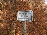 2
2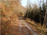 3
3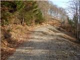 4
4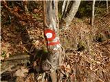 5
5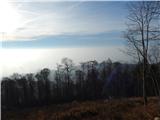 6
6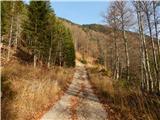 7
7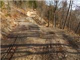 8
8 9
9 10
10 11
11 12
12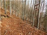 13
13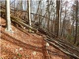 14
14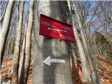 15
15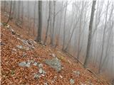 16
16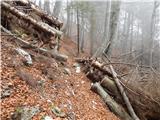 17
17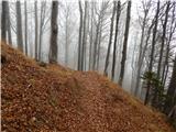 18
18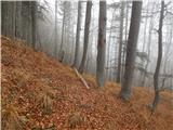 19
19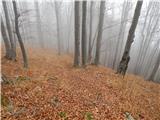 20
20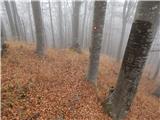 21
21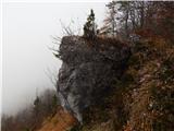 22
22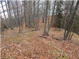 23
23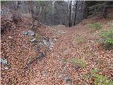 24
24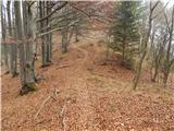 25
25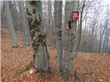 26
26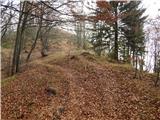 27
27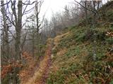 28
28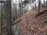 29
29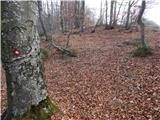 30
30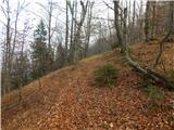 31
31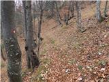 32
32 33
33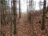 34
34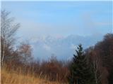 35
35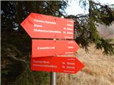 36
36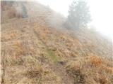 37
37 38
38 39
39 40
40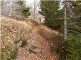 41
41 42
42 43
43 44
44
Discussion about the trail Molnarjev breg - Kamniški vrh
|
| Guest14. 11. 2006 |
MT-čudovit izlet preko vasi Klemenčevo, do Korošaških slapov, na planino Osredek,preko planjave do Kamniškega vrha. Čudoviti razgledi. Na določenih delih nemarkirana pot (Klemenčevo-K.slapovi-Osredek)in zelo strma predvsem proti vrhu pl.Osredek.Priporočam povratek do sedla(K.Vrh -Planjava) in spust levo mimo kamniške rože na širok travnik in v dolino pod Klemenčevim. Opozarjam, da je pot navzdol neprijetno strma in zaradi šodra zdrsla.
|
|
|
|
| Guest29. 11. 2006 |
Se strinjam z gostom pred mano. Korošaški slapovi so pravi zaklad. Vredni obiska Razgledi da duša počije in srce zaigra. 
|
|
|
|
| Guest10. 04. 2007 |
Počitek duše in igro srca sem doživel, ko sem so ob povratku  ozru nazaj na prehojeno pot. Strmina navzgor ni bila problem toda navzdol je zelo  nevarna in zahtevna zaradi zahtevne stalne
koncentracije previdnosti  .
|
|
|
|
| remedy9. 10. 2009 |
Pot je zelo slabo markirana, ponekod so označbe celo zavajajoče, tako, da je mogoče hitro skreniti s prave poti. Ob vračanju se držite leve strani (vrha grebena), kajti nižje so markacije, ki vodijo do Stahovice. Tik pred kolovozno potjo (slika 2) je drevo, na katerem je velika bela puščica, ki kaže navzdol. Prava pot je po klancu navzgor in ne v smeri puščice.  Sicer pa zanimiva in lahka pot s številnimi razglednimi točkami. Priporočam, a kot sem omenil, previdnost pri vračanju.
|
|
|
|
| donat17. 01. 2011 |
Pot je na novo lepo markirana in označena.Hvala PD.Mogoče manjka samo tabla na začetku poti.l.p.
|
|
|
|
| firekate25. 10. 2015 |
Pot je res ponekod slabo markirana. Markacij je že dovolj, le puščice kažejo nekoliko napačno smer, ali pa sploh ni smerokazov na razpotjih in ne veš ali sploh greš na pravi hrib. Nazaj grede sploh lahko zaideš na napačno pot.
|
|
|
|
| Enka5. 03. 2017 |
Zakaj je ta pot (v primerjavi z ostalimi, ki vodijo na Kamniški vrh) označena kot zahtevna?
|
|
|
|
| Tadej6. 03. 2017 |
Hvala za opozorilo. Prišlo je do napake. Sem spremenil na lahka označena pot. Lp, Tadej
|
|
|
|
| MonikaG4. 06. 2021 10:23:08 |
Super popoldanski sprehod/pohod, nič kaj obljudeno in res nori razgledi Na koncu ven iz gozda, pred zadnjim klancem, pa manjka smerokaz, smo šli najprej desno na hrib do Epic klopce in ugotovil da nismo prišli do tapravega vrha. Smo se potem spustili in še enkrat strmo vzpeli do Kamniškega vrha.
|
|
|
|
| Katja S30. 06. 2021 14:26:47 |
Pot lepa, tako tista po kolovozu kot tista po gozdu, markacije na pravih mestih . Priporocam za druzine.
|
|
|