Marija Reka (Strgar) - Dom pod Reško planino
Starting point: Marija Reka (Strgar) (350 m)
| Lat/Lon: | 46,2079°N 15,0884°E |
| |
Time of walking: 1 h
Difficulty: easy marked way
Altitude difference: 314 m
Altitude difference po putu: 330 m
Map: Posavsko hribovje - zahodni del 1:50.000
Recommended equipment (summer):
Recommended equipment (winter): ice axe, crampons
Views: 6.456
 | 1 person likes this post |
Access to the starting point:
From the motorway Ljubljana - Celje, take the exit Šentrupert (from Ljubljana) or Šempeter (from Celje) and continue in the direction of Prebold and Trbovlje. After Prebold, the road leads to the village of Marija Reka, where the drive continues along the stream. When you see the mountain direction signs on the right side of the road, park in the parking lot next to the road (the parking lot is located 10 m before the trailhead or almost opposite the parking lot!
Path description:
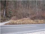
From the parking lot, first walk across the main road to the start of the footpath cart track, then climb up to the path that goes into the forest (past the former quarry on the left). The path then turns left a little further on from the quarry and climbs steeply up to a poorly graded but marked path, which is very slippery in the wet!. Continue on the poor and overgrown path, but a little higher leads us to a signpost (Prebold straight ahead, and Golava and Mrzlica back), where we turn left on the marked path over a small ridge, behind the ridge the path starts to climb steeply again on the poorly worn marked path, which leads us to a meadow, where the path continues across the meadow, where we come to a house and a trestle, on which there is a stamp for Gradiše!
Continue along the dirt road to the chapel, where you join the path from Prebold, where a footpath branches off the tarmac road uphill, which quickly turns into cart track. Follow this path, which descends gently at first and then ascends gently, all the way to Dom pod Reško mountain pasture.

We can extend the trip to the following destinations: Reška planina
Pictures:
 1
1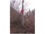 2
2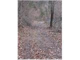 3
3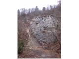 4
4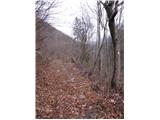 5
5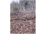 6
6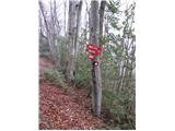 7
7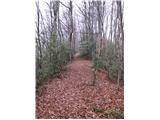 8
8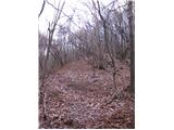 9
9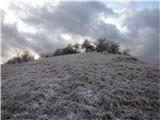 10
10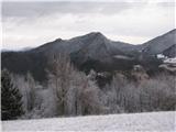 11
11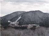 12
12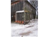 13
13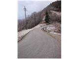 14
14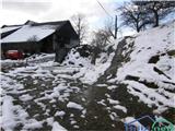 15
15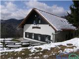 16
16
Discussion about the trail Marija Reka (Strgar) - Dom pod Reško planino
|
| caniggia6. 02. 2012 |
lEPO VABLENI SAVINČANI IN VSI OSTALI HRIBOLASCI NA POHOD V MARIJO REKO,ENA OD MOŽNIH POTI JE TUDI (ŠD. MARIJA REKA-DOM POD REŠKO PLANINO),KRASEN RAZGLED NA VELIKO REKO IN MRZLICO.LP.
|
|
|
|
| jprim7. 02. 2012 |
No, pa se tudi moški svet med sabo pokritizira  - glede pravopisa mislim. LP!
|
|
|
|
| seinfeld16. 06. 2021 14:49:50 |
Pot je dobro označena, kljub temu je treba pozorno spremljati markacije, ker zaradi zaraščenosti mimogrede zgrešiš smer.
|
|
|