Lovrenc na Pohorju - Klančnik (Glančnik) (via Kapus)
Starting point: Lovrenc na Pohorju (436 m)
| Lat/Lon: | 46,54195°N 15,38604°E |
| |
Name of path: via Kapus
Time of walking: 2 h
Difficulty: easy marked way
Altitude difference: 441 m
Altitude difference po putu: 500 m
Map: Pohorje 1:50.000
Recommended equipment (summer):
Recommended equipment (winter): ice axe, crampons
Views: 144
 | 1 person likes this post |
Access to the starting point:
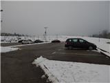
a) From the Maribor - Dravograd road, between the Fala HPP and the Ožbalt HPP, turn left towards Lovrenc na Pohorju (from the route of Dravograd turn right). On the other side of the Drava, start climbing along the Radoljna River, and at the marked crossroads, take a slight right along the main road towards Lovrenec to Pohorje. When you arrive in Lovrenc na Pohorje, follow the main road, and in the centre of the village turn right towards the primary school, where you can park in the parking lot next to the school. You can also park elsewhere in the village, where there are a few free parking spaces.
b) Drive into Ruše, then follow the road towards Lovrenec to Pohorje. At Činžat you will reach a pass where the road starts to descend, and at a lower point go left towards Lovrenec na Pohorju. When you reach Lovrenc na Pohorju, follow the main road, and in the centre of the village turn right towards the primary school, where you can park in the parking lot next to the school. You can also park elsewhere in the settlement, where there are a few free parking spaces.
Path description:
From the parking lot, continue along the road on the left (the right road leads to the Holiday Village), which continues westwards and soon forks. Continue on the right road, which starts to descend through the forest, and lower down you reach the Slepnica stream, where you reach another road and a marked crossroads.
Turn right towards Kapus (left path past Dobnik and path past Brabar) and continue along the road towards Puščava for a short distance, and at the first crossroads go sharp left, onto the road to which the markings also direct you.
Continue walking along the dirt road, which climbs past a few houses and higher farms, and then continue through the forest for a while. Higher up, the road is laid and leads us in a crossing to the homestead Pavlič (before entering the homestead there is a warning for a vicious dog), after which the road changes to cart track and we continue slightly to the right and continue our ascent along the edge of the forest. In the forest we gradually reach an indistinct ridge, which leads out of the forest onto grazing slopes. Continue towards the Kapus farm outbuilding, which you pass on the right, and then climb up to the macadam road where you join up with the path from Puščava.
Continue to the left between the farm buildings and the house, and after the farm the road turns into the forest, through which it continues to Cigelnica, where there is a marked crossroads.
Continue left on the footpath in the direction of Klančnik and St Ignatius (straight ahead to HE Ožbalt), where you climb cart track. At a higher level, cross a dirt road, and after this, climb cart track for a while. Higher up, cart track narrows, and signs direct us to the left, where we exit the forest, and then along the edge of the forest we reach the summit of Klančnik in a few minutes.
Description and pictures refer to the situation in December 2021 and February 2022.

Pictures:
 1
1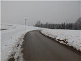 2
2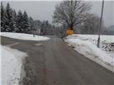 3
3 4
4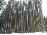 5
5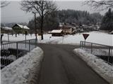 6
6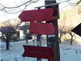 7
7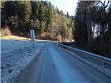 8
8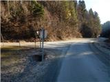 9
9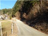 10
10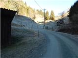 11
11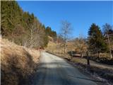 12
12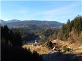 13
13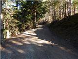 14
14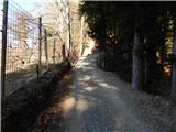 15
15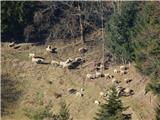 16
16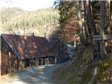 17
17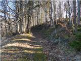 18
18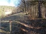 19
19 20
20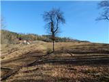 21
21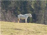 22
22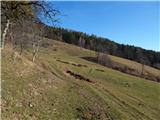 23
23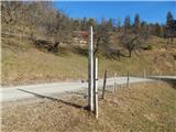 24
24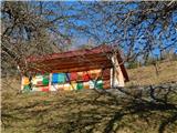 25
25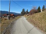 26
26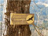 27
27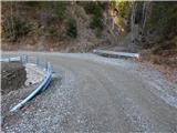 28
28 29
29 30
30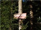 31
31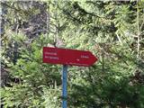 32
32 33
33 34
34 35
35 36
36 37
37 38
38 39
39 40
40 41
41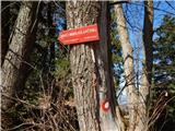 42
42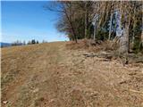 43
43 44
44 45
45
Discussion about the trail Lovrenc na Pohorju - Klančnik (Glančnik) (via Kapus)