Lopata - Planinski dom Šentjungert
Starting point: Lopata (258 m)
| Lat/Lon: | 46,2672°N 15,2317°E |
| |
Time of walking: 1 h 30 min
Difficulty: easy marked way
Altitude difference: 307 m
Altitude difference po putu: 350 m
Map: Zgornja Savinjska dolina 1 : 50.000
Recommended equipment (summer):
Recommended equipment (winter):
Views: 18.354
 | 2 people like this post |
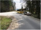
Access to the starting point:
From the Ljubljana - Maribor motorway, take the Žalec exit and follow the road towards Arji vas. At the crossroads at the end of Arja vas, continue left towards Celje. Next, the road through the village Levec leads to Celje, where at a large crossroads (almost at the beginning of Celje), continue left towards the village of Lopata. Just a few dozen metres after Lopata, the road to Šentjungert turns left. Park in the parking lot next to the bus station at the beginning of the road to Šentjungert.
From the Maribor side, you can exit the motorway at exit Celje - centre, and then drive towards Ljubljana to the above-mentioned junction. Continue as described above.
Path description:
From the bus station, continue along the asphalted road towards Gora. The road, which initially climbs gently, leads us through the village Gorica, after which we arrive in the scattered settlement Šentjungert, where signs direct us to the left, first past the houses and then up through the meadow. At the top of the meadow you reach a road where you continue right into the yard of one of the houses and then immediately left onto a footpath which climbs higher up by a pasture fence. Just ahead, rejoin the road and follow it for a few steps to the next crossroads. Signposts direct you to a footpath that climbs steeply through the forest. After a short climb, rejoin the road and follow it upwards. We continue along the road, which leads us from the summit we have just conquered, in a gentle descent, to the saddle between the two peaks. Continue along the road, which climbs a little more and leads us in a few minutes to the Šentjungert mountain lodge.
Pictures:
 1
1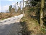 2
2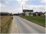 3
3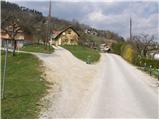 4
4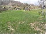 5
5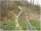 6
6 7
7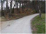 8
8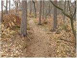 9
9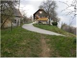 10
10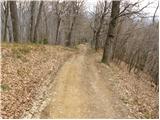 11
11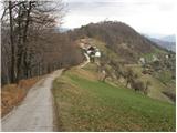 12
12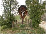 13
13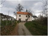 14
14 15
15
Discussion about the trail Lopata - Planinski dom Šentjungert
|
| VMA3. 02. 2011 |
Poti na Kunigundo je še mnogo. Naprimer iz smeri Galicija, Šmartno v Rožni dolini, Vojnik,ki so še mnogo lepše kot ta, ki je opisana.Poti so dobro označene. 
|
|
|
|
| tt113. 02. 2012 |
Šentjungert je zakon! Izjemni razgledi, od Pohorja, Boča, Celjske koče, Posavskega hribovja, Menine planine, Dobrovelj, Golt, Uršlje gore, Paškega Kozjaka, Kamniških Alp, Šmartinskega jezera, Celja do Sp. Savinjske doline. Praktično celotna Celjska kotlina z obrobnim hribovjem. Hrib vreden vzpona in razgledov
|
|
|