Loke - Krvavica (via Zajčeva koča)
Starting point: Loke (380 m)
| Lat/Lon: | 46,2139°N 15,0077°E |
| |
Name of path: via Zajčeva koča
Time of walking: 2 h 10 min
Difficulty: easy marked way
Altitude difference: 529 m
Altitude difference po putu: 630 m
Map: Posavsko hribovje - zahodni del 1:50.000
Recommended equipment (summer):
Recommended equipment (winter): ice axe, crampons
Views: 20.904
 | 2 people like this post |
Access to the starting point:
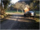
a) From the Ljubljana - Maribor motorway, take the Vransko exit and continue along the parallel old road towards Celje. Drive along the main road for a few kilometres, then signs for Tabor and Ojstriška vas point you to the right. Continue through Ojstriška vas to Tabor, and from there continue towards the village of Loke. In Loke, you will come to a crossroads where you will turn left towards Zajčeva koča (straight ahead Krvavica) along a road that will soon lead you to the next crossroads. Here, continue right in the route "Zajčeva koča - fotpath" (straight ahead Zajčeva koča on the road) along the road, which crosses a bridge and then leads to a small roadside parking lot on the other side of a meadow.
b) From the motorway Maribor - Ljubljana, take the exit Šentrupert and then continue along the parallel old road towards Trojany. Follow the main road for a few kilometres and then the signs for Tabor and Ojstriška vas will direct you to the left. Continue through Ojstriška vas to Tabor, and from there continue towards the village of Loke. In Loke you will come to a crossroads, where you continue left towards Zajčeva koča (straight ahead Krvavica) along a road that will soon lead you to the next crossroads. Here, continue right in the route "Zajčeva koča - fotpath" (straight ahead Zajčeva koča on the road) along the road, which crosses a bridge and then leads to a small roadside parking lot on the other side of a meadow.
Path description:
Leave the road near the parking lot and continue climbing along cart track, which branches off the road to the left. After a few metres, Cart track descends to a stream, crosses it and turns into a steep footpath on the other side, which climbs higher parallel to another track. The path, which passes through a forest, leads us higher up to a partly overgrown clearing, after which it turns slightly right and leads us to a dilapidated house.
Here we continue on the right-hand side of the house on the cart track, which climbs crosswise (this part of the path is poorly marked) and makes a left turn slightly higher up. The moderately steep track then turns slowly to the right and leads us higher up to grassy hay meadows above which we cross a less good forest road.
Continue along the poorly marked cart track, which after a while starts to descend and then joins a dirt road which is followed to the right to the next junction. At the junction in the middle of the bend, continue right and follow it for about 100m to a point where the sign for Zajčeva koča directs you right onto a wide cart track (a minor road) which begins to descend gently. Follow this cart track road through the forest to Zajčeva hut.
From the hut, continue in the route Krvavica along the path which, after an initial slight ascent, descends and then crosses the slopes to the west. A little further on, you reach an orientation lop where the marked path turns slightly right (porly marked). Leave the track here and continue walking along a pleasant mountain path surrounded by dense forest. After a short descent, the path leads to a forest road which you follow to the left to a crossroads.
Leave the road here and continue straight on the footpath in the direction of Krvavica (sharp left Čemšeniška mountain pasture). After a few metres of ascent, the path climbs steeply and in a few minutes leads us under the rocky cliffs of Krvavica, which the path bypasses on the left side, taking in the beautiful views. This is followed by a steep climb up a slightly exposed ledge, after which the path quickly leads us to the top of Krvavice.

Pictures:
 1
1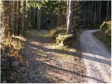 2
2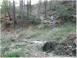 3
3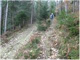 4
4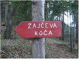 5
5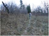 6
6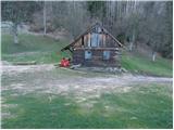 7
7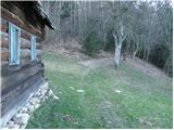 8
8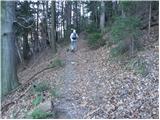 9
9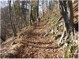 10
10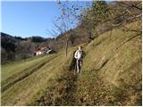 11
11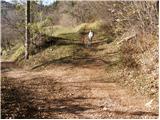 12
12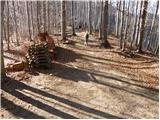 13
13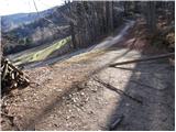 14
14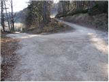 15
15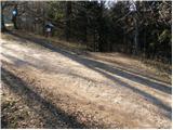 16
16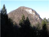 17
17 18
18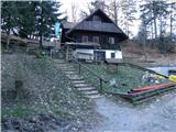 19
19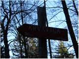 20
20 21
21 22
22 23
23 24
24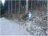 25
25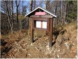 26
26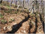 27
27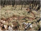 28
28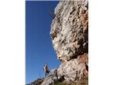 29
29 30
30 31
31 32
32
Discussion about the trail Loke - Krvavica (via Zajčeva koča)
|
| vespuci17. 11. 2011 |
Ta pot pelje po cesti ali pa ob njej,obstaja pa še ena,katero pa ne priporočam,saj je zapuščena,pa čeprav je zaslediti obledele markacije.Osebno sem jo prehodil navzdol in pelje ob neimenovanem potoku med Krvavico in sosednjim Brložnom.Oskrbniku Zajčeve koče pa priporočam,da na omenjeno pot namesti obvestilo,da ni več prehodna.
|
|
|
|
| Rudi2626. 04. 2013 |
Jaz sem bil gor v sredo 24.4.2013, šel sem od Zajčeve koče, prakiral pa tam zraven zapornice, me pa zanima kaj je tisti hrib desno od KRvavice ki je malce nižji in se lepo vidijo skale, če kdo mogoče ve?
|
|
|
|
| Rudi2627. 04. 2013 |
Hvala za odgovor 
|
|
|
|
| kamenko3. 07. 2019 |
29.6.2018 smo obiskali Krvavico, pri povratku sno se ustavili na Zajčevi koči. Iskrena hvala oskrbniku Petru za prijazno postrežbo in informacije o stanju poti do parkinga.
|
|
|