Lienzer Dolomitenhütte - Große Sandspitze (Panorama Kletterweg)
Starting point: Lienzer Dolomitenhütte (1620 m)
| Lat/Lon: | 46,7911°N 12,7842°E |
| |
Name of path: Panorama Kletterweg
Time of walking: 5 h
Difficulty: extremely difficult marked way
Ferata: C/D
Altitude difference: 1152 m
Altitude difference po putu: 1500 m
Map:
Recommended equipment (summer): helmet, self belay set
Recommended equipment (winter): helmet, self belay set, ice axe, crampons
Views: 7.154
 | 1 person likes this post |
Access to the starting point:
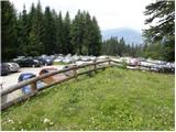
Drive through the Karavanke Tunnel into Austria, then continue to Spittal and on to Lienz (the motorway ends a little after Spittal). We continue along a relatively nice and wide road through the Drava Valley. A few kilometres before Lienz (near Unterdorf), you will see the signs for the Lienzer Dolomitenhütte hut, which will direct you left onto the local road. The road then crosses the River Drava over a bridge and leads to the village of Lavant, where you continue to the right towards the village of Tristach. Between Lavant and Tristach you will come to the next crossroads, where you turn left in the route "Lienzer Dolomitenhütte". Follow this road, which begins to climb steeply, to a large parking area near the hut. The road is toll road (July 2009 7€).
Lienz can also be reached by driving through the Zillian valley (Korensko sedlo, Hermagor, Ziljsko sedlo/Gailbergsattel pass) instead of the Drava valley, in which case you arrive in the Drava valley at Oberdrauburg.
Path description:
From the parking lot continue along the road, which will take you to the Lienzer Dolomitenhütte mountain hut in 2 minutes.
From the hut, cross the fence and continue the ascent along the scenic road (a nice view of the jagged ridge - the highest is Spitzkofel 2717 m), which is exposed to falling rocks in the initial part. The road then crosses a short lane of forest and after this leads to the undistinguished Premstall Pass (1625 m), where there is a small crossroads.
Continue straight on past a water trough (left up Weißtein Alm) along a road which, after a few minutes' further walking, leads to a small mountain pasture Instein Alm, where you see a small wooden hut and a chapel slightly above it.
Continue along the road, which quickly leads to a marked crossroads, where you leave.
We continue our ascent along a wide mountain path, which begins to climb slightly steeper, through increasingly sparse forest. The path opens up very beautiful views, crosses the mountain road a few times and leads us higher up to a small wooden shelter. At the shelter, we leave the road again and continue our ascent through a gently sloping high mountain valley surrounded by high peaks. The gently sloping path, which runs alongside a torrential stream, turns right at a higher altitude and climbs steeply for a short time. Follow this scenic route all the way to the Karlsbader Hütte mountain hut (there is also a Laserzsee lake next to the hut), which is reached after a few minutes of further walking.
The hut can also be reached by mountain road.
From the hut, walk down the road for a few 10 m and then you will see a number of mountain direction signs pointing you to the right on the footpath. After a few steps of further walking, the path splits into two parts. Continue left in the direction of "Roter Turm in Laserzwand" (Sandspitzen on the right) on a path that first climbs slightly and then crosses the slopes to the left. After a few minutes of easy walking, the path climbs steeply and then passes onto the very steep slopes of the Kleine (Little) Laserzwand. There is a steep climb for 15 minutes up an occasionally exposed slope (apart from the risk of slipping, there is also a very high risk of falling rocks), and then the path gently descends (here an unmarked, but less steep, path joins from the right, which climbs over extensive scree). Continue on a slightly less steep, but still quite steep path, which leads us higher up, under the steep walls of Roter Turm, where we also reach a less well-marked crossroads.
At the crossroads continue right and after a short climb we are back at the crossroads. Again, continue to the right, and the path to the left leads up to the Roter Turm. The path then crosses the slope below the precipitous walls of Roter Turm and then leads to the entrance to the climbing part of the route. Here the path turns left and starts to climb steeply on rocky terrain along a ropeway. The route then climbs almost vertically a few more times, and then leads to the undistinguished summit of Kleine Laserzkopf. The part of the route to the summit is marked with a difficulty level of A/B.
From Kleine Laserzkopf, continue to the right along the ridge, which is still quite steep at first. This is followed by another almost vertical ascent with the help of a rope and then a less steep ascent along a narrow ridge to the summit of Große Laserzkopf (2718m).
From the summit, continue along the ridge and start descending towards the notch between Laserzkopf and Galitzenspitzen. The descent towards the notch becomes steeper and steeper, and the route is only protected by a rope. After the steep descent into the notch, there is a more difficult climb. At first, the ascent is almost vertical along the steel cable, and then the ridge retreats to the north side. Here, first a short ascent traverses the precipitous slopes to the east, followed by a challenging vertical climb back towards the ridge. In addition to the rope, there are also a few crampons to help us on this part of the route. Once back on the ridge, there is a short climb up the ridge to the top of Galitzenspitzen
The route then descends steeply along the ridge a few more times and ascends along the steel cable to a notch below the summit of Daumen. In the notch, which is located before the most challenging part of the trail, there is also a fork in the trail, so that you also have the option to leave the ridge trail and descend towards the Karlsbader hut.
From the notch, continue first to the north side of the mountain and climb very steeply a couple of times using the cable car. This is followed by a vertical climb to the top of Daumen, which is also the most challenging point on the whole route. This part of the route is marked with a C/D difficulty level. The vertical ascent is well protected by a rope, but there are also a few crampons to help.
From the Daumen summit, a steep descent is made with the help of ropes into the notch between the Daumen and Sandspitze peaks. From the notch, there is then another vertical ascent, also of C/D difficulty. Once over the vertical rock jump, there is a climb up the north-west face of Sandspitze along a ropeway. Just below the summit, we join the easier Ari Schübel route, and then it's just a short climb to a very scenic summit.
The route described is extremely challenging and is suitable only for the most skilled mountaineers with sufficient strength in their arms and with compulsory self-belaying.
The descent is recommended via the Ari Schübel route.

Pictures:
 1
1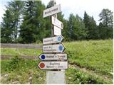 2
2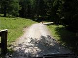 3
3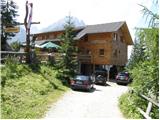 4
4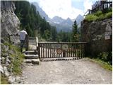 5
5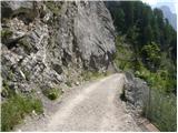 6
6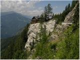 7
7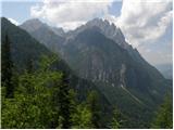 8
8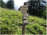 9
9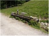 10
10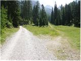 11
11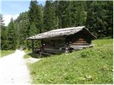 12
12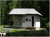 13
13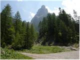 14
14 15
15 16
16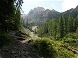 17
17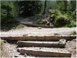 18
18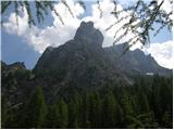 19
19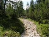 20
20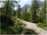 21
21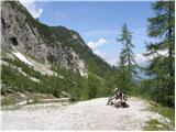 22
22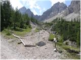 23
23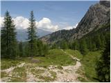 24
24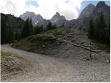 25
25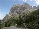 26
26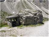 27
27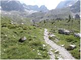 28
28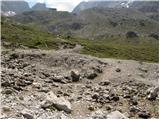 29
29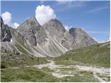 30
30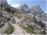 31
31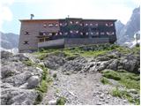 32
32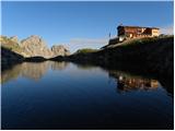 33
33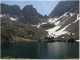 34
34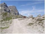 35
35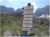 36
36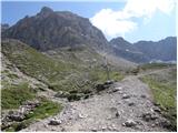 37
37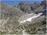 38
38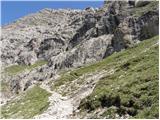 39
39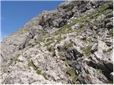 40
40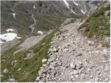 41
41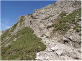 42
42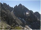 43
43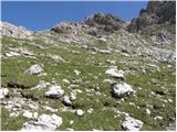 44
44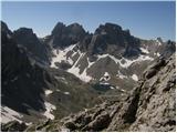 45
45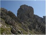 46
46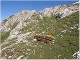 47
47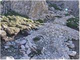 48
48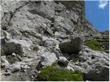 49
49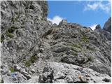 50
50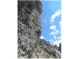 51
51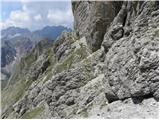 52
52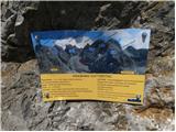 53
53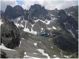 54
54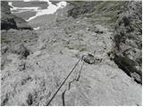 55
55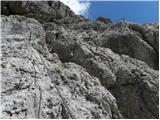 56
56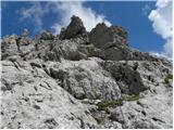 57
57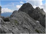 58
58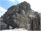 59
59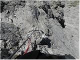 60
60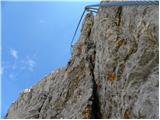 61
61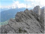 62
62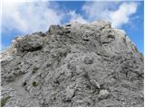 63
63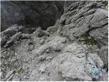 64
64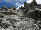 65
65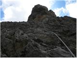 66
66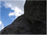 67
67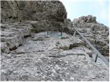 68
68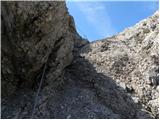 69
69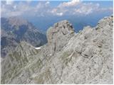 70
70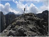 71
71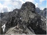 72
72 73
73 74
74 75
75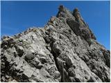 76
76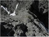 77
77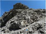 78
78 79
79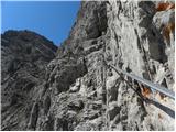 80
80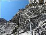 81
81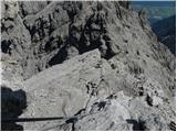 82
82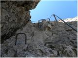 83
83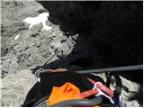 84
84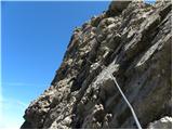 85
85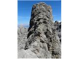 86
86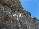 87
87 88
88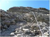 89
89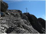 90
90 91
91
Discussion about the trail Lienzer Dolomitenhütte - Große Sandspitze (Panorama Kletterweg)