Ledinsko Razpotje - Medvedje Brdo (east path)
Starting point: Ledinsko Razpotje (702 m)
| Lat/Lon: | 46,0281°N 14,0477°E |
| |
Name of path: east path
Time of walking: 3 h 10 min
Difficulty: easy marked way
Altitude difference: 112 m
Altitude difference po putu: 350 m
Map:
Recommended equipment (summer):
Recommended equipment (winter):
Views: 871
 | 1 person likes this post |
Access to the starting point:
a) From Železniki, Kranj or Medvode, drive to Škofja Loka, and from there continue in the direction of Gorenje vasi in the Poljanska valley and Žire. In Žire, or at the end of Žire (Stare Žiri), leave the main road towards Rovty and Logatec and turn right towards Idrija. After about 6 km of driving from the crossroads in Žire, you will arrive at the Ledine crossroads, where there is a small crossroads with mountain direction signs. Park about 50 m further in the direction of Idrija, in a slightly larger parking lot at the next crossroads. The parking lot is located in the immediate vicinity of several mountain direction signs and the pension Kmečki hram Fortuna.
b) From Horjul or Polhov Gradec, drive to Šentjošt nad Horjul, and from there continue to Smreč. When you reach the main road Podlipa - Žiri, follow it to the right, and we drive along it to Žiri. When you reach the main road Škofja Loka - Logatec in Žire, follow it to the left, and you will pass the parish church and the Lenger Inn and Pizzeria. After the inn we reach a crossroads, where we leave the main road towards Logatec and continue in the direction of Idrija. After about 6 km of driving from the crossroads in Žire, we arrive at the Ledine crossroads, where there is a small crossroads and mountain direction signs. Park about 50 m further in the direction of Idrija, in a slightly larger parking lot at the next crossroads. The parking lot is located in the immediate vicinity of several mountain direction signs and the pension Kmečki hram Fortuna.
c) From the motorway Ljubljana - Koper take the exit Vrhnika, then when you reach the old road Ljubljana - Logatec, continue in the direction of Logatec, but only for a short time, because already at the next junction continue right in the direction of Horjul. The road continues for a short distance through Vrhnika, later through the outskirts of Stara Vrhnika, and then soon we leave the road towards Horjul and continue slightly left in the direction of Smrečje. After Smrečje the road starts to descend towards Račeva and Žire. Once in Žire, we reach the main road Škofja Loka - Logatec, follow it to the left, and we drive along it past the parish church and the Lenger Inn and Pizzeria. After the inn we reach a crossroads, where we leave the main road towards Logatec and continue in the direction of Idrija. After about 6 km of driving from the crossroads in Žire, we arrive at the Ledine crossroads, where there is a small crossroads and mountain direction signs. Park about 50 m further in the direction of Idrija, in a slightly larger parking lot at the next crossroads. The parking lot is located in the immediate vicinity of several mountain direction signs and the pension Kmečki hram Fortuna. d) From the motorway Koper - Ljubljana take the exit Logatec, and when you reach the old road Logatec - Vrhnika follow it to the right (first exit from the roundabout), and follow it for a short time, as the signs for Rovte and Žiri then direct you to the left. After Rovte, the road starts to descend towards Žire, and when you reach the above-mentioned place, you will soon turn left towards Idrija. After about 6 km of driving from the crossroads in Žire, you arrive at the Ledine crossroads, where there is a small crossroads with mountain direction signs. Park about 50 m further in the direction of Idrija, in a slightly larger parking lot at the next crossroads. The parking lot is located in the immediate vicinity of several mountain direction signs and the pension Kmečki hram Fortuna.
e) From the road Idrija - Spodnja Idrija, just after the end of Idrija, turn right (if coming from Spodnja Idrija, turn left before Idrija) over the bridge over the Idrijca river towards the Eurospin shop. On the other side of the bridge you will reach the village of Mokraška vas, and we stick to the main road leading to Ledinsko Razpotje and Žire. Higher up, the road leads us through some serpentines, and then we arrive at the Ledine Razpotje settlement, where we turn right at the first crossroads and park in a slightly larger parking lot. The parking lot is located in the immediate vicinity of several mountain direction signs and the pension Kmečki hram Fortuna.
Path description:
From the starting point, we take the road in the direction of Idršek - Gore, Zagodov vrh and Idrija and continue along the Idrija - Cerkljanska mountain trail (ICPP). The trail initially leads us past the Fortuna Farmers' Castle, where the marked footpath to Idrija branches off to the right, and we walk along the asphalt road to the nearby crossroads, where we continue along the road slightly to the left in the direction of the scattered settlement of Idršek (slightly to the right - the western trail).
Continue along the road, which continues for a short time without any major changes in elevation, and then begins to climb moderately up an increasingly scenic slope, from which a beautiful view of Gradišče and Sivka opens up. Higher up, the road leads us past a few houses, then it flattens out a little. It is followed by a few minutes of walking alternately through the forest and partly across the viewing slopes, then begins to descend gently, where we pass a nearby house on the right-hand side. When the descent ends, a narrower road joins us on the left, leading to the nearby houses, and just ahead, at a left turn, we leave the road and, at the place where the woodpile is usually located, continue right on cart track, which passes along the edge of the forest a few 10 m higher. Climb along the edge of the forest for a few minutes, then the clearing on the right ends and the well-marked path enters the forest, through which it continues on cart track. Higher up, cross a hayfield, beyond which you come to a solitary house, after which you join an asphalt road, where the western path joins.
Continue on the asphalt road, which first descends gently and then, with good views, climbs gently to the settlement of Gore. When you reach the above-mentioned settlement, walk through the village, where at a small crossroads a road branches off to the right, which will take you up to the Church of St Mary Magdalene in 2 to 3 minutes.
From this junction, continue straight ahead and quickly leave the central part of the settlement. When the houses along the road end, the path splits into two.
The left marked path leads along the edge of the meadows and then leads to the hamlet of Tabor, after which we return to the main road and then follow it to the left. If you continue on the right-hand carriageway, at the crossroads in the hamlet of Rebro, continue straight on towards Dole.
After about 20 minutes, the two roads merge and we continue along the asphalt road, which continues with some short ups and downs. The trail continues through the longer but sparsely populated settlement of Dole, and then straight ahead at a small crossroads (slightly left Zavratec). After a longer walk on flatter ground, and then after a short climb, we reach the undistinguished and scenic ridge Medvedje Brdo. At the hamlet of Trate, continue slightly left (right Godovič), then begin a mostly gentle descent, ending at a point where the marked path from Rovt joins from the left.
Continue along the asphalt road, which runs along a scenic ridge, and then passes the fire house at Medvedje Brdo, leading to a crossroads by the chapel. Turn right here and left at the next crossroads in the direction of the Open Door Farm Šinkovc. There is a short climb and you reach the top of Medvedje Brdo, where you can see the military buildings of the former JNA on the left and the Medvedje Brdo lookout on the right.
Description and pictures refer to the situation in 2016 (January).

Pictures:
 1
1 2
2 3
3 4
4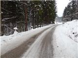 5
5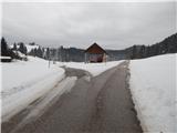 6
6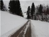 7
7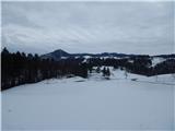 8
8 9
9 10
10 11
11 12
12 13
13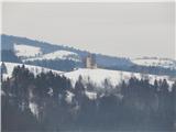 14
14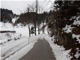 15
15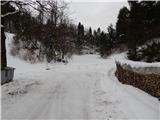 16
16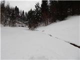 17
17 18
18 19
19 20
20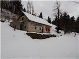 21
21 22
22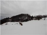 23
23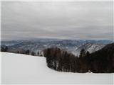 24
24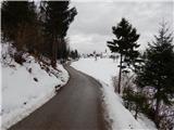 25
25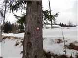 26
26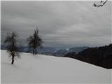 27
27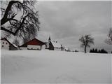 28
28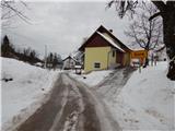 29
29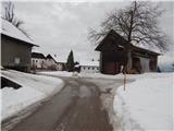 30
30 31
31 32
32 33
33 34
34 35
35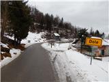 36
36 37
37 38
38 39
39 40
40 41
41 42
42 43
43 44
44 45
45 46
46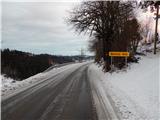 47
47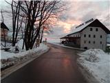 48
48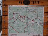 49
49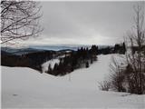 50
50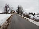 51
51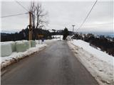 52
52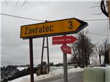 53
53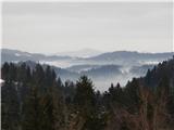 54
54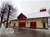 55
55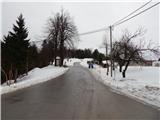 56
56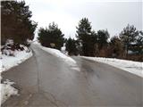 57
57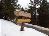 58
58 59
59 60
60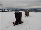 61
61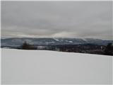 62
62
Discussion about the trail Ledinsko Razpotje - Medvedje Brdo (east path)