Starting point: Laško (815 m)
| Lat/Lon: | 46,3322°N 14,4°E |
| |
Time of walking: 2 h
Difficulty: easy marked way
Altitude difference: 719 m
Altitude difference po putu: 719 m
Map: Karavanke - osrednji del 1:50.000
Recommended equipment (summer):
Recommended equipment (winter): ice axe, crampons
Views: 47.522
 | 1 person likes this post |
Access to the starting point:
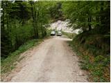
a) From the motorway Ljubljana - Jesenice, take the exit Kranj - East, then continue driving towards Jezersko. When you reach Preddvor, leave the main road and turn left towards the centre of the town, and from there follow the signs for Bašelj. When we arrive in Bašelj, first at the beginning of the left turn in the direction of straight ahead there is a narrower road leading to the parking lot at the log cabin TD Bašelj (in the descriptions the starting point Bašelj), and from the mentioned crossroads we continue along the main road for another 100 m to the next crossroads, where we continue to the right along the road towards the Gamsovemu raje and the hamlet Laško (Laško hamlet). Only about 50 m further on, continue along the left-hand road, which gradually starts to climb moderately. At the hamlet of Laško, turn left again, and then the asphalt ends and we continue along a steep macadam road, which leads us past a trail junction (kolovoz) to the Church of St. Lovrenec and the Doma na Lovrencu. From this turn-off, drive a little further, to the end of the road or a small parking area a few 10 metres earlier.
b) From the motorway Jesenice - Ljubljana, take the exit Kranj - West and continue left at the first junction. Continue through the underpass under the motorway, then reach a roundabout, from where you continue in the direction of Golnik. The road continues through the village Mlaka pri Kranju, and at the end of the village we turn right in the direction of Srakovlje. Then drive through Srakovlje, Spodnja Bela, Srednja Bela, Zgornja Bela (in Zgornja Bela we join the road from Preddvor) to Bašlja, where the main road makes a long left turn, where a narrower road continues in a straight direction, leading to the parking lot of the log cabin TD Bašelj (in the descriptions the starting point is Bašelj), and from this junction we continue along the main road for another 100 m to the next junction, where we continue right along the road towards Gamsovem raje and the hamlet of Laško. Only about 50 m further on, continue along the left-hand road, which gradually starts to climb moderately. At the hamlet of Laško, turn left again, and then the asphalt ends and we continue along a steep macadam road, which leads us past a trail junction (kolovoz) to the Church of St. Lovrenec and the Doma na Lovrencu. From this turn-off, drive a little further, to the end of the road or a small parking area a few 10 metres earlier.
Path description:
At the end of the road, turn left cart track in the direction of Kališča and Storžič. Cart track climbs moderately and after a ten-minute walk leads to a crossroads. Continue along the left-hand cart track, which runs out after a few metres. The path here leaves the small valley along which it climbed and ascends steeply to the left. After this short steep ascent the steepness eases and the path leads to the partisan hospital Košuta. Behind the hospital the path crosses two successive torrents and then climbs steeply again. The path, which runs through the forest all the time, leads us to the side ridge of Kališča, where we join the unmarked path from Bašlja. Gozd then becomes more sparse and occasionally we get a nice view towards Storžič. The path then turns slightly right into the forest again. Suddenly, we see a small house in front of us, located at mountain pasture below Kaliste. Just a few metres further on, the path from the village of Mače joins us. The path climbs for about 15 minutes through the forest. The path then makes a sharp left turn and in front of us we see the home at Kišče which is only a few steps away.

Pictures:
 1
1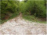 2
2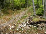 3
3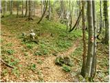 4
4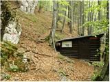 5
5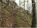 6
6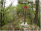 7
7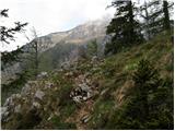 8
8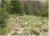 9
9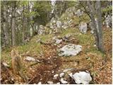 10
10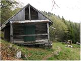 11
11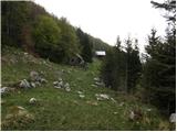 12
12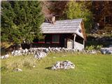 13
13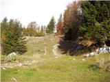 14
14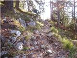 15
15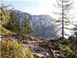 16
16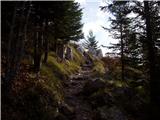 17
17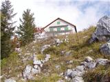 18
18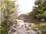 19
19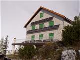 20
20
Discussion about the trail Laško - Dom na Kališču
|
| velkavrh7. 05. 2011 |
Danes šel to pot prvič pri turi na Storžič. Jaz vas Laško nisem videl. Hiše imajo hišne številke Bašlja. Pot je prijetna. Je dobro označena. Opremljena je celo z dvema jeklenicama na najbolj kritičnih mestih. Mislim , da je namenjena za zimske pohode. Pot nas nagradi z lepimi pogledi na Storžič.
|
|
|
|
| Janiel7412. 01. 2012 |
Mogoče kdo ve kako je s snežnimi razmerami na tej poti do doma?
|
|
|
|
| sodnick12. 01. 2012 |
Bil sem 2. januarja. Malo mešano. V glavnem je pot kopna, mestoma malo snega in malo poledenelo. Veliko ljudi uporablja pohodne dereze. Pot od malega Kališča (več manjših koč) pa do doma je pa čista drsalnica in je brez derez precej zoprno, se pa da. Pač ne greš čisto po stezi. Sicer je snega malo.
|
|
|
|
| Borut11. 09. 2014 |
Zanima me, kakšna je kaj cesta v tem času. Hvala.
|
|
|
|
| limona2. 09. 2014 |
Cesta je na enem ali dveh mestih malo razjedena od vode (ko se vzpne iz vasi v gozd), a v redu prevozna. Vsi, ki smo bili v soboto gor, smo prišli brez težav. Lp!
|
|
|
|
| jcerni27. 07. 2015 |
Zanima me, ali je planinska pot prehodna zaradi žledoloma pred nekaj leti. Želim iti po njej, ker bom hodil po poti Karla in Žiga Zoisa.
|
|
|
|
| sodnick27. 07. 2015 |
Pot je bila prehodna že takoj po žledolomu (sem prehodil). Malo umikanja in plezanje čez kak hlod, sicer pa prehodno. Verjamem pa, da je sedaj še precej bolje, saj je ta pot precej priljubljena.
|
|
|
|
| claire24. 07. 2016 |
Zelo lepo markirana pot, pohvalno!
|
|
|
|
| Pelca27. 08. 2016 |
Navodila za izhodišče so napačna - v Bašlju je treba iti levo, ne desno, proti oznakam za Gamsov raj. Cesta od Laškega (ki ni vas, ampak področje, in zato sploh ni označeno) je bila tako razrita, da smo z avtom komaj prevozili prvi ovinek. Ker smo parkirali razmeroma daleč, je to pot podaljšalo za dobre pol ure. Pot do Doma na Kališču pa je res lepo označena in tudi ponudba v koči je super. Dobra hrana in postrežba.
|
|
|
|
| Kranj28. 08. 2016 |
Niso napačna samo vi ste šli po drugi poti tudi čez gamsov raj je odlično markirana 
|
|
|
|
| Pelca29. 08. 2016 |
Ne, to je ta pot (Laško) - ki je LEVO iz Bašlja, samo za to gre
|
|
|
|
| PUHIPUHI17. 04. 2018 |
Ali kdo ve v kakem stanju je trenutno pot do opisanega izhodišča? LP; P
|
|
|
|
| Anansie19. 04. 2018 |
Januarja je bila brez posebnosti
|
|
|