Starting point: Krn (900 m)
Time of walking: 1 h 40 min
Difficulty: easy marked way
Altitude difference: 548 m
Altitude difference po putu: 548 m
Map: Julijske Alpe - zahodni del 1:50.000
Recommended equipment (summer):
Recommended equipment (winter): ice axe, crampons
Views: 9.958
 | 1 person likes this post |
Access to the starting point:
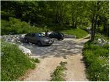
a) From the Tolmin - Kobarid road, a little before Idrski, the road to the village of Kamno branches off to the right. Follow the signs for Vrsno when you arrive in the village. From Vrsno, where the birthplace of Simon Gregorčič stands, continue along the narrow and steep road to the village of Krn, where the road splits into two parts. The road continues to the left towards mountain pasture Kuhinja, and we continue straight towards Mrzlemi vrh. We park above the last houses in the village, where there is a nice small parking lot with space for 4 to 5 cars.
b) We drive to Kobarid, then continue driving towards Drežnica. Just after the bridge over the Soča River, turn right in the direction of Ladra, Smast, Libušnje, Vrsno and Krn. When you reach the village of Krn, continue straight on (left mountain pasture Kuhinja), and we continue along the narrow road to a small, well-maintained parking lot, located above the last houses in the village.
Path description:
From the parking lot, continue along the road along which you parked, but after a few steps it splits into two parts. Continue straight ahead in the direction of Mrzlje vrh and follow the initially still wide cart track, which gradually turns into a dense forest. Higher up, the signs for Pretovč, Mrzli vrh and Puščavnikova cave direct us left onto a wide ascending path, which is quickly joined by an even less beaten path with mountain pasture Kuhinja. The track soon turns right and then climbs transversely through the forest. A little further on, you reach the Hermit's Cave, which is only a short 10-step walk from the waymarked trail.
Continue through the occasionally slightly more sparse forest, and a moderately steep path leads to a forest road, which you follow to the left in the direction of mountain pasture Sleme (right down Mrzli vrh and mountain pasture Pretovč). Just a little higher up, you reach the next crossroads, where the path joins from the right with the path from the mountain pasture Polog.
Continue again in the direction of mountain pasture Sleme, and the road, which begins to climb steeply, leads us into lane of a compacted forest. Higher up, we leave the forest and a gradually less steep road leads us to mountain pasture Sleme.

Pictures:
 1
1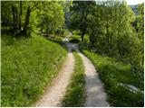 2
2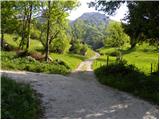 3
3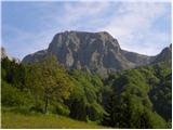 4
4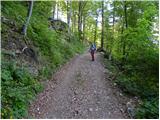 5
5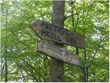 6
6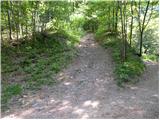 7
7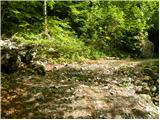 8
8 9
9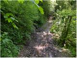 10
10 11
11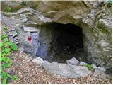 12
12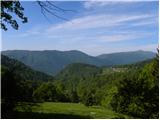 13
13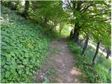 14
14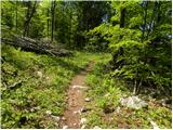 15
15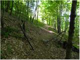 16
16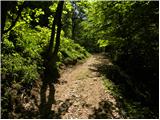 17
17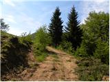 18
18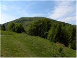 19
19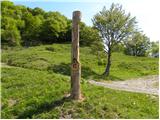 20
20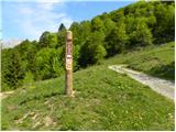 21
21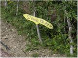 22
22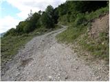 23
23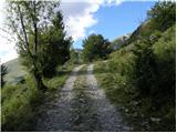 24
24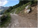 25
25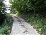 26
26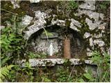 27
27 28
28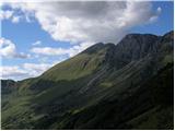 29
29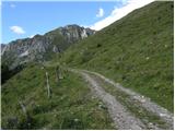 30
30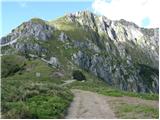 31
31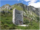 32
32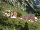 33
33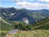 34
34
Discussion about the trail Krn - Planina Sleme