Starting point: Košnica (232 m)
Time of walking: 1 h
Difficulty: easy marked way
Altitude difference: 377 m
Altitude difference po putu: 450 m
Map:
Recommended equipment (summer):
Recommended equipment (winter): crampons
Views: 5.575
 | 3 people like this post |
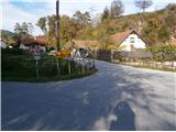
Access to the starting point:
a) From Celje, drive along the Savinja river towards Laško. After a few kilometres, the road turns right for Košnica and you park in front of a sign with the name of the village.
b) From Laško, follow the Savinja river towards Celje and shortly after the village of Tremerje, turn left at the crossroads for Košnica. Park near the sign with the name of the settlement.
Path description:
Practically directly on the Celje - Laško road, at the crossroads, we start the ascent to Veliki Slomnik. The path follows the eastern ridge and at the beginning is quite steep to the electricity pylon. A woven wire/braided cord for grip is also helpful in this part. Continue along the hunter's feeding ground on a more distinct ridge trail, which offers views in several places of the Savinja valley below. Further on, the path from Tremerje joins from the left and a little further on, the path from Košnice (the second path from Košnice - from a higher starting point) joins from the right. There is also a table with benches, and then a moderate climb through rugged terrain to the top of Veliki Slomnik with a table, benches and a registration box. There are no views.
From Veliki Slomnik you can extend a few minutes to the excellent Libojska Stena lookout point.
The total length of the route is about 2700 metres, 450 positive vertical metres and 80 negative vertical metres.

Pictures:
 1
1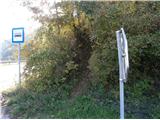 2
2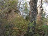 3
3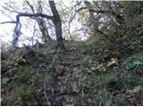 4
4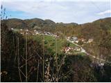 5
5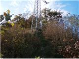 6
6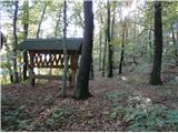 7
7 8
8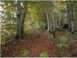 9
9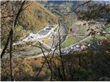 10
10 11
11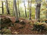 12
12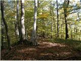 13
13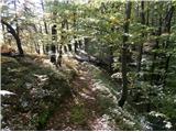 14
14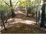 15
15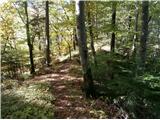 16
16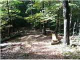 17
17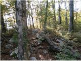 18
18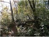 19
19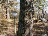 20
20
Discussion about the trail Košnica - Veliki Slomnik
|
| bruny15. 12. 2013 |
V okviru krožne pohodniške aktivnosti vzpon po opisani poti čeprav v prvotnem planu ni bila predvidena. Bilo je prijetno in kolega, ki se mi je danes pridružil je omenjeno pot ocenil kot eno bolj zanimivih v širšem razponu poti ob Savi in Savinji med(pod) Celjem in Ljubljano in tudi osebno se mnenju pridružujem. Bila je to nekje igra sonca, meglic in padajočega ivja z dreves. Danes pot doživel v drugi luči ker opis poti je nastal pred meseci ob  sestopu iz Velikega Slomnika in danes ob vzponu ,,filing,, popolnoma drugačen.
|
|
|
|
| minčamb30. 05. 2014 |
Pot na Veliki Slomnik poteka po čudovitem gozdu. Na določenih delih je pot kar strma. Ker obiskovalcev ni veliko, pot ni dobro uhojena. Hkrati sem jedla borovnice in nabirala smrekove vršičke.
|
|
|