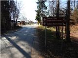
Starting point: Koseze (337 m)
| Lat/Lon: | 46,1682°N 14,5382°E |
| |
Time of walking: 30 min
Difficulty: easy marked way
Altitude difference: 130 m
Altitude difference po putu: 130 m
Map:
Recommended equipment (summer):
Recommended equipment (winter):
Views: 2.221
 | 2 people like this post |
Access to the starting point:
a) Leave the Gorenjska motorway at the Vodice exit, then continue driving towards Kamnik, then turn slightly right in Vodice towards Bukovica. Continue along the road towards Mengeš, and follow it to the crossroads at the end of the settlement of Koseze, where the route described above starts at the bus stop. Park in a suitable place nearby.
b) Take the Mengeš, then from the main crossroads in the centre of Mengeš, continue to Kranj. A little further on from the main road, turn slightly left onto the road towards Vodice. At the beginning of the village of Koseze, you will reach a crossroads where the route described above starts at the bus stop. Park in a suitable place nearby.
Path description:
From the starting point, continue on the side road in the route Koseški hrib, which continues northwards. The road initially passes a few houses before entering a forest, where it turns into cart track. Cart track soon turns slightly to the right and is joined by a "marked path" on the right (the marked path is impassable as it is cut by a new building). A few steps further on, cross another unmarked cart track, and at the next crossroads the path splits.
Straight ahead the path continues to Debeli vrh and Topole, and we continue left. The ascent is moderate at first and then gently ascending higher up. A little further on, we join the slightly wider cart track, where we continue straight on (Suhadole on the right), and a little further on, the marked path past Mlinčkov joins us from the right.
Continue slightly left here, and then, following the path, along which you will see a few more stations of the "cross-roads of slovakia", climb up to the scenic Koseški Hill.
Description and pictures refer to the situation in 2017 (March).

Pictures:
 1
1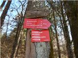 2
2 3
3 4
4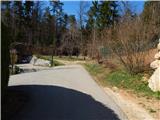 5
5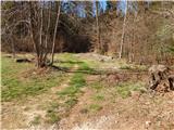 6
6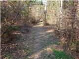 7
7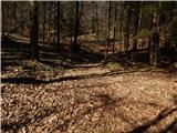 8
8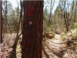 9
9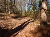 10
10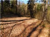 11
11 12
12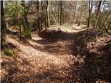 13
13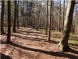 14
14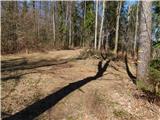 15
15 16
16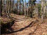 17
17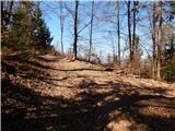 18
18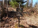 19
19 20
20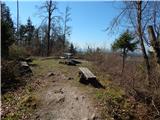 21
21 22
22
Discussion about the trail Koseze - Koseški hrib
|
| tinky22. 04. 2020 |
V Bukovico sem prikolesaril do Jane.Ob kavici mi pove da čaka Berbaro,in potem smo šli na Koseški hrib, Mlinčke in po stezicah, po katerh še nisem hodil.
Če bi se zmenili se nebi tako dobili. Potem pa na kolo in proti domu.
|
|
|