Starting point: Komare doline (297 m)
| Lat/Lon: | 45,4969°N 13,8867°E |
| |
Time of walking: 50 min
Difficulty: easy unmarked way
Altitude difference: 121 m
Altitude difference po putu: 155 m
Map: Slovenska Istra - Čičarija, Brkini in Kras 1:50.000
Recommended equipment (summer):
Recommended equipment (winter):
Views: 3.001
 | 1 person likes this post |
Access to the starting point:
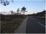
From the motorway Ljubljana - Koper take the exit Črni Kal. From Črni Kal, continue along the old road towards the sea, and we take it only as far as the next slightly larger crossroads, where we turn left towards Border crossing Sočerga. Follow the road past Kubed to the village of Gračišče, where you turn left at the junction in the direction of Rakitovec, Movraž and Smokvica. From Gračišče, drive for about 800 m, and then you will see markings along the road and an inscription on a rock for Lačno, pointing to the left. Park here in a suitable place along the road. The starting point is about 50 m before the next small crossroads.
The starting point can also be reached from the coast via Prade, Pobegi, Čežarji, and Sveti Anton.
Path description:
From the starting point, follow the marked footpath towards Lačná. The path first crosses a rather overgrown meadow and then joins the wider cart track, which we follow. At the crossroads, follow the signs and cart track turns into a slightly steeper and in several places overgrown mountain path. Higher up, we get some views of the surrounding hills, and the path leads us just a little further on to the ridge of Lačná, where we also step onto the wide cart track.
Follow the track to the right (left Lačna 15 minutes), and it leads us along a quite scenic ridge in a few ascents and descents. A little further on, the path leads us past a natural cave, and just a little further on we arrive at the undistinguished but scenic Top of the Cross.
From Vrh križa we continue along the marked cart track, which turns into lane of a pine forest, ending in a medium-sized clearing. In the middle of the clearing we see a small stone cairn, which points us slightly to the right onto an unmarked and, in the summer, quite overgrown path, which continues to climb parallel to the track we have just left. From the clearing we cross a short lane of scrub and the path quickly leads us to the partly rocky top of the Circle, from which, if we step on the edge of the ridge, a fine view opens up to the west.

Pictures:
 1
1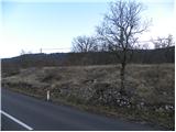 2
2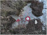 3
3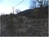 4
4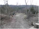 5
5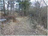 6
6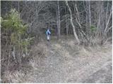 7
7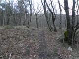 8
8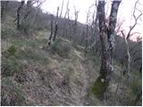 9
9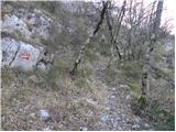 10
10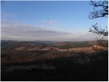 11
11 12
12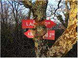 13
13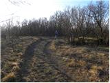 14
14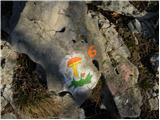 15
15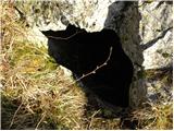 16
16 17
17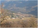 18
18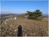 19
19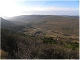 20
20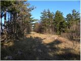 21
21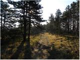 22
22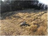 23
23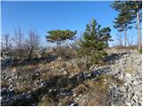 24
24
Discussion about the trail Komare doline - Krog