Koča pri Savici - Vrh Planje (via sedlo Planja)
Starting point: Koča pri Savici (653 m)
| Lat/Lon: | 46,2896°N 13,8022°E |
| |
Name of path: via sedlo Planja
Time of walking: 5 h 30 min
Difficulty: easy unmarked way, partly demanding marked way
Altitude difference: 1318 m
Altitude difference po putu: 1500 m
Map: TNP 1:50.000
Recommended equipment (summer):
Recommended equipment (winter): ice axe, crampons
Views: 4.895
 | 2 people like this post |
Access to the starting point:
From the Ljubljana - Jesenice motorway, take the Lesce exit and follow the road towards Bled and on to Bohinjska Bistrica. Continue driving towards Bohinjsko jezero (Ribčev laz), at which you will come to a crossroads, where you will continue straight along the left (south) side of the lake in the direction of Ukanec and the Savica waterfall. Follow this increasingly narrow road to the large parking lot at the Savica cottage. There is a charge for parking.
Path description:
From the parking lot, take the wide path that climbs along the river Savica (direction Komna and waterfall Savica). After two minutes of easy walking, you will reach a small house (a small newsagent) where the path to the waterfall branches off to the right, and we continue straight on in the direction of the house on Komna. The path ahead leads us along an old military causeway and climbs in many switchbacks, all the way through the forest. After crossing 48 serpentines, the path leads us into an unmarked valley between Dobračeva glava and Plešo. This valley is called Pekel. The ascent continues up a less steep slope, where you can see a cave on the right that was made during the war. Ten minutes before the Komna lodge, you reach a crossroads, where you go left (to the right, the Black Lake). A few steps further on, you reach the next crossroads, where a path branches off to the right, leading to the hut by the Triglav Lakes. Continue left and follow the slightly steeper path all the way to the house at Komna.
At the home, turn left on the path leading to Tolminski Kuk and Vogel. After a few dozen steps, the path leads us to the next crossroads, where the path to Vogel branches off to the left, and we continue on the right path towards mountain pasture Govnjač, which we reach in just over 15 minutes of gentle ascent.
At mountain pasture, carefully follow the signs for Kuk and Mahavšček. There are a lot of paths here, so you can get lost if you are a little careless.
The way forward climbs the Spodnje Komne plateau and after a short climb leads us to the next crossroads, where we leave the marked path leading to Mahavšček and continue left along the unmarked path. Continue along the slightly ascending and sometimes quite overgrown path, which leads us slightly higher under the northern foot of the Tolminski Kuk. Here the trail turns slightly right and climbs in a moderate ascent to the saddle Planja, where you enter the marked trail.
Continue right (left Tolminski Kuk) and follow the relatively steep path to the top of Planja, which is reached after 15 minutes of further walking.
Savica - Komna 2:30, Komna - Peak Planja 3:00.

Pictures:
 1
1 2
2 3
3 4
4 5
5 6
6 7
7 8
8 9
9 10
10 11
11 12
12 13
13 14
14 15
15 16
16 17
17 18
18 19
19 20
20 21
21 22
22 23
23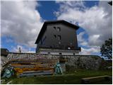 24
24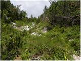 25
25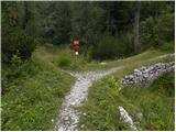 26
26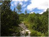 27
27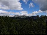 28
28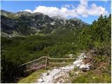 29
29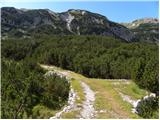 30
30 31
31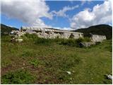 32
32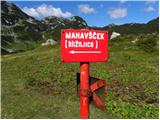 33
33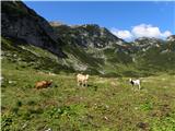 34
34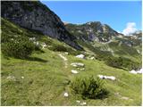 35
35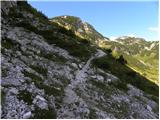 36
36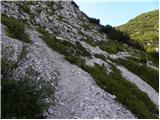 37
37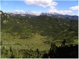 38
38 39
39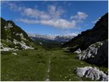 40
40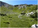 41
41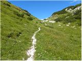 42
42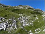 43
43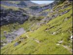 44
44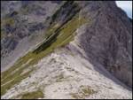 45
45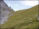 46
46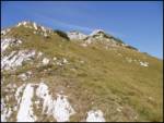 47
47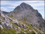 48
48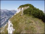 49
49 50
50
Discussion about the trail Koča pri Savici - Vrh Planje (via sedlo Planja)