Koča pri Savici - Malo Špičje (via Zasavska koča)
Starting point: Koča pri Savici (653 m)
Name of path: via Zasavska koča
Time of walking: 6 h
Difficulty: difficult marked way, easy unmarked way
Altitude difference: 1659 m
Altitude difference po putu: 1750 m
Map: Triglav 1:25.000
Recommended equipment (summer): helmet
Recommended equipment (winter): helmet, ice axe, crampons
Views: 9.034
 | 2 people like this post |
Access to the starting point:
From the Ljubljana - Jesenice motorway, take the Lesce exit and follow the road towards Bled and on to Bohinjska Bistrica. Continue driving towards Lake Bohinj (Ribčev laz), at which you will come to a crossroads, where you will continue straight along the left (south) side of the lake in the direction of Ukanec and the Savica waterfall. Follow this increasingly narrow road to the large parking lot at the Savica cottage. There is a charge for parking.
Path description:
From the parking lot, follow the road that crosses the Savica River via a bridge. Continue along the path in the direction of the Triglav Lakes. The initially gentle path soon becomes steep and climbs up the southern lower slopes of Komarča. After a good half an hour's walk, the path becomes even steeper and leads to technically difficult places. The path along the Komarča wall is beautifully laid out, but care is needed at every step to avoid slipping. In the more difficult places, the fixed safety gear are helpful to get to the top of the wall more safely. The steep climb, which takes about an hour, ends with a view down the valley to the parking lot where the car is parked. The steepness then eases, and the path leads us to the Black Lake in five minutes of easy walking.
At the beginning of the lake, the path to mountain pasture Viševnik and Pršivec branches off to the right, and we continue straight on along the right-hand side of the lake. On the other side of the lake, the path leads to the next crossroads. Continue straight on towards the huts at Triglav Lakes (Komna on the left). The path continues to climb under the walls of Stador on the right and the Lopučnica forest on the left. After a while the path leads to a grassy clearing where the marked path turns right steeply upwards. After 15 minutes the steepness eases and after a further 15 minutes the path leads to the next crossroads, where it continues to the left (to the right mountain pasture Ovčarija, Dedno polje and Blato). There is a gentle climb up to a point where you can see the Double Lake in front of you. The path continues gently downhill to the lake and continues on the right-hand side. Here you come to a crossroads where the path to Tičarica branches off to the right. Continue on the lower path, which after a few minutes of further walking leads us to the hut at Triglav Lakes, which we can see in front of us.
At the hut, head straight ahead in the direction of Triglav. Just a few metres from the hut, you will pass the artificial lake Močivec, which is the source of drinking water at the hut. The path then climbs moderately up the valley of the Triglav Lakes. During the ascent, you can admire the walls of Tičarice and Kopice on the right, with views to the left towards the Špičje ridge. The way forward leads us to the next crossroads, where we continue slightly to the right along the path in the direction of Prehodavci and Triglav (Veliko Špičje on the left). The forest along the way is becoming increasingly sparse and the path leads us to the largest Triglav lake, Ledvice. The trail bypasses the lake on the right side over extensive scree, which is slowly but steadily filling in the lake. The beautiful high-mountain path then leads to the next lake, Zelená jezera, which has a distinctive green colour. From the Green Lake, continue along the left path towards Zasavska hut (right Hribarice), which soon splits into two parts. Continue along the left path, which ascends directly towards Zasavska hoča (the right path leads past Rjavega jezera) and after a few minutes leads to an indistinct ridge (the border between Primorska and Gorenjska). Here, continue left towards Velikie Špičja (right Zasavska hoča 5 miunt) along a path that is slightly more difficult to find in the fog. The way ahead climbs, first gently and then steeply, towards the top of Malega Špičja. The marked trail turns left just 10 steps below the top of Malá Špičja, and we leave it at this point and climb to the top in a few steps.
Starting point - hut at Triglav Lakes 3:00, hut at Triglav Lakes - Zasavska hut 2:00, Zasavska hut - Malo Špičje 1:00.

Pictures:
 1
1 2
2 3
3 4
4 5
5 6
6 7
7 8
8 9
9 10
10 11
11 12
12 13
13 14
14 15
15 16
16 17
17 18
18 19
19 20
20 21
21 22
22 23
23 24
24 25
25 26
26 27
27 28
28 29
29 30
30 31
31 32
32 33
33 34
34 35
35 36
36 37
37 38
38 39
39 40
40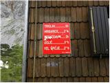 41
41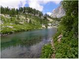 42
42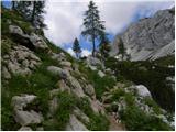 43
43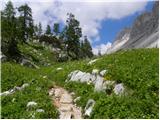 44
44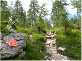 45
45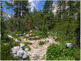 46
46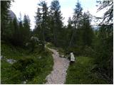 47
47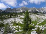 48
48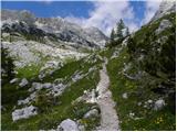 49
49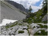 50
50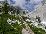 51
51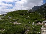 52
52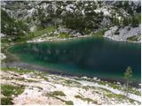 53
53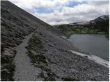 54
54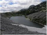 55
55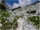 56
56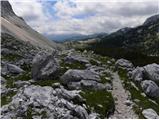 57
57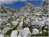 58
58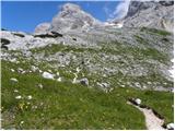 59
59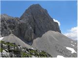 60
60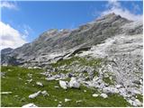 61
61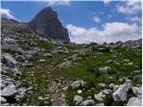 62
62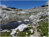 63
63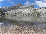 64
64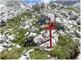 65
65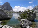 66
66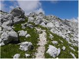 67
67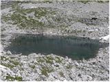 68
68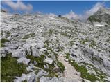 69
69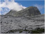 70
70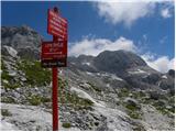 71
71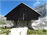 72
72 73
73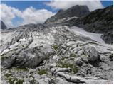 74
74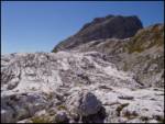 75
75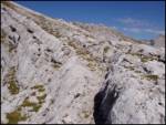 76
76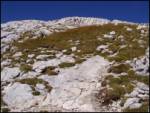 77
77 78
78
Discussion about the trail Koča pri Savici - Malo Špičje (via Zasavska koča)