Kesselfall - Großes Wiesbachhorn
Starting point: Kesselfall (1034 m)
| Lat/Lon: | 47,21724°N 12,72585°E |
| |
Time of walking: 8 h 30 min
Difficulty: very difficult marked way, difficult unmarked way
Altitude difference: 2530 m
Altitude difference po putu: 2580 m
Map:
Recommended equipment (summer): helmet, self belay set, ice axe, crampons
Recommended equipment (winter): helmet, self belay set, ice axe, crampons
Views: 3.920
 | 4 people like this post |
Access to the starting point:
Drive through the Karavanke Tunnel into Austria, then continue along the Turkish Autobahn. We continue through the Katschberg Tunnel and later the Thuringian Tunnel / Tauerntunnel, and follow the motorway to Salzburg (aka Solnograd) only as far as the exit for Bischofshofen, from where we continue on the four-lane road to the aforementioned town. From Bischofshofen, follow the signs for Zell am See and then Kaprun. In Kaprun, continue along the Kaprunertal valley and follow the signs for 'Speichererseen'. Follow the road ascending slightly until it ends. Park in the free garage at the end of the road next to the Kesselfall Alpenhaus. The road ahead of the garage is closed to public traffic.
Path description:
In the garage, follow the exit signs and go up the stairs. The exit is at the top of the garage. Exit the garage and turn right onto the road, where you will also find signs for the ticket office where you can buy tickets to Lake Mooserboden.
We continue past the lock on the road which is closed to public traffic. After a very short climb up the road, a signpost directs you to the left onto a footpath through the forest. The path then leads through the forest and soon crosses a stream. Walk along the relatively level path through the forest for a while and then join the cart track which leads to the bottom station of the inclined lift. Cart track is the old access to the inclined elevator, the new road leads through the tunnel. The inclined elevator is the largest of its kind in Europe and leads to the upper part of the road to Lake Mooserboden. The lift was originally built for the construction of the dam on lakes Wasserfallboden and Mooserboden
Before the bottom station of the lift, our route turns to the right and then climbs for some time through the forest. On the ascent, it crosses the lift route several times through a short tunnel. Higher up, we then cross a grazing fence and the path leads us to mountain pasture where cows graze in the summer months. Climb for a while on slightly more scenic grassy slopes before the path turns left and leaves mountain pasture. The path then follows cart track, which leads to a tarmac road. The road leads to the left to the lower part of the dam at Wasserfallboden, and we continue on the road to the right up to where the signs direct us. Soon we come to a crossroads where the road from the top station of the inclined lift joins from the right.
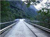
At the junction, continue left along the road, which quickly leads to the tunnel. Walking through the tunnel is forbidden, so our route turns left and then crosses the slightly steeper slopes next to the tunnel. On the other side of the tunnel, rejoin the road and you will reach the dam at Lake Wasserfallboden. At the dam, continue slightly right along the road and soon rejoin the tunnel to the left on a footpath. The path then crosses the rather steep slopes above the lake, from which you have a very nice view of the many three-thousand-point peaks above the lake. The path then turns right and briefly joins the tunnel. In the tunnel, the path follows a narrow pavement separated from the road by a fence. The tunnel is soon left and the path leads back to the steep slopes above the lake. This time the slope is a little steeper and some caution is needed when walking. The path descends gently at first, and the fixed safety gear are helpful. We then join the old abandoned road for a short distance and after a short exposed crossing we rejoin the main asphalted road. At the next tunnel you leave the road again, but this time the slopes you cross are less steep. The route here passes over grassy slopes with a fine view of the lake and the surrounding peaks. When we rejoin the road, the road soon brings us to a crossroads. Signposts here direct us right up and after a short climb we reach mountain pasture Fürthermoaralm where there is also a hut and a chapel.
Continue along cart track past the chapel and you are quickly back at the crossroads. The Hochkammerweg leads up to the right towards the Kitzsteinhorn - Kaprun ski resort, and we continue straight on, following the signs for Mooserboden. From the crossroads, our path first descends gently and leads us past some information boards presenting plants and animals at mountain pasture. The path then crosses a few streams and turns into a track at cart track. The path turns left here and starts to climb a little steeper and leads back to the asphalted road. Follow the road to the next tunnel where signs direct you right again onto the footpath. There is one last climb to the dam on lake Mooserboden. There is also a restaurant at the dam.
Continue on the road over the dam and about halfway across the dam you will come to the foot of the slope of the Höhenburg peak. There is another restaurant on the left and protected climbing routes (Klettersteigarena Höhenburg) leading to the summit. We continue along the dam and on the eastern side of the summit, an easier stairway to the summit of Höhenburg branches off to the left. We continue over the other half of the dam and then come to a marked crossroads.
The path to the right leads to the Großer Bärenkopf, and we continue to the left where we are directed by signs for the Wiesbachhorn and the Heinrich-Schwaiger Haus. After a short climb up a grassy slope, we reach another crossroads.
This time, the Max Hirschl Weg trail branches off to the left towards the Gleiwitzer Hütte, and we continue to the right towards the Heinrich-Schwaiger Haus. From the crossroads we start climbing in long switchbacks up a relatively steep slope. In a few places we are helped by ropes. The trail then leads into the central part of the Hohe Tauern National Park. We then continue to climb for some time in switchbacks up a steep slope, all the time enjoying a good view of the Mooserboden and Wasserfallboden lakes and the peaks above the lakes. As we approach the cargo cableway, the path turns slightly to the left and, especially in the parts where the path runs on smooth slabs, the cableways are also helpful. A little later the path turns right again and there is only a short climb to the Heinrich-Schwaiger Haus hut.
At the hut, continue left after the "Wiesbachhorn" signs and cross the slope to the north-east. The path quickly leads to a steep ravine. The route becomes considerably more difficult here and the use of self-propulsion is recommended. After a relatively short steep climb, the path turns to the right and then climbs up a rocky slope where the path is marked with red dots. The slope is quite steep so some caution is still needed. This is the path that leads to the ridge at the summit of Unterer Fochezkopf. On the ridge where the view to the east opens up, continue to the right and descend a little at first, then continue climbing along the ridge passing by the Fochezkees glacier. At the end of the glacier, the trail continues past the Oberer Fochezkopf peak where the marked trail ends.
We continue along the ridge, which is occasionally slightly exposed to the right. The Kaindlgrat ridge then leads us over the Kaindlkees and Wielingerkees glaciers, with a fine view of the Großes Wiesbachhorn. When you reach the west side of the summit, the ridge ends and leads you to lower slopes. Although there are no longer any markings, the path is usually still clearly visible.
Our route turns left here and starts climbing again a little more steeply up the western slopes of the mountain. Further on, we can climb up the left side on a slightly rockier ridge, which requires some easy scrambling. Alternatively, climb up the right side where the track climbs up an admittedly very steep slope, so some caution is needed here too. Which option we choose also depends on the snow conditions. We then climb up such a slope until we reach the Großes Wiesbachhorn lookout peak.
Descend along the ascent route. The best time to climb is in late summer, when it is often possible to climb without winter equipment.
The ascent can be shortened by a combination of an inclined lift and a shuttle bus to the Mooserboden dam. In this case, it is a 5-hour climb to the top.

Pictures:
 1
1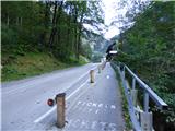 2
2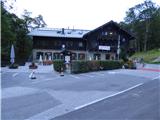 3
3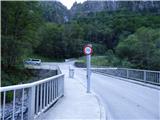 4
4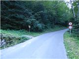 5
5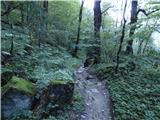 6
6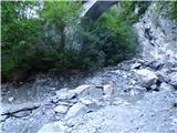 7
7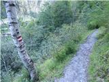 8
8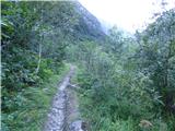 9
9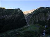 10
10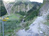 11
11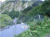 12
12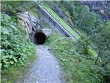 13
13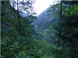 14
14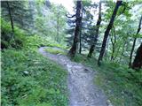 15
15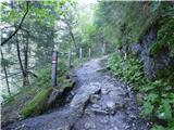 16
16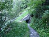 17
17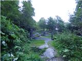 18
18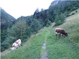 19
19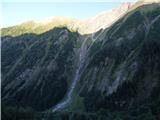 20
20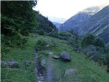 21
21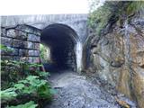 22
22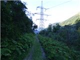 23
23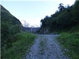 24
24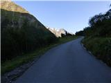 25
25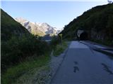 26
26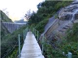 27
27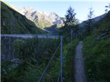 28
28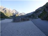 29
29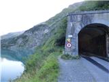 30
30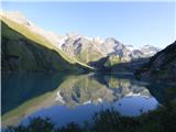 31
31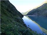 32
32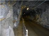 33
33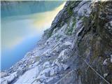 34
34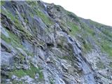 35
35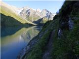 36
36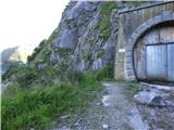 37
37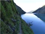 38
38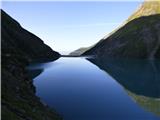 39
39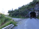 40
40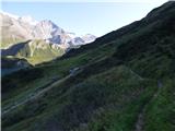 41
41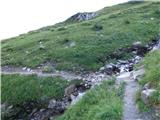 42
42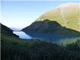 43
43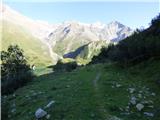 44
44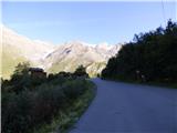 45
45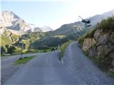 46
46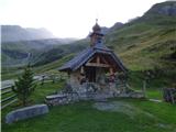 47
47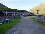 48
48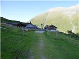 49
49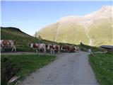 50
50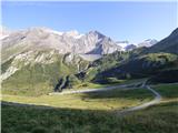 51
51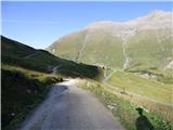 52
52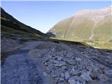 53
53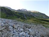 54
54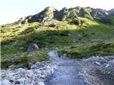 55
55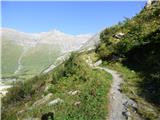 56
56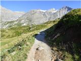 57
57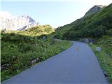 58
58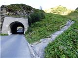 59
59 60
60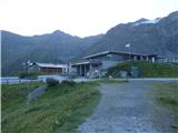 61
61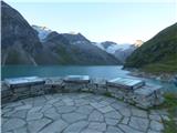 62
62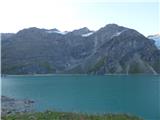 63
63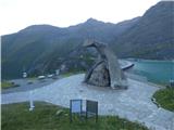 64
64 65
65 66
66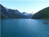 67
67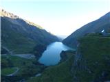 68
68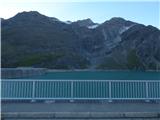 69
69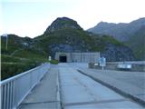 70
70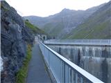 71
71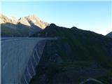 72
72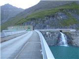 73
73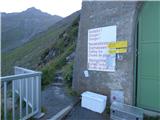 74
74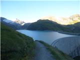 75
75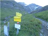 76
76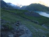 77
77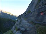 78
78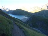 79
79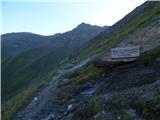 80
80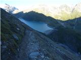 81
81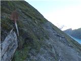 82
82 83
83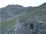 84
84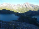 85
85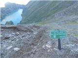 86
86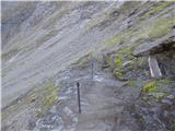 87
87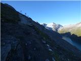 88
88 89
89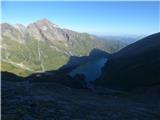 90
90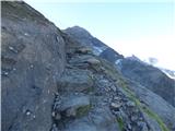 91
91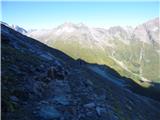 92
92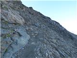 93
93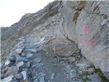 94
94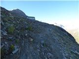 95
95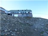 96
96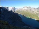 97
97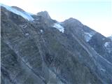 98
98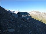 99
99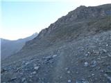 100
100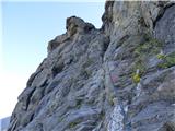 101
101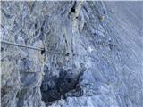 102
102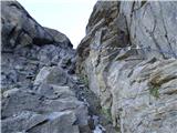 103
103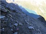 104
104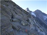 105
105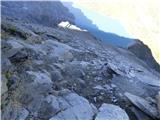 106
106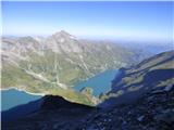 107
107 108
108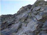 109
109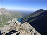 110
110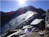 111
111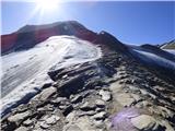 112
112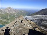 113
113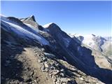 114
114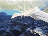 115
115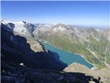 116
116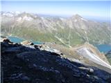 117
117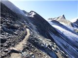 118
118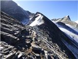 119
119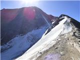 120
120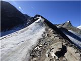 121
121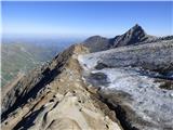 122
122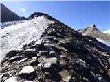 123
123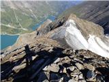 124
124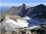 125
125 126
126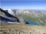 127
127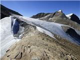 128
128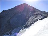 129
129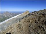 130
130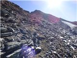 131
131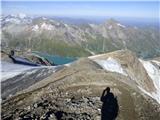 132
132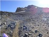 133
133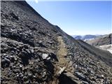 134
134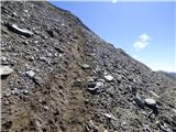 135
135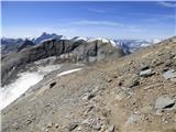 136
136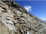 137
137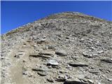 138
138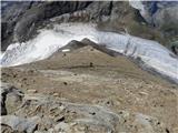 139
139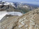 140
140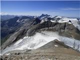 141
141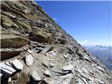 142
142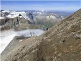 143
143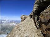 144
144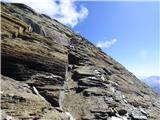 145
145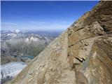 146
146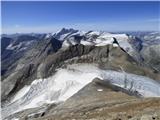 147
147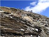 148
148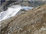 149
149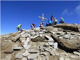 150
150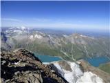 151
151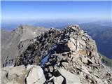 152
152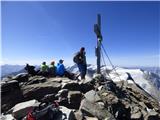 153
153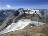 154
154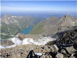 155
155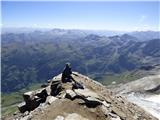 156
156
Discussion about the trail Kesselfall - Großes Wiesbachhorn
|
| Nejc78718. 08. 2020 |
Pozdravljeni, je kdo zadnje čase hodil tu okrog? Ali je trenutno za vzpon na vrh potrebna zimska oprema? Mogoče kdo pozna vozni red poševne vzpenjače in avtobusa za dostop do jezera Mooserboden? Hvala za odgovore!
|
|
|
|
| Nejc78713. 08. 2022 20:55:19 |
Torek 9. in sredo 10. Razmere za vzpon odlične, žal brez stopinje v sneg, kar bi malo začinilo turo. Pot logična, dobro vidna in v lepem vremenu ne moreš kaj zgrešit. Je pa na mesta izpostavljena in ni za vrtoglave. Tehnični del takoj nad kočo odlično zavarovan z jeklenico, na ostalem delu je varoval malo, samo tam so, kjer so nujno potrebna. Od jezera do koče slabi dve uri, od koče do vrha dobri dve uri. Obiska kar nekaj, na palec kakih 100 gornikov na lep dan.
Kočo je potrebno prej rezervirati, ker je v lepem vremenu polna. Hrana dobra, tudi organizacija dekletom, ki kočo vodijo, klapa.
Povratno karto za bus-vzpenjača-bus od garažne hiše v dolini do zgornjega jezera Mooserboden kupiš na licu mesta, avtobusi vozijo neprestano.
Skratka, krasna tura, priporočam. Naša ekipa je uživala.
|
|
|