Starting point: Kanonir (725 m)
| Lat/Lon: | 46,3801°N 14,4619°E |
| |
Time of walking: 3 h 45 min
Difficulty: partly demanding marked way, partly demanding unmarked way
Altitude difference: 1008 m
Altitude difference po putu: 1150 m
Map: Karavanke - osrednji del 1:50.000
Recommended equipment (summer):
Recommended equipment (winter): ice axe, crampons
Views: 2.960
 | 1 person likes this post |
Access to the starting point:
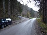
First, drive to Preddvor or Tupaliče (reachable from the Gorenjska highway or Kranj), then continue in the direction of Jezersko. When you arrive in Jezersko, you will soon see signs for the Kanonir Inn. After the guesthouse, turn left onto the road in the direction of Dol - Podstoržič and Kovk Farm. Continue along a slightly narrower road, which leads past houses, and then after a further 100 m of driving, you will reach a crossroads where a steep road branches off to the left, which is also the marked path to Kozji vrh. Park in a suitable place at the crossroads.
Path description:
From the starting point, continue along the road on the left in the route Kozji vrh, at which point you will notice that from 20. 7. to 20. 10. no further driving is allowed. Walk for about 20 minutes along a fairly steep road and then you will come out of the forest, on the edge of the Robci pasture, where you will have a beautiful view of the Kočna massif.
From Robci, located on the saddle between Macesnovec (1042 m) on the left and Kozji vrh (1628 m) on the right, continue to the right, on cart track in the direction of Kozji vrh. Cart track leads quickly into the forest, through which you start to climb steeply. At a few small crossroads, follow the signs and cart track turns into a mountain trail higher up, which continues to climb mostly cross-country to the right, crossing several ravines and steep slopes in the process. In wet conditions there is a greater risk of slipping in some parts, and in dry conditions more care is needed in places. Higher up, some views open up through the treetops, and the path leads below the Kozji vrh cliffs, where, especially in spring, there is a greater chance of falling rocks. Below the cliffs, the path leads over a small scree slope, but mostly on a steep slope. When the traverse ends, the path leads to an indistinct wooded saddle between Kozji vrh on the left and Turni (1432 m) on the right.
Here you leave the marked trail, which turns left and leads on to Kozji vrh (Kozji vrh is about 40 minutes away) and continue right, along an indistinct ridge, where you soon see an old path and a wire fence. When you reach the bottom of Turnov, the track disappears completely, and we just cross the slopes of Turnov (if you go right up the bank, you can reach the top of Turnov in less than 10 minutes).
On the other side of the highest peak of Turnov, we arrive at a small saddle where we see an old boundary stone (the boundary stone separated the land of Carniola from the land of Carinthia). From here there is a slight descent to the left, and then you reach the newer cart track, after which you continue descending to the lowest point in the ridge from Kozji vrh to Malý Grintovec (1299 m). At this saddle, cart track turns slightly to the left and continues descending, and we continue slightly to the right, on a clearly visible path that continues along or slightly along the ridge. Continue through dense forest, climbing gently at first and then moderately. During the ascent, the path leads us past more old boundary stones, and we follow the well-traced path to where it turns slightly left from the ridge and onto a slope. At this point, we leave the nice path and continue along the ridge, initially on a trackless path, and then the path reappears (if we had continued to the left, following the path, we would have soon realised that we were on the wrong path, as the path soon disappears). The way forward leads us along the ridge, where we climb steeply for a few metres on a slightly exposed jump, and then through the lane of dwarf pines we quickly reach a pleasant lookout point from where we open a beautiful view of the surrounding mountains, the most beautiful of course is the view towards the massif of Kočna.
The viewpoint also opens up a view of the part of the trail ahead, as the path through dwarf pines is clearly visible. The path continues to climb transversely through dwarf pines, and in doing so it also leads us over a short, partly rocky and slightly exposed ledge. Higher up, we reach a side ridge, and beyond it a sparse forest covered with grasses. The path continues along a steep grassy slope, where the track quickly becomes lost. Cross the slope and climb across to the left (there is a risk of slipping in wet conditions), then higher up again, regain the track and follow it to the right. The path climbs through lane of dwarf pines and then returns to the ridge, which is reached near two ravines. The passage over the two ravines which meet on the ridge is not difficult, but the path after them becomes the longer lane of dwarf pines. The route through dwarf pines is relatively easy to pass, and initially also follows a slightly exposed ridge. After about 20 minutes of relatively steep climbing through dwarf pines, the scenic peak of Licjanovac is reached.
Descend via the ascent route, or via cart track, which is reached at Turni (the track turns into a road at a lower level and leads around Kozji vrh to the starting point, or continue to the nearby Mali Grintovec and then descend via the marked path over the Bašeljski Preval.
Description and pictures refer to the situation in 2015 (November).

Pictures:
 1
1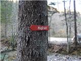 2
2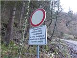 3
3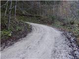 4
4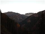 5
5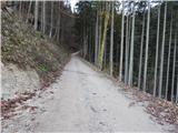 6
6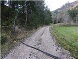 7
7 8
8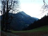 9
9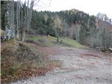 10
10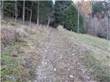 11
11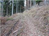 12
12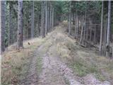 13
13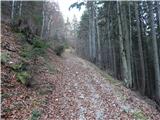 14
14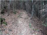 15
15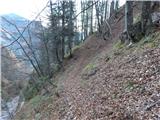 16
16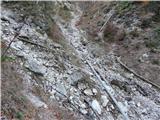 17
17 18
18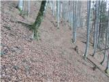 19
19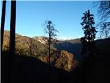 20
20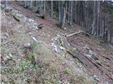 21
21 22
22 23
23 24
24 25
25 26
26 27
27 28
28 29
29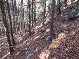 30
30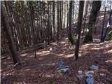 31
31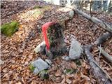 32
32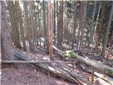 33
33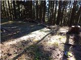 34
34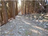 35
35 36
36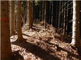 37
37 38
38 39
39 40
40 41
41 42
42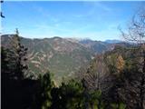 43
43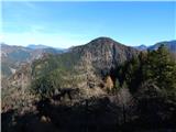 44
44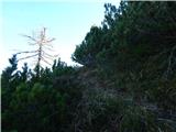 45
45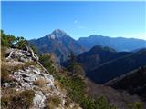 46
46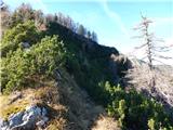 47
47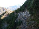 48
48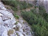 49
49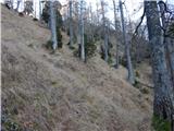 50
50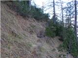 51
51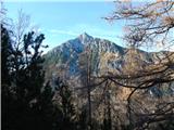 52
52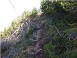 53
53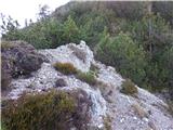 54
54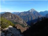 55
55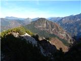 56
56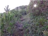 57
57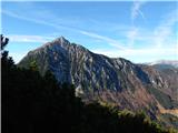 58
58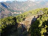 59
59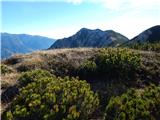 60
60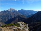 61
61
Discussion about the trail Kanonir - Licjanovec
|
| metod11. 06. 2017 |
Lepa tura, tudi opis je dober in brez problema se jo da slediti. Mejni kamen ima inicialki FD; Franc Dolenc, nekdanji veleposestnik oziroma lastnik gozdov v dolini Koritarce.
|
|
|