Kamnje - Koča Antona Bavčerja na Čavnu
Starting point: Kamnje (250 m)
| Lat/Lon: | 45,901°N 13,8345°E |
| |
Time of walking: 2 h 30 min
Difficulty: easy marked way
Altitude difference: 992 m
Altitude difference po putu: 1000 m
Map: Goriška 1:50.000
Recommended equipment (summer):
Recommended equipment (winter):
Views: 13.070
 | 2 people like this post |
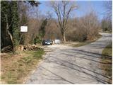
Access to the starting point:
a) From the expressway Razdrto - Nova Gorica take the Ajdovščina exit, then turn left at the junction towards Nova Gorica. Continue along the regional road towards Nova Gorica to the village of Potoče, where you turn right towards the village of Kamnje. The road then soon leads to the above-mentioned village, where you pass a church and cross a bridge to a crossroads, where you turn left in the direction of Kuclje, Čavno and Mala Gora. Just a little further on, at the signs for Kucelj and Čaven, leave the asphalted road and park in a small parking lot by the road.
b) From the motorway Nova Gorica - Razdrto, take the exit Selo, and then, when you get on the old road Nova Gorica - Ajdovščina, turn right towards Nova Gorica. Follow the regional road towards Ajdovščina to the village Potoče, where you turn left towards the village of Kamnje. The road then soon leads to the above-mentioned village, where you pass a church and cross a bridge to a crossroads, where you turn left in the direction of Kuclja, Čavno and Mala gora. Just a little further on, at the signs for Kucelj and Čaven, leave the asphalted road and park in a small parking lot by the road.
Path description:
From the parking lot, continue along the dirt road, which slowly turns into cart track. After about half an hour's walk, leave cart track, as the signs for Čaven direct you to the right onto the footpath. Continue along the path as it climbs gently through the forest. The well-marked path leads us a little higher to the Šija resting place (bench and table). The way forward gradually starts to climb steeper and steeper and leads us higher to a beautiful viewpoint called Kopice.
We continue to climb through the forest for some time, then we move on to the uncultivated slopes of Mala gora, where the steepness also eases. After a few more steps, you reach the hut on Mala gora, from which you continue straight on in the direction of Kuclj and Čavno. A few steps further on, cart track joins us from the hunting hut on the left. Continue along the cart track, which soon branches off to the right to the Cottage na Čavnu.
Continue right here and after a short climb reach the next crossroads, where you will come out on the path Koča na Čavnu - Kucelj. Again, continue to the right and follow the gently sloping path cart track, which leads us after a good 15 minutes of further walking to the Cottage na Čavnu.

Pictures:
 1
1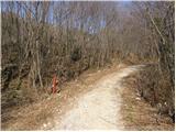 2
2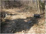 3
3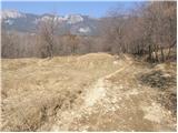 4
4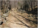 5
5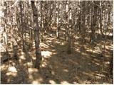 6
6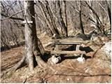 7
7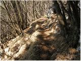 8
8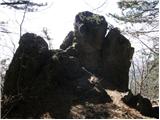 9
9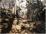 10
10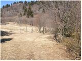 11
11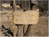 12
12 13
13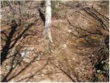 14
14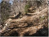 15
15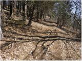 16
16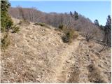 17
17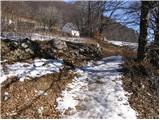 18
18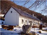 19
19
Discussion about the trail Kamnje - Koča Antona Bavčerja na Čavnu
|
| di20. 03. 2017 |
Pot ni zadovoljivo markirana (veliko je tudi novih kolovozov). 
|
|
|
|
| BT8821. 03. 2017 |
di bale same bale najboljse,da ti spago napeljemo do koce
|
|
|
|
| gvodopivec23. 03. 2017 |
Pozdravljen "dj"! Nikakor se ne morem strinjati z vašo trditvijo, da je planinska pot iz Kamenj na Malo goro in naprej h koči na Čavnu slabo označena. Iz Kamenj vodi planinska pot, ki se prične pri kapelici, kjer stoji tudi velika info tabla na kateri so izrisane in opisane poti in ture v čavenskem "pogorju". Nekako vzporedno s planinsko potjo in deloma po njej poteka tudi tematska pot - Pot koscev in grabljic, ki je zelo dobro uhojena in označena. Ste mogoče zgrešili že v samem štartu? Drži pa, da je med potjo (v bližini požarne ceste)trenutno sečnja in zaradi tega, so rahlo spremenjeni kolovozi (nove krajše gozdne ceste... V želji, da spremenite mnenje o označenosti poti, vas vabim, da vzpon opravite še enkrat, mogoče tudi, da se udeležite Velikonočnega pohoda na Malo goro  Lep planinski pozdrav 
|
|
|