Juranščina - Ivanščica (via valley of stream Brana)
Starting point: Juranščina (340 m)
Name of path: via valley of stream Brana
Time of walking: 2 h
Difficulty: easy marked way
Altitude difference: 721 m
Altitude difference po putu: 721 m
Map:
Recommended equipment (summer):
Recommended equipment (winter): crampons
Views: 1.780
 | 1 person likes this post |
Access to the starting point:
a) Arrive in Croatia via Border crossing Gruškovje / Macelj. Leave the Macelj-Zagreb motorway at Zabok. Continue in the direction of Bedekovčina, Zlatar Bistrica. After Poznanovec, leave the main road and go in the direction of Maca, Zlatar (it is also possible to reach Zlatar by continuing on and turning in the town of Zlatar-Bistrica). In Zlatar you will see signs for Belec, which is about 15 minutes away on a worse road.
b) From Prekmurje, take the Goričan-Zagreb motorway, leaving at the Novi Marof exit. From Novi Marof, we will continue in the direction of Zlatar, but only as far as the town of Budinscina, where we will take the worse road, which will lead us to the village of Belec after twenty minutes.
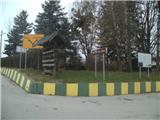
The official start of the route is at the church in Belec, but from here to "our" starting point in Juranščina is a half-hour walk on asphalt.
Path description:
The official start of the route is at the church in the village of Belec. I recommend that you drive further to the village of Juranščina, because it is a half-hour walk on asphalt and flat ground.
In Juranščina there is a crossroads where you will see mountain signs. Go left in the direction of Belecgrad (Kopanja and Židovina on the right). The asphalt will soon be over and the path will turn into a forest (there are still a few parking places here).
Through the forest we walk on a mostly level path, with some views of the ruins of Belecgrad Castle through the trees, and on the left side of the path runs the pleasant stream Brana, which descends towards the valley in numerous rapids. After half an hour's walk, you reach the Belecgrad Mountain Home.
Behind the lodge is a large crossroads from which you continue straight on (Minđalovec peak on the right, the path along Belecgrad and Beliga on the left). Soon you arrive in a short lane of spruce forest, and then the path leads you to a water supply facility. From here on, the valley along the Brana stream becomes narrower and narrower, and the path becomes steeper and steeper.
Higher up, the path turns to the right, where it crosses a steeper part where there is a risk of slipping in the wet. When you reach the next left turn, there is a slightly more difficult part where the biggest problem is the slippery ground and slight exposure. The route ahead turns right once more to go north. Once in the lane of the thinner forest, there is another fork where the path to the right leads to the top of Hanjžico, and we go straight ahead. After a few minutes we will leave cart track and go right into the forest (if we had continued on cart track we would have come to a service road leading to the top of Ivanjščice).
The path ahead becomes steeper again, and during the ascent we will cross another forest cart track. After a few minutes, leave the forest and you will come to a service road, along which you will continue your journey.
As we climb along the road, the path leads us past the next crossroads, where an asphalt road branches off to a former military barracks, and we continue straight on, then at a bend we leave the road and join the Mrzljak trail from Ivanec. We are in the forest for a few minutes, then we get on the road, which we follow to the Pasarićeva koča mountain home and to the nearby summit.
Juranscina - home Belecgrad 45 min
Dom Belecgrad - road 1,00 h
road - summit 15 min

Pictures:
 1
1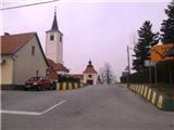 2
2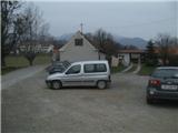 3
3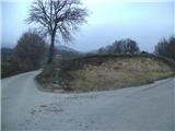 4
4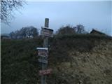 5
5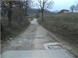 6
6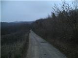 7
7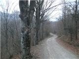 8
8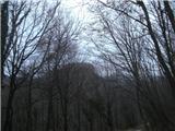 9
9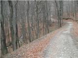 10
10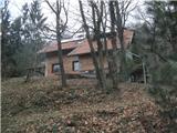 11
11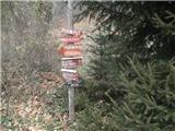 12
12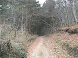 13
13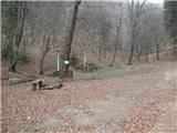 14
14 15
15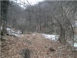 16
16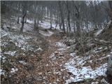 17
17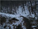 18
18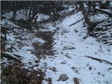 19
19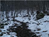 20
20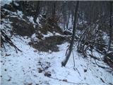 21
21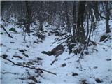 22
22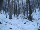 23
23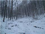 24
24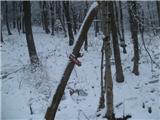 25
25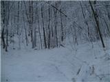 26
26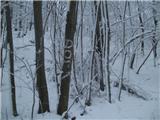 27
27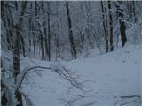 28
28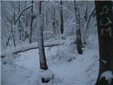 29
29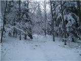 30
30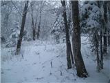 31
31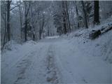 32
32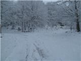 33
33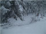 34
34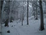 35
35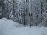 36
36 37
37 38
38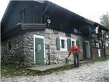 39
39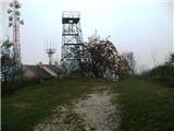 40
40
Discussion about the trail Juranščina - Ivanščica (via valley of stream Brana)
|
| Marx17. 03. 2020 |
Pot je rahlo spremenjen.
Zdaj ni več puščice z slike 25 ker je varianta prek Hanjžice postala neuradna in se več ne markira (ampak je še vedno dobro uhojena)
Na sliki 26 ne gremo več desno (Tudi ta varianta več ne obstaja) ampak levo (Imamo novi natpis na drvesu) in pridemo na obskrbno cesto kateroj sledimo do do slike 32 kjer gremo na pot Mrzljak(Ali le nadaljujemo naprej po cesti do koče).
Žal so poti z južne strani slabše vzdrževani i so markacije kar zbledele...
|
|
|