Jekarica - Dom na Kališču
Starting point: Jekarica (994 m)
| Lat/Lon: | 46,3602°N 14,4244°E |
| |
Time of walking: 2 h
Difficulty: easy marked way
Altitude difference: 540 m
Altitude difference po putu: 640 m
Map: Karavanke - osrednji del 1:50.000
Recommended equipment (summer):
Recommended equipment (winter): ice axe, crampons
Views: 25.668
 | 1 person likes this post |
Access to the starting point:
From the motorway Ljubljana - Jesenice take the exit Kranj - East and follow the road in the direction of Jezersko, but only as far as the Kanonir Inn, where you turn left and follow the asphalted road. At all junctions, follow the signs for Storžič. When the road makes a sharp right turn, you will see signs for Kališče and Storžič. Park in the parking lot near the signposts so as not to interfere with the forestry work. The road is CLOSED from 20. 7. to 20. 10. When the road is closed we park lower down, which extends the climb by one hour.
Path description:
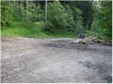
At the bend, take the cart track, which is to the left of the signs. After a few metres, you will see a marking on a tree, which tells you that you are on the right track. After a good five minutes of walking, the signpost points to the left on the footpath. The path, which starts to climb moderately, soon leads us to cart track which we just cross. The path crosses cart track again only about a minute further on, and then climbs more steeply. The path slowly turns slightly to the left and leads to a small ridge, where we approach cart track. Climb for a while along cart track, and then the path leads to a viewpoint where a bench stands. The way forward leads to cart track again, but this time to the point where it ends. It is also possible to access the cart track (at all crossroads, keep to the left, but the start is the same). The way forward is a little more difficult to follow as large amounts of fallen trees make it impossible to climb the marked path, so it is necessary to find the crossings, which are only partially covered. Once this part is passed, the path is easier to follow again, but only for a short time. The way ahead approaches the clearing below Storžič and turns left between fallen trees. Again look for passages between the trees. A few metres before Praprotnikova koča, rejoin the marked path, which takes a few steps to reach the hut. The path ahead climbs steeply again, then turns right and crosses the slopes in a gentle ascent to the debris carried by the torrent. The way forward takes us between two boulders and, after a few steps downhill, begins to climb again. Soon we come to the dwarf pines, where the view opens up. The path continues to climb under the Bašeljski vrh walls, which we go around on the underside. First we cross a small scree slope and then the path leads us into a ravine between dwarf pines. The ascent up the ravine is not difficult, but care is needed, especially when descending, because of the gravel on the rocky surface. The path out of the ravine leads to a pleasant meadow where we have a view of the south side.
At the signposts turn left towards Kišče (Storžič on the right). The wide path on the south side passes Bašeljski vrh and then descends in a gentle downhill on a scenic route to the house at Kišče. Jekarica - Bašelj saddle 1:45, Bašelj saddle - Kališče 15 minutes.

Pictures:
 1
1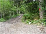 2
2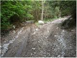 3
3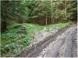 4
4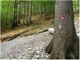 5
5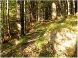 6
6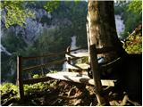 7
7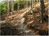 8
8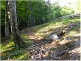 9
9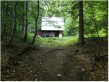 10
10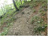 11
11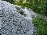 12
12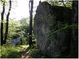 13
13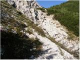 14
14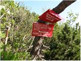 15
15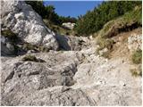 16
16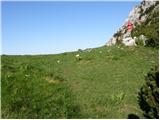 17
17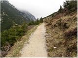 18
18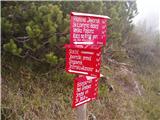 19
19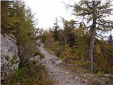 20
20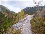 21
21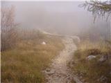 22
22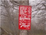 23
23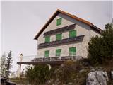 24
24
Discussion about the trail Jekarica - Dom na Kališču
|
| Guest22. 07. 2007 |
Brane V.-Lep kratek,lahek pohod,ki ga pa močno podaljša zaprta cesta.Se pa zaradi prelepih dveh slapov in polzeče vode na nekem skalovju oblečenim v zelen mah ob cesti kmalu za zapornico, splača tudi samo sprehoditi.V tej vročini to zelo paše.
|
|
|
|
| malena10. 06. 2013 |
Včeraj smo se s hčerko in nečakinjo, ki ima 6 let, po omenjeni poti podale na Kališče. Opis poti smo imela k sreči s sabo, saj so nekje oznake res pomanjkljive. Na omenjeni poti nismo srečale nobenega planinca.
Štruklji v domu odlični, cene tako za pijačo kot hrano pa precej visoke.
|
|
|
|
| balon5. 07. 2013 |
Ali je/bo napis, da bo koča zaprta 3 mesece aktualen ali je to še iz pretektosti ostalo.
|
|
|
|
| balon15. 10. 2013 |
razpolaga kdo s podatkom ali bo cesta do parkirišča po 20.10. odprta? hvala za odgovor 
|
|
|
|
| balon20. 07. 2014 |
ali je cesta zaprta ali....?
|
|
|
|
| Borut11. 09. 2014 |
Ali velja navedena zapora ceste tudi letos? Hvala.
|
|
|
|
| SunnyDay17. 07. 2017 |
Cesta je uradno zaprta - dovoljeno samo za uporabnike/lastnike gozdnih zemljišč, vendar je bila rampa 15. 7. 2017 še dvignjena (na "parkirišču" ob izhodišču opisane ture smo bili trije avtomobili). Od 20. 7. naprej velja popolna zapora.
|
|
|
|
| simon796. 05. 2019 |
2.5.2019 - zapornica dvignjena, šlo je z avtom še ca. 3 km, kjer so potekala gozdarska dela. Potem še ca. 20 minut peš do izhodišča na 1. sliki. Mogoče bi bil za popravit opis, pot je sedaj lepo markirana in normalno sledljiva, nobenih preprek. 5 minut pred kočo je modras prečkal pot.
|
|
|