Starting point: Jazne (Lanišar) (660 m)
| Lat/Lon: | 46,0732°N 14,0242°E |
| |
Time of walking: 1 h 30 min
Difficulty: easy marked way
Altitude difference: 348 m
Altitude difference po putu: 375 m
Map: Škofjeloško in Cerkljansko hribovje 1:50.000
Recommended equipment (summer):
Recommended equipment (winter):
Views: 12.662
 | 2 people like this post |
Access to the starting point:
a) First, drive to Gorenjska vas in the Poljane valley (reachable from Škofja Loka, the new bypass road that bypasses Škofja Loka Horjul or Polhov Gradec), then continue driving towards Žire and Cerkno. After Trebija and just before the bridge over the Poljane Sora River, leave the main road towards Žire and turn right towards Cerkno. Continue along a slightly winding road, which quickly leads to the settlement Sovodenj, where you turn left in the middle of the settlement, onto the road that continues between the fire station and the cooperative home. Continue along the road that leads along the Javorščica stream, and after Koprivnik, at a small crossroads, turn right in the route Jazne-Otalež (straight ahead Ledine, Javorjev dol, Mrzli vrh and Sivka). From this junction, drive for about 200 m and then reach a hamlet of a few houses, where you will see red mountain direction signs. Park in a suitable place near the junction, or drive a little further in the direction of the marked trail to Sivka and then park in a suitable place by the road.
b) Drive to Žiri (to get here from Vrhnika or Logatec), then continue driving towards Škofja Loka. Before Trebija, turn left onto the road towards Cerkno. Continue along a slightly curvier road, which quickly leads to the settlement Sovodenj, where you turn left in the middle of the settlement onto the road that continues between the fire station and the cooperative home. Continue along the road that leads along the Javorščica stream, and after Koprivnik, at a small crossroads, turn right in the direction Jazne-Otalež (straight ahead Ledine, Javorjev dol, Mrzli vrh and Sivka). From this junction, drive for about 200 m and then reach a hamlet of a few houses, where you will see red mountain direction signs. Park in a suitable place near the junction, or drive a little further in the direction of the marked trail to Sivka and then park in a suitable place by the road.
c) Leave the main road Idrija - Straža-Želin at the turnoff for the settlement Jazne, then ascend to the settlement, from where you continue towards Sovodnje. After a small pass, where the marked trail to Bevkov vrh branches off to the left, the road begins to descend, and we follow it to a small hamlet, at which we see red mountain signs for Sivka. Park in a suitable place near the crossroads, or drive a little further in the direction of the marked trail to Sivka and then park in a suitable place along the road.
Path description:
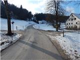
From the starting point, we take the road in the direction of Sivka, where the path leads us past some houses. Above the hamlet, when the road turns into a forest, at the "rio mlinčku", continue left up the cart track towards Sivka. Cart track climbs crosswise and quickly leads to houses where you get on the road. There is a short descent to where the road turns right. At the mid-point of the bend, leave the road and continue straight ahead along the wide cart track, which, after a further few dozen steps, leads us to the mountain signs.
Here, continue right on the fainter cart track, which climbs over a meadow. Cart track then crosses lane of wodland and after this leads to a road where you continue right past houses. Follow the road, which makes a sharp left turn between the houses, for some time. When the road leads to the next houses, it ends. Just a few steps before the houses, turn onto cart track in the direction of Sivka. Cart track climbs gently over a large meadow and after 10 minutes leads to a tarmac road where you turn right. The road then takes us past the Vodičar farm and leads us just a little further to the chapel, where we join the path from the village of Ledine.
Here, continue to the right in the direction of Sivka on a less good road which climbs steeply over a meadow. This road is followed for a short time, because even before the road goes into the forest, a marked path branches off to the right, which leads us to the top after a further 5 minutes of moderate ascent through the forest.

Pictures:
 1
1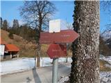 2
2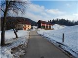 3
3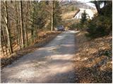 4
4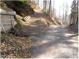 5
5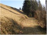 6
6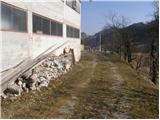 7
7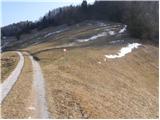 8
8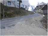 9
9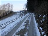 10
10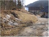 11
11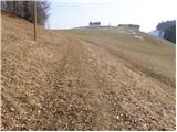 12
12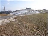 13
13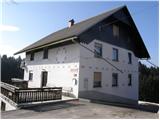 14
14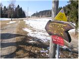 15
15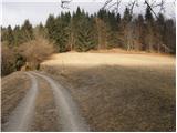 16
16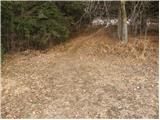 17
17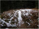 18
18 19
19
Discussion about the trail Jazne (Lanišar) - Sivka
|
| jure19779. 02. 2011 |
Včeraj sem bil na Sivki iz smeri Jazne. Na vrhu ni žiga, nekdo si ga je prisvojil... Žig dobite na kmetiji Vodičar, ki je na sliki.
|
|
|
|
| Lunca4. 01. 2012 |
žig je po novem na vrhu, pritrjen v skrinjici...
|
|
|
|
| Lisica30. 04. 2012 |
Včeraj prišla gor iz Bevkovega vrha - do slike 10, naprej ni nobenih markacij za Sivko več. Šla sem čez cesto do Mrzlega vrha in nazaj...  Navodil iz Hribi.net nisem imela s sabo, zemljevida pa tudi ne, pa vidim da bo to kar obvezno. Drugič z avtom gor po žig in na pir. 
|
|
|