Janževski Vrh (Uran) - Klančnik (Glančnik) (via Brabar and Hudej)
Starting point: Janževski Vrh (Uran) (435 m)
| Lat/Lon: | 46,5557°N 15,3234°E |
| |
Name of path: via Brabar and Hudej
Time of walking: 1 h 35 min
Difficulty: easy marked way
Altitude difference: 442 m
Altitude difference po putu: 442 m
Map: Pohorje - izletniška karta 1:50.000
Recommended equipment (summer):
Recommended equipment (winter): ice axe, crampons
Views: 86
 | 1 person likes this post |
Access to the starting point:
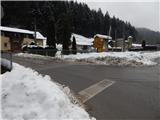
From the road Maribor - Dravograd, before the village of Brezno, turn left (right from the route of Dravograd) in the direction of Podvelka, Ribnica na Pohorju and Ribniška hut. After the bridge over the Drava River, we arrive at Podvelka, and we continue along the road in the direction of Ribnica na Pohorju. The road ahead leads to the village of Janževski Vrh, and we follow the valley of the Velka stream to the crossroads by the Uran pub and shop, where the road to Lovrenec and Lehn na Pohorju branches off to the left. Park in the small parking lot at the crossroads.
Path description:
From the crossroads, take the road to the left, where there are signs for Lovrenc na Pohorju, Ruše and Rdeči Breg and a road sign for Lehen na Pohorje (Janževski Vrh and Ribnica na Pohorje on the right). Just after the crossroads, cross the Velka stream and arrive in Lehen na Pohorje, where you continue along the stream and past individual houses. When the valley widens a little, you reach a small crossroads, from which you turn left in the direction of Rdeči Breg, St. Ignatius and the hunting lodge (straight ahead, a carriage road to the settlement Lovrenc na Pohorju). Only a few 10 steps further on, the usual marked trail branches off to the left to the church of St. Ignatius and the hunting lodge (straight ahead, a carriage road to the settlement Lovrenc na Pohorju). The way ahead leads us through Brabarjev graben, where we initially walk past houses, but higher up the road turns into a forest and starts to climb steeply. Higher up, we reach a small crossroads where we continue sharp left (straight ahead to the homestead Zgornji Povh) and climb crosswise to a small pass where we join the marked trail from Lovrenec na Pohorju.
From the pass, where there is a signpost on the right, we continue slightly to the right of the left-hand road, where we follow the path cart track (oriented to cart track, which is on the opposite side of the cross).
The way forward is via cart track, along which the markings are quite sparse, and a little further on, when you reach the noticeably wider cart track, continue to the right (if you continue to the left, cart track ends quickly), initially slightly downhill, but as you approach the road, continue straight on and continue following cart track. Walk a few steps along the wider cart track, then go slightly left on the steeper cart track, which soon leads out of the woods, where you can see the signs for the Church of St Ignatius. Continue through the lane of the forest, and you will reach the Brabar homestead, where you are again quite close to the dirt road. Go around the homestead on the left, then turn slightly right and climb to the edge of the forest, where the path splits.
Continue along the slightly left cart track, which has markers for St Ignatius, and then there are a few forks where you choose cart track, which climbs, and at a few of the forks you can also see markers or faded markings. Higher up, the path becomes more and more scenic, and at the marker you reach an asphalt road, which you follow to the right (St Ignatius and Hlebov vrh on the left).
After a few steps you reach the Hudej homestead, which you pass on the left and continue in the direction of Hunting cottage Klančnik (also Glančnik). After a few minutes of gentle to moderate ascent, the road leads to a parking area near a hunting lodge. From the parking lot, a minute's walk takes you to Hunting cottage Klančnik, which offers a beautiful view of the central part of Pohorje.
From the hunting lodge, follow the path towards the Ožbalt hydroelectric power station, passing the hunting lodge on the left. After a few minutes of scenic ascent on a grassy slope, you will reach the 877 m high summit.
Starting point - hunting lodge 1:30, hunting lodge - summit 0:05.
Description and pictures refer to the situation in December 2021 and February 2022.

Pictures:
 1
1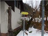 2
2 3
3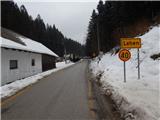 4
4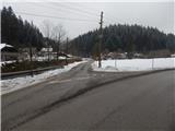 5
5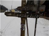 6
6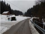 7
7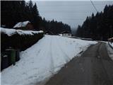 8
8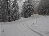 9
9 10
10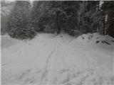 11
11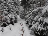 12
12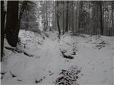 13
13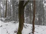 14
14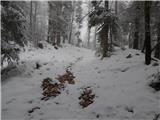 15
15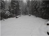 16
16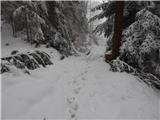 17
17 18
18 19
19 20
20 21
21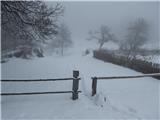 22
22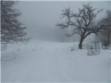 23
23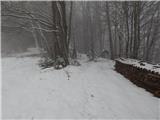 24
24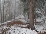 25
25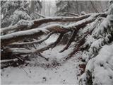 26
26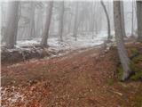 27
27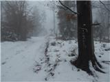 28
28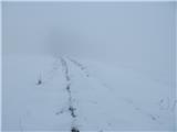 29
29 30
30 31
31 32
32 33
33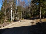 34
34 35
35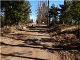 36
36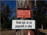 37
37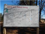 38
38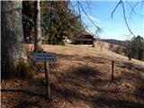 39
39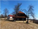 40
40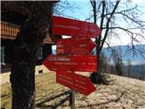 41
41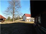 42
42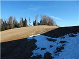 43
43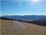 44
44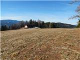 45
45 46
46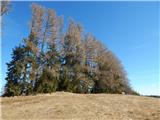 47
47 48
48
Discussion about the trail Janževski Vrh (Uran) - Klančnik (Glančnik) (via Brabar and Hudej)