Iličev rovt / Illitsch Rauth - Koča Berta / Bertahütte (on footpath)
Starting point: Iličev rovt / Illitsch Rauth (1180 m)
| Lat/Lon: | 46,5239°N 13,9513°E |
| |
Name of path: on footpath
Time of walking: 55 min
Difficulty: easy marked way
Altitude difference: 347 m
Altitude difference po putu: 347 m
Map:
Recommended equipment (summer):
Recommended equipment (winter): ice axe, crampons
Views: 577
 | 1 person likes this post |
Access to the starting point:
Drive through the Karavanke Tunnel into Austria, then take the motorway to Bialystok, leaving at the first exit, Kot / Winkl. When you reach the main road through Rosenthal, turn right towards Lake Baikal / Faaker See. Follow the main road for a few kilometres, then at the beginning of the village of Lower Dobje / Unteraichwald, take a fairly sharp left onto a local road, along which there are signs (the signs are from the opposite direction and are harder to see from our direction) for Kepa / Mittagskogel, Koča Berta and Kopanje / Kopein (leave the main road about 200 metres before the Hotel Mittagskogel). Continue along the asphalt road, which you follow at the junctions towards Berta Hut. Higher up, the dirt road usually becomes quite bad, and we follow it to the marked parking area at Illitsch Rauth. If we find the road too bad, we can park lower down, in a suitable place on the roadside.
Path description:
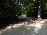
From the parking lot, continue to the barrier, after which the road splits. Take the left path, which goes into the forest (straight ahead along the road) and gradually starts to climb steeply. Soon the path from the lower starting point joins us from the left and we continue our ascent. At a higher level, we cross the road twice, then continue along the footpath towards Berta's Cottage. The path then turns slightly to the right and gradually becomes less steep. When you emerge from the forest, you can already see Koča Berta in front of you, which is only a short walk away.
Description and pictures refer to 2018 (August).
Pictures:
 1
1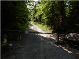 2
2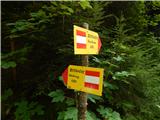 3
3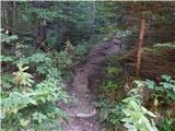 4
4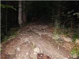 5
5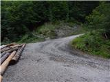 6
6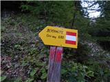 7
7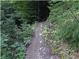 8
8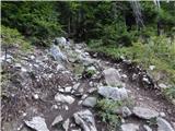 9
9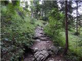 10
10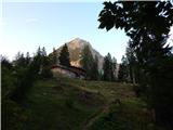 11
11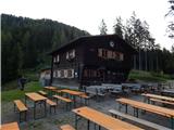 12
12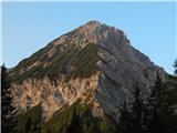 13
13
Discussion about the trail Iličev rovt / Illitsch Rauth - Koča Berta / Bertahütte (on footpath)