Hrušica - Rosenkogel/Hruški vrh (via Češnjevec and Hruška planina)
Starting point: Hrušica (610 m)
Name of path: via Češnjevec and Hruška planina
Time of walking: 3 h
Difficulty: easy unmarked way
Altitude difference: 1166 m
Altitude difference po putu: 1166 m
Map: Karavanke - osrednji del 1 : 50.000
Recommended equipment (summer):
Recommended equipment (winter): ice axe, crampons
Views: 2.727
 | 3 people like this post |
Access to the starting point:
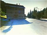
From the motorway Ljubljana - tunnel Karawanks, take the last exit Hrušica and turn right, back towards Jesenice. After 200 m drive, you will come to a crossroads, where you will turn left onto a road going uphill through a right-hand bend. At the top of the hill, you will again come to a crossroads, where you will also take the left direction. After a further 100 m, turn right onto a side road and follow it in a right direction to a large parking area in front of the Hrušica Community Centre.
Path description:
From the starting point, head east, past the KS building, and you will immediately come across the railway and the Karavanke railway tunnel. On the left side of the tunnel, behind the apartment building, find the path that leads above the railway tunnel and continue past the military bunker to the macadam road. Turn right and walk along this road for 200 m to the first houses on your left. Here you will see two paths leading off to the far left and take the higher one - logging trail, which leads into the woods, with a yellow sign next to it. The path (the wide, partly stony logging trail) climbs moderately to steeply and winds north-westwards. After a while, the first major crossroads is reached, where the left-hand logging trail is followed. When the path briefly dips, a wooden shed is encountered and the path climbs again through a predominantly beech forest. The steepness subsides for the second time, and the path leads us close to the gorge of the Dobršnik stream, where we can hear the sound of waterfalls. Shortly afterwards, the path briefly leads us out of the forest, past a sisle on the left and a hay field on the right. Immediately afterwards, you will come across an old brick building, which you pass on the right. A little higher up, the path once again approaches the gorge, and when it recedes a little, we come to another major crossroads. Here, take the left again, and continue through the beech forest, where the moderately ascending and occasionally sloping path to the left loses a little ground, but can be easily identified by its characteristic stone base. After a moderate ascent, the path then begins to turn right, and a little higher up, it ends at the road, at Rogar's Gully. Cross the road and take the cart track, which leads across the meadow, uphill to the north. This leads quickly into the forest, where it begins to climb moderately to steeply. When the path turns slightly right and splits, continue on the right, past the sluice gate, slightly steeper uphill. The path increasingly takes on the appearance of a well-maintained forest road. After a few bends, the steepness gradually begins to give way, and when the view opens up to the Rožec saddle on the right, and the Klek, the forest road finally gives way. After a short time, the path climbs again only slightly, and shortly afterwards we come across a barrier with a gate or a gate. Enter mountain pasture, where we first see Hruški vrh, and the path leads us through a few bends, after crossing a small stream and a final slight ascent, to the shepherd's hut on Hruški mountain pasture. On the wall, in front of the entrance to the hut, you will come across a registration box. Continue north-west from behind the hut, towards the larch-covered part of the southern slope of Hruški vrh. As you climb over the slightly marshy terrain towards the larch trees, you come across the remains of a path which continues to climb in the keys in a slightly leftwards direction, towards the ruined ridge of Črničje with a height of 1610 (name not on maps). Near the top of the valley between the slope of Hruški vrh and the ridge, the path, interrupted several times, turns left towards a pasture fence. Cross the latter and continue sharp right on a less visible path, steeply uphill (straight path towards mountain pasture Dovška Rožca). There follows approx. 15 min. of steep ascent on grassy terrain (danger of slipping when descending in wet conditions) on both sides of the pasture fence. When the steepness subsides and we have crossed the mountain path (Via Alpina), we arrive at the "Izidor's sign" at the top of Hruški vrh, from where we continue just a few metres to the right, to a bench with a stamp and a registration book.

Pictures:
 1
1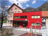 2
2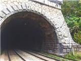 3
3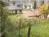 4
4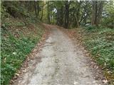 5
5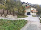 6
6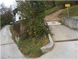 7
7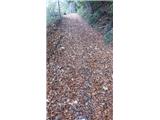 8
8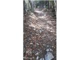 9
9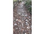 10
10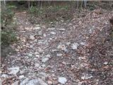 11
11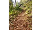 12
12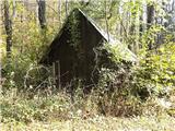 13
13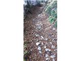 14
14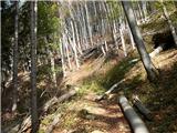 15
15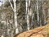 16
16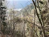 17
17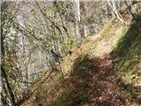 18
18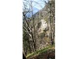 19
19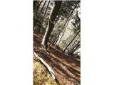 20
20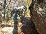 21
21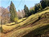 22
22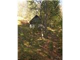 23
23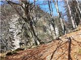 24
24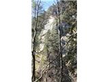 25
25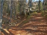 26
26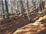 27
27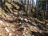 28
28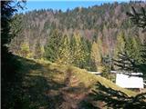 29
29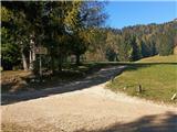 30
30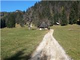 31
31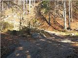 32
32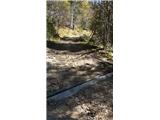 33
33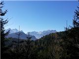 34
34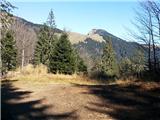 35
35 36
36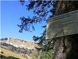 37
37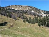 38
38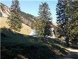 39
39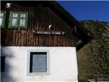 40
40 41
41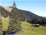 42
42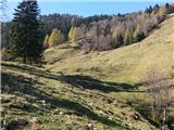 43
43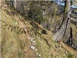 44
44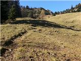 45
45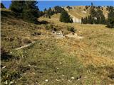 46
46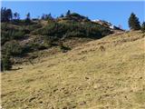 47
47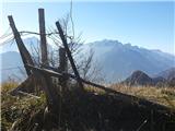 48
48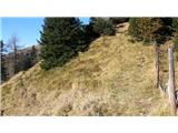 49
49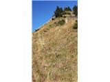 50
50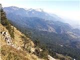 51
51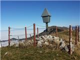 52
52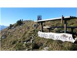 53
53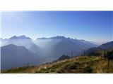 54
54
Discussion about the trail Hrušica - Rosenkogel/Hruški vrh (via Češnjevec and Hruška planina)
|
| Jusk3. 06. 2020 |
Na Hruški planini in višje na Rožci pa Hruškem vrhu polno raznega pisanega cvetja,tudi narcis je še nekaj na Rožci. To pot nisem prehodil čisto po tem opisu,ampak sem šel čez Rožco na vrh. Lepo,mirno,brez ljudi,vsaj danes je bilo tako 
|
|
|