Hotavlje - Koča na Ermanovcu (by road)
Starting point: Hotavlje (409 m)
| Lat/Lon: | 46,1072°N 14,1176°E |
| |
Name of path: by road
Time of walking: 2 h 10 min
Difficulty: easy marked way
Altitude difference: 559 m
Altitude difference po putu: 600 m
Map: Škofjeloško in Cerkljansko hribovje 1:50.000
Recommended equipment (summer):
Recommended equipment (winter):
Views: 5.024
 | 1 person likes this post |
Access to the starting point:
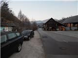
a) From Železniki, Kranj or Medvode, drive to Škofja Loka, and from there continue in the direction of Gorenje vasi in the Poljane valley and Žirem. After Gorenja vasja, in Hotavlje, leave the main road towards Žire at the junction after Gostilna Lipan and turn right towards the ski resort Cerkno and the village of Leskovica. Just after the junction, park in a suitable place on the roadside.
b) From Horjul or Polhovy Gradec, drive to Lučine and from there descend to Gorenjska vas. In Gorenjja vas, turn left towards Žire, then at Hotavlje, at the junction after Gostilna Lipan, turn right towards the ski resort Cerkno and the village of Leskovica. Just after the crossroads, park in a suitable place on the roadside.
c) From Vrhnika, Logatec or Spodnja Idrija, drive to Žiri, from there continue to Gorenjska vas and Škofja Loka, and follow the main road only to Hotavlje, where you turn left towards the ski resort Cerkno and the village of Leskovica. Just after the crossroads, park in a suitable place on the side of the road.
d) First drive to Cerkno and from there continue over the Kladje (Podlanišče) pass towards Sovodnje. From Sovodnje, drive along the Hobovščica stream, then turn left at a slightly larger junction towards Gorenje vas (right Žiri). Follow the main road towards Škofja Loka to Hotavlje, where you turn left towards the ski resort Cerkno and the village of Leskovica. Just after the crossroads, park in a suitable place on the roadside.
Path description:
From the starting point, where the vending machine of the farm pr Šupc is located nearby, continue along the road towards the village Leskovica and in the direction of the hiking trails to Blegoš, Ermanovec and Slajko. Walk along the roadside for a few minutes, partly on the pavement, and then the signs for Ermanovec and Slajka direct you to the left (straight ahead Blegoš), where you cross the bridge Kopačnica, and just after the bridge at the church of St. Lawrence, continue to the right and gradually begin to climb. At first, we climb past a few houses, then a marked footpath branches off to the left, and we continue along the road, which leads us past a water trough. Higher up, the settlement ends, and the road, which offers beautiful views, soon turns sharp left and gradually turns into the forest. Higher up, we cross the route of the marked trail, and we follow the steep road to a marked crossroads, where the road to Slajka branches off to the right, and we continue straight on towards Stara Oselica. The asphalt ends and we continue along the grassy valley to Hom Farm. At the farm, the road turns left, then makes a right serpentine and climbs cross-country to a crossroads where it joins the marked path leading past the Hom na Slajki.
Continue in the direction of Ermanovec and then walk for some time along the macadam road, which later becomes asphalt. There is some downhill with beautiful views, then from a small crossroads continue slightly right (slightly left you can go down to St. Paul's Church in Stara Oselica), and from the next crossroads go slightly left (slightly right Rotovž Farm).
There is an easy ascent and the path leads to a point where the marked path splits.
Continue on the slightly right path, which continues along the road (to the left the top of Ermanovec, but it is also possible to get to the Dom na Ermanovcu, but the path is slightly longer) and continue to climb crosswise. Higher up, continue slightly to the left, and at the hamlet of a few houses the road turns sharp right, and then, with beautiful views, leads us to a marked crossroads by the chapel and the bell.
Continue straight on in the direction of Dom na Ermanovcu (sharp left top of Ermanovcu, left road descending to Sovodnja) and continue walking along the gently sloping asphalt road, which a little further on is joined by the marked path from Sovodnja. From this crossroads, it is only a short walk of 10 steps to reach the Dom na Ermanovcu.
Description and pictures refer to the situation in January 2020.

Pictures:
 1
1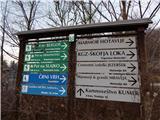 2
2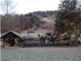 3
3 4
4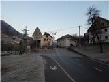 5
5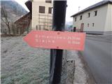 6
6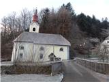 7
7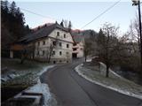 8
8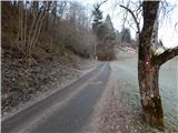 9
9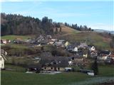 10
10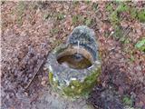 11
11 12
12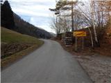 13
13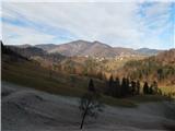 14
14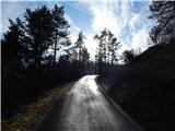 15
15 16
16 17
17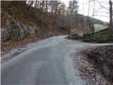 18
18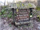 19
19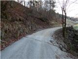 20
20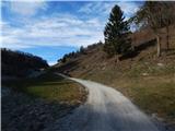 21
21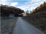 22
22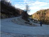 23
23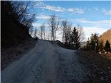 24
24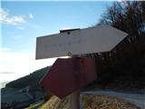 25
25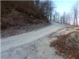 26
26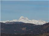 27
27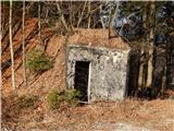 28
28 29
29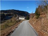 30
30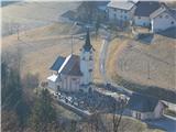 31
31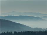 32
32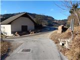 33
33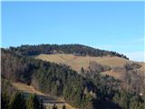 34
34 35
35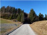 36
36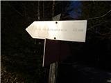 37
37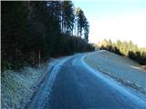 38
38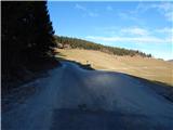 39
39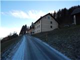 40
40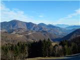 41
41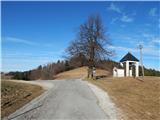 42
42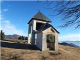 43
43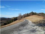 44
44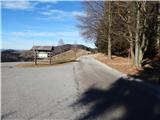 45
45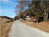 46
46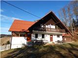 47
47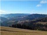 48
48
Discussion about the trail Hotavlje - Koča na Ermanovcu (by road)
|
| navigator7731. 03. 2018 |
Po mojem mnenju je opis poti preskop. Prvi del ni markiran!(od Hotavelj do Stare Osilnice). Naj vas tudi ne zavede markiran odcep (cca 15 minut od izhodišča), speljan desno v hrib, ki gre proti Slajki. Nadaljujte po asfaltirani cesti do razcepa, na katerem se usmerite proti Stari Osilnici (po prednostni cesti). Srečno!
|
|
|
|
| navigator7731. 03. 2018 |
pardon! en napaka zgoraj: mislil sem na Staro Oselico.
|
|
|