Heidi Alm - Schwarzkofel (ridge path)
Starting point: Heidi Alm (1872 m)
| Lat/Lon: | 46,8634°N 13,8313°E |
| |
Name of path: ridge path
Time of walking: 2 h
Difficulty: easy marked way
Altitude difference: 296 m
Altitude difference po putu: 475 m
Map:
Recommended equipment (summer):
Recommended equipment (winter): ice axe, crampons
Views: 3.232
 | 2 people like this post |
Access to the starting point:
a) Drive through the Karavanke Tunnel into Austria, then continue along the Tur Autobahn, leaving at the Beljaška bypass and continuing on to Feldkirchen. Continue along Lake Ossiach / Ossiacher See to the aforementioned town. In Feldkirchen, turn left towards the Turacher Höhe pass and continue past Himmelberg, Gnesau, Mitterdorf to Wiedweg, where the road from Bad Kleinkircheim joins from the left. From this junction we continue towards the Turacher Höhe pass for a few 100 m, and then the signs for mountain pasture Heidialm and the village and lake Falkertsee direct us to the left onto the ascending road. Follow this road to its end, where you park in one of several car parks.
b) From Styria or Carinthia, first drive to Dravograd and then via Border crossing Vič to Austria, following the signs for Klagenfurt / Klagenfurt. Continue on the so-called Southern Motorway, leaving at Klagenfurt (direction Feldkirchen). Continue along the regional road to reach the aforementioned town. In Feldkirchen, turn right towards the Turacher Höhe pass and continue past Himmelberg, Gnesau and Mitterdorf to Wiedweg, where the road from Bad Kleinkircheim joins from the left. From this junction we continue towards the Turacher Höhe pass for a few 100 m, and then the signs for mountain pasture Heidialm and the village and lake Falkertsee direct us to the left onto the ascending road. Follow this road to its end, where you park in one of several car parks.
Path description:
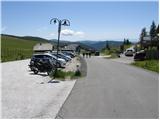
From the parking lot, head in the direction of Heidi-Alm Park, 130 metres away. After 130 m, the path to the park branches off to the left (there is an entrance fee to visit the park), and we continue straight ahead and continue along the road, which quickly leads us to the high mountain lake Falkertsee.
From the lake, which we pass on the left, the path starts to climb more moderately and continues along a road that gets worse and worse. A little higher, however, we arrive at a marked crossroads, where we continue to the left in the direction of the summit of Rodresnock (straight ahead, saddle Falkertscharte, Rodresnock and Falkert via the aforementioned saddle and the climbing route to Falkert). The way ahead, first crosses the gently sloping slopes to the left, and then passes to the steep slopes of Rodresnocka, where it begins to climb steeply. With fine views of Lake Falkertsee and the village of the same name, the path climbs a step higher, where it dips and turns right, quickly arriving at a scenic and unspoilt ridge. The ridge is wide and grassy on the left and steeply descending on the right towards cirque between Rodresnock and the summit of Falkert. The occasionally steeper ridge trail, which offers beautiful views that reach all the way to the Slovenian mountains, then flattens out and leads to a less well-marked crossroads where a marked but less well-trodden path branches off to the left downhill, leading to the nearby Schwarzkofel and onwards towards the valley.
Continue in the direction mentioned above (straight ahead Rodresnock for 5 minutes) and follow the path as it begins to descend steeply to the south-east. After a few minutes, the path lays down and leads to a wide grassy ridge, after which you continue the descent. A little lower still, we arrive at an undistinguished pass between Rodresnock and Schwarzkofl. From here onwards, we start to climb steeply, and we follow the scenic route all the way to the top of Shcwarzkofl, which we have been looking at for quite some time.

Pictures:
 1
1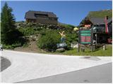 2
2 3
3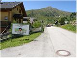 4
4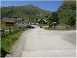 5
5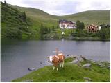 6
6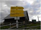 7
7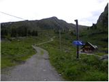 8
8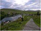 9
9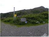 10
10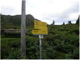 11
11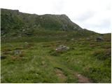 12
12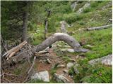 13
13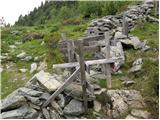 14
14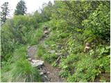 15
15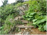 16
16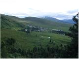 17
17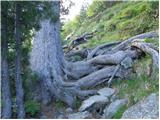 18
18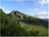 19
19 20
20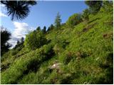 21
21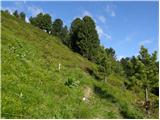 22
22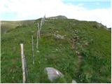 23
23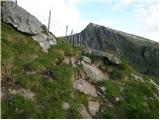 24
24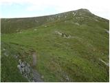 25
25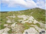 26
26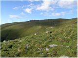 27
27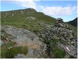 28
28 29
29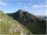 30
30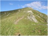 31
31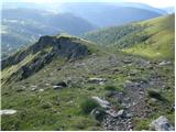 32
32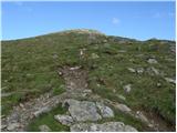 33
33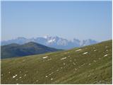 34
34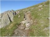 35
35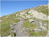 36
36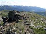 37
37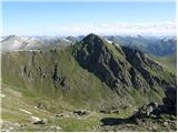 38
38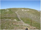 39
39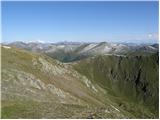 40
40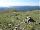 41
41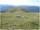 42
42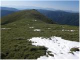 43
43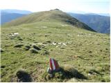 44
44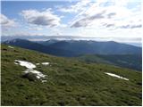 45
45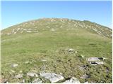 46
46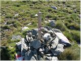 47
47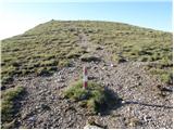 48
48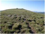 49
49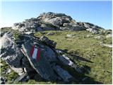 50
50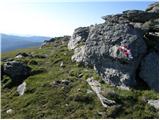 51
51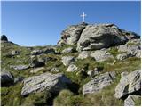 52
52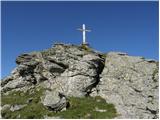 53
53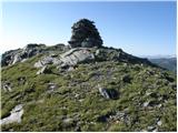 54
54 55
55
Discussion about the trail Heidi Alm - Schwarzkofel (ridge path)