Grahovše - Planina Spodnja Konjščica (mimo Pavšlna)
Starting point: Grahovše (800 m)
| Lat/Lon: | 46,3664°N 14,3518°E |
| |
Name of path: mimo Pavšlna
Time of walking: 1 h 45 min
Difficulty: easy marked way
Altitude difference: 651 m
Altitude difference po putu: 651 m
Map: Karavanke - osrednji del 1:50.000
Recommended equipment (summer):
Recommended equipment (winter):
Views: 10.417
 | 2 people like this post |
Access to the starting point:
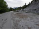
From the motorway Ljubljana - Jesenice take the exit Ljubelj (Tržič), then just before the petrol station at Bistrica pri Tržiču, turn right into Tržič. Continue through Tržič in the direction of Dolžanove soteska, then just before the end of the town, turn right up towards the villages of Čadovlje, Lom and Grahovše. Follow the signs for Dom pod Storžičem up the ascending road at the junctions, and we follow it to the large marked parking lot by the quarry in Grahovše.
Path description:
From the parking lot, continue along the road along which you parked and after a few steps you will come to two crossroads. At the first crossroads, continue straight ahead (there is a village on the right across the bridge) and at the second crossroads you will come to a set of mountain signs. Here, turn left onto the upper path marked Javornik, Stegovnik and Bela peč.
The road starts to climb moderately here and leads us through meadows with views. The road then leads to the next crossroads, where you go left again (Rekar farm on the right). The road then crosses private land where there is wood and soon afterwards comes to the next crossroads. Take the road to the left and follow it to where the marked path to mountain pasture Lower Konjščica branches off to the right.
The way forward goes into the forest, climbs steeply and after a good 20 minutes of further walking leads us to the road. Once on the road, a marked path branches off to the left to the viewpoint "na Bošt" (5 minutes), and we continue right along the road, which after a short climb leads us out of the forest to the vast mountain pasture Lower Konjščica, where two small shepherd's huts stand.

Pictures:
 1
1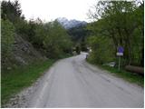 2
2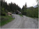 3
3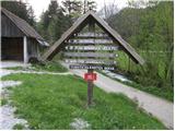 4
4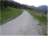 5
5 6
6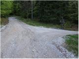 7
7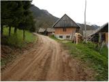 8
8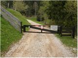 9
9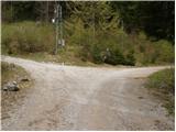 10
10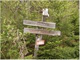 11
11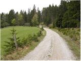 12
12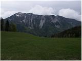 13
13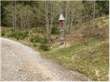 14
14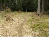 15
15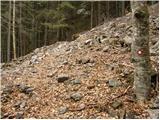 16
16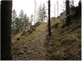 17
17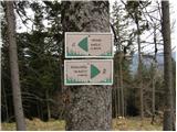 18
18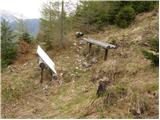 19
19 20
20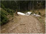 21
21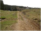 22
22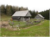 23
23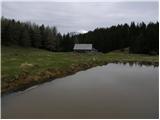 24
24
Discussion about the trail Grahovše - Planina Spodnja Konjščica (mimo Pavšlna)
|
| Guest30. 04. 2007 |
Takale hoja pretežno po cesti zame ni posebno privlačna. Na Konjščico grem rajši iz druge smeri - peljem se precej visoko do kmetije Tič v Potarjah, potem pa grem peš po lepih pašnikih in gozdovih naprej do Spodnje, Zgornje Konjščice in Bele peči. Priporočam!
|
|
|
|
| velkavrh31. 08. 2013 |
Bil tu pred leti, ko je še tu pasel moj brat s kolegom. Z avtom sem se pripeljal pod planino, ker sem mu pripeljal robo.Sedaj baje pase znan kranjski amaterski slikar-Valenčič.Imamo njegovo sliko.Takrat sem šel še naprej do Bele peči, kjer je skrinjica za vpise. Tu je tista znana plezalna stena tržiških alpinistov.
|
|
|
|
| kurirček31. 08. 2013 |
Lep tuta je iz Grahovš na Konšico, Belo Peč, planino Javornik, Ženiklovec in dom pod Storžičem pa po senožetih v Grahovše.
|
|
|