Gößgraben - Gießener Hütte
Starting point: Gößgraben (1600 m)
| Lat/Lon: | 46,9804°N 13,3351°E |
| |
Time of walking: 1 h 30 min
Difficulty: easy marked way
Altitude difference: 615 m
Altitude difference po putu: 615 m
Map:
Recommended equipment (summer):
Recommended equipment (winter):
Views: 886
 | 2 people like this post |
Access to the starting point:
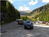
From the Karavanke Tunnel, follow the motorway towards Salzburg to the Gmünd exit. Then follow the signs for the Maltatal valley. Follow the road through the valley to Koschach. When you see the Fallbach waterfall (the highest waterfall in Carinthia) on your right, you will soon come to a crossroads where you turn left over a bridge that crosses the river Malta. Shortly afterwards, turn left again along the narrow road steeply up into the Gossgraben valley (signs for hut Gießener Hütte). Follow the road all the way to the large parking lot below the Goskarspeicher dam. The last few kilometres of the road are only open in the summer months when hut Gießener Hütte is open (from the beginning of July to the end of September).
Path description:
From the parking lot, continue along the asphalted road, which is closed to traffic. After a few minutes of climbing, you will come to a crossroads where you turn right onto a dirt road, where you will be directed by a sign with the inscription "Gießener Hütte". To the left, there is only a short climb to the Gößkarspeicher lake.
At the crossroads, you also enter National Park High Tauern (Nationalpark Hohe Tauern). The road climbs steadily and the views towards the Reißeck mountain group start to get better and better. On the ascent, we also pass pasture fences a few times, as cattle also graze along the road in the summer months. You can continue walking along the road or take the marked shortcuts. The forest is getting thinner and thinner and in the last part of the way towards the hut you walk along rocky terrain. Here you will also have a beautiful view of the Hochalmspitze and the many streams that flow down the hillside. Continue along the road and you will soon reach the Gießener Hütte.

We can extend the trip to the following destinations: Hochalmspitze
Pictures:
 1
1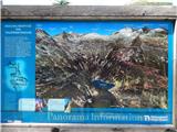 2
2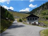 3
3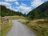 4
4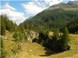 5
5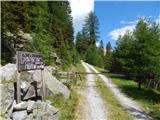 6
6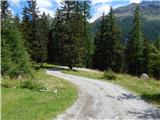 7
7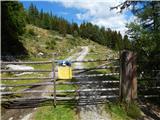 8
8 9
9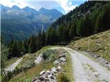 10
10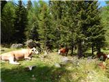 11
11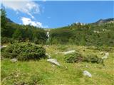 12
12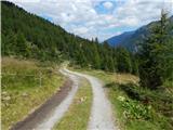 13
13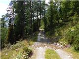 14
14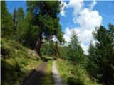 15
15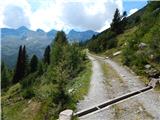 16
16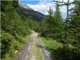 17
17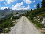 18
18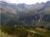 19
19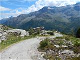 20
20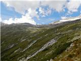 21
21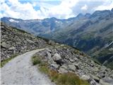 22
22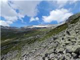 23
23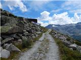 24
24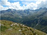 25
25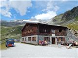 26
26
Discussion about the trail Gößgraben - Gießener Hütte