Göriach - Hochgolling (Normalanstieg)
Starting point: Göriach (1443 m)
| Lat/Lon: | 47,2408°N 13,7453°E |
| |
Name of path: Normalanstieg
Time of walking: 4 h
Difficulty: difficult marked way
Altitude difference: 1420 m
Altitude difference po putu: 1430 m
Map:
Recommended equipment (summer): helmet
Recommended equipment (winter): helmet, ice axe, crampons
Views: 8.233
 | 1 person likes this post |
Access to the starting point:
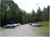
From the motorway Villach-Salzburg take the St. Michael exit (the exit is located between the two major tunnels) and follow the road towards St. Martin, Mariapharr and Göriach. Follow the ascending road through these villages to the parking lot located a few kilometres above the village of Göriach, where you park in a large parking lot.
Path description:
From the parking lot, continue along the road, which leads you to a large meadow in the middle of which you can see a large number of wooden houses within a 5-minute walk. One of the cottages is a mountain lodge, located on the right side of the path.
The way forward gradually begins to climb and leads us across two successive bridges to the point, from where we have a beautiful view of the waterfall. Behind the waterfall, the deteriorating road climbs a notch higher and, after half an hour's walk from the starting point, leads us to the hamlet of privat huts. The path continues along the road, and the numerous streams lead us to a crossroads, where we turn right to follow the Hochgolling signs. The trail continues along the road and leads to the Landawirsee Hütte. From the crossroads, the path then crosses a stream and begins to climb steeply. When you approach the stream again, the steepness subsides and you can see the Gollingscharte notch. The path towards the notch runs over rocky terrain and in early summer you will climb over some relatively large snowfields on this part of the route. At the notch (2326m), turn right towards Hochgolling, and follow the straight path towards the Golling Hütte hut. The path then crosses the north-west slopes above the notch in a gentle ascent and leads to the south-west slopes of the mountain. The path then turns slightly to the left and, after a few steep ascents, leads to a crossroads. Take the easier route to the right (Normalanstieg, Historischer Weg) and the left route (up to climbing level 2), which leads along the north-west ridge, also to the summit of Hochgolling. The route then crosses quite steep slopes to the south-east and climbs steeply a few times (up to climbing level 1). In early summer you will also cross a short steep snowfield on the way. Towards the end, the trail turns slightly left again and there is a slightly steeper climb towards the viewpoint.

Pictures:
 1
1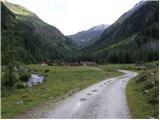 2
2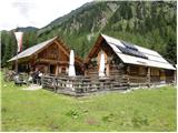 3
3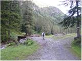 4
4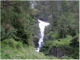 5
5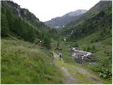 6
6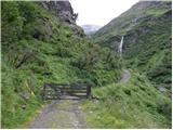 7
7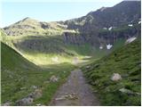 8
8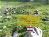 9
9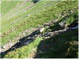 10
10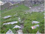 11
11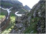 12
12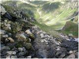 13
13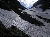 14
14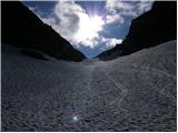 15
15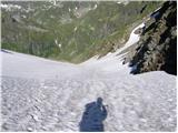 16
16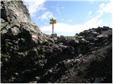 17
17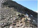 18
18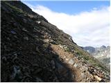 19
19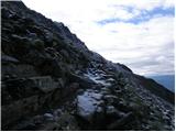 20
20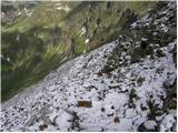 21
21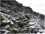 22
22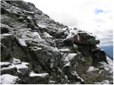 23
23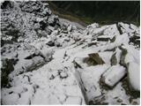 24
24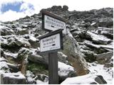 25
25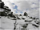 26
26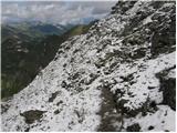 27
27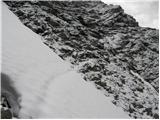 28
28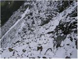 29
29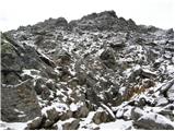 30
30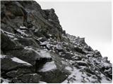 31
31
Discussion about the trail Göriach - Hochgolling (Normalanstieg)
|
| Nickster22. 07. 2008 |
En metr nižji od triglava 
|
|
|
|
| VanSims9. 08. 2012 |
Če malo dopolnim pomanjkljiv opis dostopa:
Na izvozu St. Michael gremo iz AC in skozi St.Michael do križišča kjer gremo levo proti Mauterndorfu(desno Katschberg prelaz).
Ali pa če hočemo prišparati tunelnino za tunel Katschberg, že pri Rennwegu iz AC in čez prelaz Katschberg in ko pridemo iz prelaza gremo na istem križišču naravnost(levo St.Michael in AC).
V vsakem primeru se potem pripeljemo v Mauterndorf, kjer sledimo smerokazom za Tamsweg. Peljemo se proti Tamswegu in NE zavijemo v vas Mariapharr temveč malo po njej zagledamo smerokaz za Göriach, ki mu sledimo. Nato smerokazom sledimo vse do Göriacha(eventuelno se lahko peljemo tudi do Tamswega, kjer je trgovina, pumpa, če imamo še kaj za nakupiti, pojesti,... tudi iz Tamswega s sledenjem smerokazov pridemo v Göriach).
Ko smo enkrat v Göriachu se znajdemo na križišču. Gremo naravnost in pridemo do drugega križišča kjer zavijemo levo(tam že vidimo smerokaz za Landawiser hütte). Potem peljemo naravnost in kmalu se cesta spremeni v makadam, ki postaja vedno bolj zoprn in ga je vsega skupaj cca 6 km dokler ne pridemo do parkirišča iz prve slike.
Če ne bi poznal tistih krajev okoli St. Michaela, ker se peljem pogostokrat mimo tunelov, ko grem v tisto smer po turski AC in če ne bi v Göriachu spraševal se ne bi znajdel.
|
|
|
|
| Robie9. 09. 2023 21:09:40 |
Lepa a zelo obljudena tura. Čelada več kot priporočljiva.
|
|
|