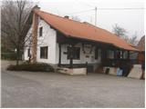
Starting point: GEOSS (645 m)
| Lat/Lon: | 46,1203°N 14,8157°E |
| |
Time of walking: 1 h
Difficulty: easy marked way
Altitude difference: 235 m
Altitude difference po putu: 235 m
Map: Ljubljana - okolica 1:50.000
Recommended equipment (summer):
Recommended equipment (winter):
Views: 10.231
 | 2 people like this post |
Access to the starting point:
From Litija, drive to Ljubljana or vice versa. When you reach the village of Spodnji Hotič, head towards the village of Vače. Follow the road towards GEOSS, where you can park in a marked parking lot just 100m in front of GEOSS.
From the motorway Ljubljana - Celje take the exit Krtina and Moravče. Follow the road towards Moravče and then towards Zagorje. In the village Kandrše turn right in the direction of Vače and Slivna. Follow this road towards the signs for GEOSS, where you park 100m in front of GEOSS.
Path description:
From the parking lot, continue along the road towards GEOSS. In a few dozen steps you will reach GEOSS, behind which you will see mountain signs. Here we turn right in the direction of Slivna (the inscription for Slivna is on a tree, not on a mountain sign). The path then immediately climbs steeply and leads us in a few minutes to the road, which we follow only a few steps. The markings direct us to the footpath again, and we see a sign indicating that we are entering a rabies area. Continue along the path, which emerges from the forest after 20 minutes. Here, the path takes us past a chapel at which the path turns sharp left. After a few more steps, we reach the road, where we can already see the Slivna home.
Here we continue to the right along the road, which descends only slightly but only to the point where the markings direct us to the left to cart track. Follow this cart track to a fork in the path where the path to the top of Slivna (Pivkelj) branches off upwards to the left. The path, which climbs steeply here, leads us in five minutes of ascent through the forest to a vegetated peak.

Pictures:
 1
1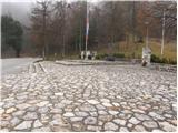 2
2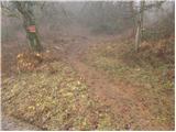 3
3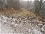 4
4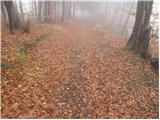 5
5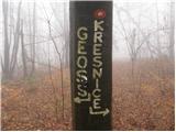 6
6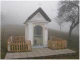 7
7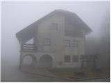 8
8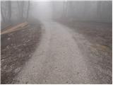 9
9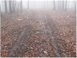 10
10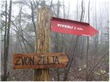 11
11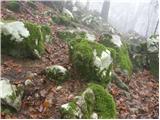 12
12 13
13
Discussion about the trail GEOSS - Slivna (Pivkelj)