Gaber pri Semiču - Semenič
Starting point: Gaber pri Semiču (415 m)
| Lat/Lon: | 45,645°N 15,1572°E |
| |
Time of walking: 30 min
Difficulty: easy marked way
Altitude difference: 175 m
Altitude difference po putu: 185 m
Map: Dolenjska - Gorjanci in Kočevski rog 1:50.000
Recommended equipment (summer):
Recommended equipment (winter):
Views: 2.674
 | 1 person likes this post |
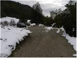
Access to the starting point:
a) From the Ljubljana - Brežice motorway, take the Ivančna Gorica exit, then continue driving towards Črnomelj. After Črmošnjice, the road climbs for a short time and then begins to descend steeply. At the end of the long right turn, where you will see the sign "Welcome to Bela krajina" on the retaining wall, turn left and then immediately right. Park about 50 metres ahead in a suitable space above the mountain direction signs.
b) From the Brežice - Ljubljana motorway, take the Novo mesto exit, then continue in the direction of Dolenjske Toplice and Podturno near Dolenjske Toplice. In Podturno, join the main road Ivančna Gorica - Črnomelj, and follow it to the left in the direction of Črnomelj. After Črmošnjice, the road climbs for a short time and then starts to descend more steeply. At the end of a long right turn, where you will see a sign on a retaining wall saying "Welcome to Bela krajina", turn left and then immediately right. Park about 50 metres ahead in a suitable space above the mountain direction signs.
c) From Bela krajina, first drive to Semič, then continue to Črmošnjice and Soteska. Before reaching the left turn with the sign "Hello in Bela krajina", leave the main road at Gaber near Semič and turn right and immediately right again onto the Smuška cesta. Park about 50 metres further on in a suitable space above the mountain direction signs.
Path description:
From the starting point, walk to the mountain signposts and from there continue along the Smuška cesta in the direction of Smuka. At first, walk along the asphalt road, which quickly leads to a few houses. Here the road descends slightly and leads to signposts behind the Church of St Primož, which direct us slightly to the left onto a footpath that continues through the forest. After a short climb, you will come to cart track, which you follow to the right to the nearby church of St Primož and Felicijan.
From the church, continue in the direction of Semenič and Smuka, following the path which continues through the forest and is further marked with the letter S, which is located in a white circle. The path continues to climb gently to moderately and, after about 20 minutes of further walking, leads to the wooded Semenič.
Pictures:
 1
1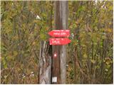 2
2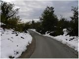 3
3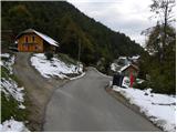 4
4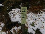 5
5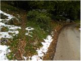 6
6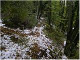 7
7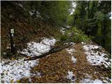 8
8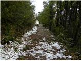 9
9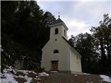 10
10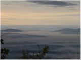 11
11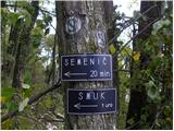 12
12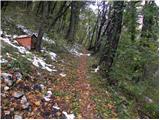 13
13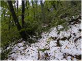 14
14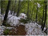 15
15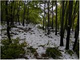 16
16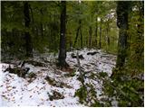 17
17
Discussion about the trail Gaber pri Semiču - Semenič
|
| 75'er6. 05. 2013 |
A mi lahko kdo pove če je možen dostop z gorskim kolesom, oziroma če je kje možno varno pustiti kolo, brez skrbi da bo kaj narobe?
|
|
|
|
| rjudnic6. 05. 2013 |
Kolesa nimaš tam kje pustit, ker ni blizu nobene gostilne ali česa podobnega, lahko ga prikleneš za kako drevo, samo ne vem če je to glih varno. Glede na to, da je pot dokaj položna in poteka po stezi, ne boš imel problema z dostopom do vrha.
|
|
|