Zadnja Trenta (Flori) - Veliki Ozebnik (via Jalovška škrbina)
Starting point: Zadnja Trenta (Flori) (900 m)
| Lat/Lon: | 46,4043°N 13,7098°E |
| |
Name of path: via Jalovška škrbina
Time of walking: 5 h 30 min
Difficulty: difficult pathless terrain
Altitude difference: 1580 m
Altitude difference po putu: 1580 m
Map: TNP 1:50.000
Recommended equipment (summer): helmet, self belay set
Recommended equipment (winter): helmet, self belay set, ice axe, crampons
Views: 5.403
 | 2 people like this post |
Access to the starting point:
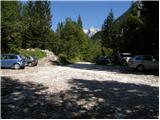
From Kranjska Gora, drive over the Vršič pass towards Bovec or vice versa, but only as far as the 49th serpentine of the vršiška road (near the village of Trenta). Here, take a side road in the direction of the source of the Soča River. After a short climb, the road quickly leads us to a parking area in front of a hut at the source of the Soča River, but we continue to the left over a bridge and follow the road to a parking area at the end of the road (at the parking area, we see the mountain signs for Bavški Grintavec, the waterfalls of the Suhega potok and Jalovec).
Path description:
From the parking lot, take the path to the right in the direction of the shelter under Špičko and Jalovec. The path, which soon enters the forest, begins to climb steeply up the relatively steep slopes above Zadnja Trenta. After an hour and a half of walking, the mostly monotonous path leads us to a crossroads, where we continue to the right in the direction of Jalovec and Malega kota (to the left, shelter under Špičko and Jalovec past the shelter). The path continues through the forest, but higher up leads us to the next crossroads, where the path from Vršič joins us from the right. Continue straight up towards Jalovec (shelter under Špičko on the left). The path, which continues to climb relatively steeply, soon leads us out of the forest to increasingly scenic slopes. The path, which mostly climbs on steep slopes, then transitions to a rockier world higher up, where we also arrive at a crossroads. Continue left (straight ahead Jalovška škrbina and Tamar) along the path which crosses the slopes below Jalovška škrbina towards the rocky slopes of Goličica. The relatively easy path is then stopped by the Goličica wall. Before entering the climbing part of the route, a sign informs us that we will continue the climb on a very difficult route. The route continues on a gentle ascent, crossing steep and exposed slopes, before turning right and starting to climb the wall almost straight up. During the ascent of the Goličica wall, we are helped only by a few measured fixed safety gear. Higher up, the steepness eases, and the path leads to a scree slope on and along which we then climb. The increasingly scenic route then leads us to a place where we have a view through the Jalovški ozebnik into the Tamar valley. Continue along a slightly less steep path over the slopes called Jezerca. There is a short descent and the path leads to a crossroads where you continue left towards the shelter under Špičko (right Jalovec). The path continues to climb gently on a partly grassy slope. After a few minutes of easy walking, the path leads us to a place where we leave the marked path leading towards the shelter under Špičko (the marked path leaves just a few metres before the jeklenico and the ravine, which is exposed to falling stones).
Continue to the right and ascend the pathless world of the southern slopes of Veliki Ozebnik. After 20 minutes of easy climbing, which does not exceed level 1, you reach the top of Veliki Ozebnik. Orientation is difficult in the last part and there is a high risk of falling rocks.

Pictures:
 1
1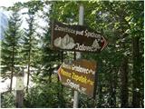 2
2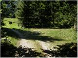 3
3 4
4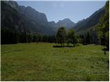 5
5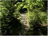 6
6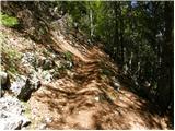 7
7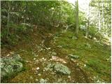 8
8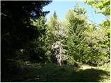 9
9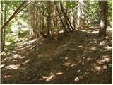 10
10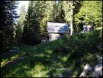 11
11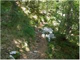 12
12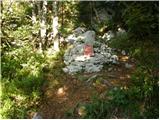 13
13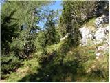 14
14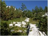 15
15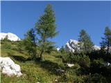 16
16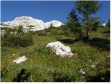 17
17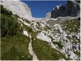 18
18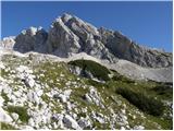 19
19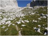 20
20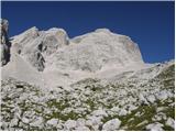 21
21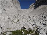 22
22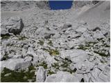 23
23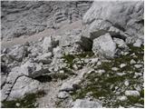 24
24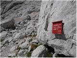 25
25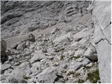 26
26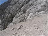 27
27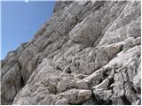 28
28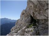 29
29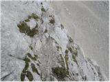 30
30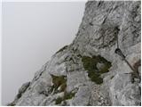 31
31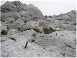 32
32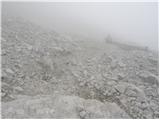 33
33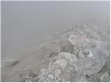 34
34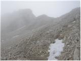 35
35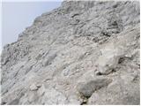 36
36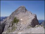 37
37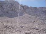 38
38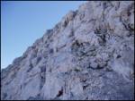 39
39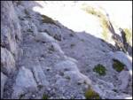 40
40 41
41
Discussion about the trail Zadnja Trenta (Flori) - Veliki Ozebnik (via Jalovška škrbina)