End of road on Pokljuka - Begunjski vrh
Starting point: End of road on Pokljuka (1340 m)
| Lat/Lon: | 46,3386°N 13,9045°E |
| |
Time of walking: 6 h 30 min
Difficulty: difficult marked way
Altitude difference: 1121 m
Altitude difference po putu: 1330 m
Map: Triglav 1:25.000
Recommended equipment (summer): helmet
Recommended equipment (winter): helmet, ice axe, crampons
Views: 6.449
 | 1 person likes this post |
Access to the starting point:
a) Leave the Gorenjska motorway at the exit for Lesce, then follow the signs for Bled and Pokljuka. Continue through Gorje and past the ski resort Zatrnik to Rudni Polje on Pokljuka, where there is a large pay parking lot and a military barracks and shooting range nearby. From here, continue straight along the macadam road, which leads us a little further to a crossroads, where we continue to the right (Uskovnica on the left). Follow this road to the former parking lot Za Ribnico, which is at the end of the road (there are mountain signs for mountain pasture Konjščico).
After the new parking at the end of the road is forbidden, so we park already at Rudne polje, which lengthens the route by about 40 minutes, but it is more convenient to choose the marked trail, which starts already at Rudne polje.
b) From Železniki or Podbrdo, take the road to Bohinjska Bistrica and then continue in the direction of Bled. Shortly after the Petrol station, which is located just after Bohinjska Bistrica, turn left in the direction of Pokljuka and Jereka. The road climbs steeply at first, then gradually flattens out behind Koriti, leading to a junction by the bus station, where you continue right in the direction of Pokljuka, Koprivnik and Jereka (straight ahead Srednja vas). Just after the crossroads we arrive at Jereka, and from the crossroads in front of the church we continue straight on towards Pokljuka (left Podjelje). After Jereka the road starts to climb steeply again, and higher up it levels off and continues along the Mrzle potok. When you join the road from Bled, go left and drive to Rudno Polje, where there is a large pay parking lot, and also a military barracks and a shooting range nearby. From here, continue straight along the macadam road, which leads us a little further to a crossroads, where we continue to the right (Uskovnica on the left). Follow this road to the former parking lot Za Ribnico, which is at the end of the road (there are mountain signs for mountain pasture Konjščico).
After the new parking at the end of the road is forbidden, so we park already at Rudne polje, which lengthens the route by about 40 minutes, but it is more convenient to choose the marked trail, which starts already at Rudne polje.
Path description:
From the former parking lot, continue right up cart track towards mountain pasture Konjščica. Cart track, which climbs steeply at first, soon becomes steep and turns into a footpath a little higher up. A moderate ascent follows, following the path which climbs along the Ribnica stream, which has a waterfall in its upper part, which can be seen from the path. Further on, the path crosses a small spring and passes into the mountain pasture Konjščica grazing area. After a few dozen steps, the path crosses another small spring and ascends gently to the cheese-maker's hut at mountain pasture.
From mountain pasture, continue up the gently sloping meadow slightly to the other side of mountain pasture. There the path becomes dwarf pines and starts to climb, first gently and then steeply. In the last part of the ascent, the path from Rudno Polje joins from the right. There is only a short climb along the torrent to the grassy plain of Jezerce. Here the path turns left and after a few steps leads us into the narrower area of the TNP. Next, we climb along a small spring towards Studorski Preval. A little higher, cross the torrent and the path turns slightly right into the grassy slopes surrounded by dwarf pines. The path then ascends crosswise to Studorski preval, from which a fine view of the Bohinj side opens up.
The path continues, initially descending slightly, then crossing the slopes of Veliki Draški vrh and Tosc with some slight ascents and descents. After a while the path leads us to the grassy southern slope of Tosc. Here, the path to Tosc branches off to the right, and just a few metres further on, the path from Uskovnica joins us from the left. Continue straight ahead, still crossing the slopes of Tosc. The path then crosses a short lane of sparse forest in a slight descent and then leads us to steep slopes. A little further on, the path crosses the precipitous slopes of Tosc on an artificially made wide ledge in a gentle descent. As the path is quite wide it does not cause any problems (caution due to falling rocks, rock fall in 2008). The path then climbs slightly again and leads us to a crossroads where we continue to the right in the direction of Vodnikov's home. There is a further walk of about ten minutes without any major ascents or descents to Vodnik's home. From home, continue straight on in the direction Triglav (right up Bohinjska vratca). The path climbs moderately and crosses the slopes below Vernar. Soon we come across the first steel cable, which helps us to overcome a short ledge. The way forward climbs on scree and then leads us to a steep rock jump. A well-protected path leads us up steep steps to the top of this jump. There are a few metres of scrambling up a steep slope before the path leads to the open areas near Konjski preval. This is reached after a short descent.
From Konjski preval we continue in the direction of Kredarica and Staničev dom (left Mountain pasture, right Krma), and we follow the wide path towards Kredarica for a few steps, then the inscription on the rock Staničev dom directs us slightly to the right on a well-traced but less well-trodden path. The path continues with a few short ascents and descents, crossing the slopes to the right, crossing a few ravines which may still be under snow in early summer. The path then crosses lane of dwarf pines, and then crosses a grassy slope over which it ascends. The path then lays down and crosses the path leading from Krma via Kalvarija to Kredarica just a little further on.
Continue in the direction of Stanič's home (inscription on a rock) and continue the ascent along a moderately steep path, which becomes increasingly closer to the scree below Ržja. After a pleasant path over the Ržke Pods, you arrive at the aforementioned scree, over which you start to climb crosswise. When you reach the other side of the scree, the path turns slightly to the left and starts to climb steeply on the broken rocks. The steepness quickly gives way and after a few minutes of further walking the path joins the path leading from Krma.
Continue in the direction of Stanič's home and after a few minutes of moderate ascent, you will reach an undistinguished ridge where the marked path to Rjavina branches off to the right. Continue straight ahead and follow the trail, which begins to descend moderately, with views of Triglav, Begunjski vrh, Visoka Vrbanova špica, to Dom Valentina Staniča, which is reached after about 10 minutes of descent.
From home, continue in the direction of Begunjski vrh, Visoka Vrbanova špica and Cmira. After a few minutes of walking, the rather difficult path leads to the Begunjski Preval, where the path to Vrbanove špice branches off to the right. Continue straight on the path, which soon splits into two parts. Here, turn left in the direction Begunjski vrh (the path leads straight on to Cmir) along a path that climbs crossways over rocky slopes. The path then turns slightly right and climbs steeply along the top ridge of Begunjski vrh. Follow this increasingly scenic path to the summit.

Pictures:
 1
1 2
2 3
3 4
4 5
5 6
6 7
7 8
8 9
9 10
10 11
11 12
12 13
13 14
14 15
15 16
16 17
17 18
18 19
19 20
20 21
21 22
22 23
23 24
24 25
25 26
26 27
27 28
28 29
29 30
30 31
31 32
32 33
33 34
34 35
35 36
36 37
37 38
38 39
39 40
40 41
41 42
42 43
43 44
44 45
45 46
46 47
47 48
48 49
49 50
50 51
51 52
52 53
53 54
54 55
55 56
56 57
57 58
58 59
59 60
60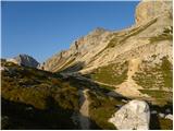 61
61 62
62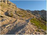 63
63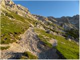 64
64 65
65 66
66 67
67 68
68 69
69 70
70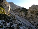 71
71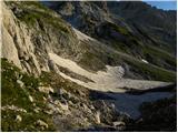 72
72 73
73 74
74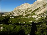 75
75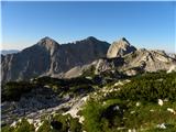 76
76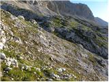 77
77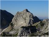 78
78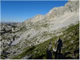 79
79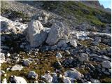 80
80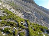 81
81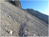 82
82 83
83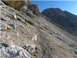 84
84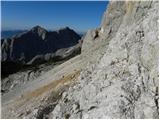 85
85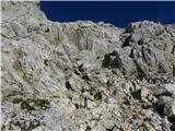 86
86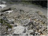 87
87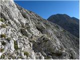 88
88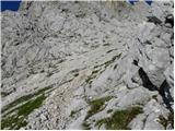 89
89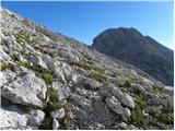 90
90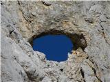 91
91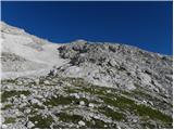 92
92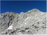 93
93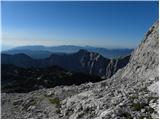 94
94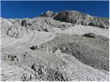 95
95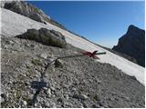 96
96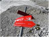 97
97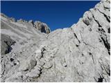 98
98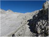 99
99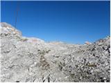 100
100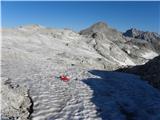 101
101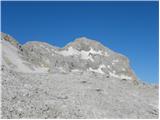 102
102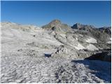 103
103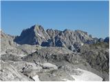 104
104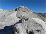 105
105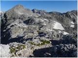 106
106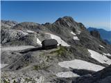 107
107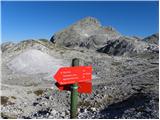 108
108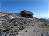 109
109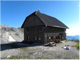 110
110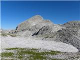 111
111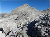 112
112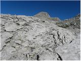 113
113 114
114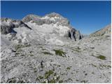 115
115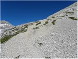 116
116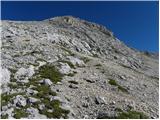 117
117 118
118 119
119 120
120 121
121 122
122 123
123 124
124 125
125
Discussion about the trail End of road on Pokljuka - Begunjski vrh