Dule - Grmada on Mala gora
Starting point: Dule (550 m)
| Lat/Lon: | 45,8405°N 14,6755°E |
| |
Time of walking: 2 h
Difficulty: easy marked way
Altitude difference: 337 m
Altitude difference po putu: 400 m
Map:
Recommended equipment (summer):
Recommended equipment (winter):
Views: 5.117
 | 2 people like this post |
Access to the starting point:
a) From Ljubljana, drive to Kočevje or vice versa. Just a kilometre after (from Kočevje before) Velike Lašče you will reach a crossroads where you turn left towards the village of Zgornje Retje (from Kočevje to the right). The road then leads over a narrow overpass over the railway line to a crossroads where you continue left (right Zgornje Retje). Just a little further on you reach the next crossroads where you continue right up a dirt road. Follow this road for about 3 km to a junction where you will see the signs for Kamen vrh. Park in one of the roadside car parks near the junction.
b) From the Ljubljana - Novo Mesto motorway, take exit Grosuplje (from the Ljubljana direction you can also take exit Cikava) and then continue towards the centre of Grosuplje. From Grosuplje, drive towards Veliko Mlačevo, Mala and Velika Račna and Vidmo. From Veliko Mlačevo, turn right (straight ahead to Lobček and Luče), then continue towards Videm, and we follow the road to Zdenska vas, where we first turn right towards Videm, and then right again a few 10 metres further towards Rašica. The road then leads through part of the settlement of Cesta and continues along the railway line to the settlement of Predstruge, where at the crossroads at the end of the settlement we continue straight on (left Videm, right Rašica) on what was at first still an asphalt road, which later becomes a macadam road and begins to climb through the forest. When you reach a slightly larger crossroads, where you see a sign for Kamen vrh, park in a suitable place at the crossroads.
Path description:
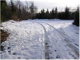
From the crossroads, do not continue along the road in the direction of Kamen vrh, but return along the road for a few metres to the marked mountain path leading from Ponikev towards Kamen vrh (if you came from Predstruge, continue along the road on the right). The marked footpath goes immediately into the forest and climbs only gently at first. The trail, which is sometimes a bit harder to follow, joins the cart track higher up, which continues the ascent. Cart track, which gradually starts to climb steeper, turns into a footpath at a higher level, which in a few minutes of further walking ascends to Kamen vrh, and from there in a few 10 steps descends to the mountain hut.
From the mountain hut, continue along a less good macadam road, which begins to descend slightly. Follow the road for only a few 10 metres, and then a signpost for Grmada directs you left onto a footpath. After a few steps of further walking, you arrive at a less marked crossroads, where you continue to the right (slightly to the left Podgora).
The path, which continues to descend slightly, soon leads to a forest road, which you follow to a nearby crossroads. From the crossroads, continue along the right-hand road and follow it to where a signpost directs you left into the dense forest. Continue climbing along the path, which leads you higher up to a grassy slope with a view. The path, which is less visible and sometimes very poorly marked, then turns slightly further to the right, where you reach a large meadow. In the middle of the meadow, the marked path turns left into the forest (access to Grmada is also possible via the cart track, which leads straight ahead), after which, in a few minutes of slightly steeper walking, you will climb to the top of Grmada.
The whole route, and especially the part from Kamen vrh to Grmada, is difficult in terms of orientation.

Pictures:
 1
1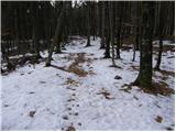 2
2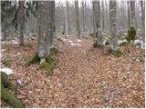 3
3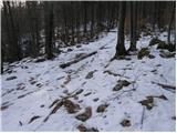 4
4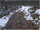 5
5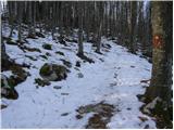 6
6 7
7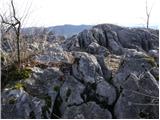 8
8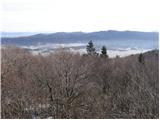 9
9 10
10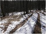 11
11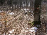 12
12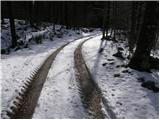 13
13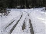 14
14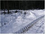 15
15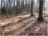 16
16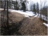 17
17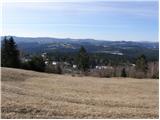 18
18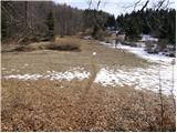 19
19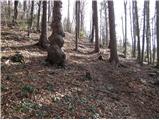 20
20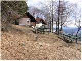 21
21 22
22
Discussion about the trail Dule - Grmada on Mala gora
|
| gustavs18. 04. 2017 |
14.4.2017 sem pretekel zgoraj opisano pot kot del teka Grosuplje - Ponikve - Kamen vrh - Grmada - Stene Sv. Ane - Ribnica.
Bojazen da bi se izgubil, je bila povsem odvec, saj je pot v vecjem delu zelo dobro in vidno markirana. Moja izkusnja je torej za smer iz Grosuplja proti Ribnici, kako je v obratno smer ne morem potrditi.
Imel sem le 3 orientacijske tezave:
1. Od Ponikev naprej je na travniku razpotje makedamskih poti kjer ni povsem jasno katera je prava (prava je sredinska, torej enostavno gremo naravnost).
2. Po travniku tik pred vzponom na Grmado (kot je opisano zgoraj "slabše vidna in občasno zelo slabo markirana pot") sem izgubil sled za markacijami in sledil makedamski poti proti jugu-vzhodu namesto da bi se usmeril na ustreno pot proti vzhodu. Zato sem prisel do vasi Vrh pri Poljanah ki lezi malo pod Grmado.
3. Po spustu z Grmade sem spregledal markacije proti stenam Sv. Ane in sledil markacijam za Ortnek. Ker sem napako videl na zemljevidu (mobilni telefon) sem po prihodu na asfaltirano cesto šel malenkost proti severu in nato po makedamski poti proti vzhodu.
Vendar v vseh primerih tezave z orientacijo pripisujem sebi (zaradi teka zmanjšana pozornost na okolico). V pohodnem tempu bi markacije verjetno videl.
|
|
|