Dravograd (Meža) - Skala (above Dravograd)
Starting point: Dravograd (Meža) (363 m)
| Lat/Lon: | 46,5853°N 15,0264°E |
| |
Time of walking: 25 min
Difficulty: easy marked way
Altitude difference: 162 m
Altitude difference po putu: 162 m
Map: Koroška 1:50.000
Recommended equipment (summer):
Recommended equipment (winter): ice axe, crampons
Views: 1.740
 | 1 person likes this post |
Access to the starting point:
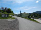
a) From Slovenj Gradec or Raven na Koroškem, take the Dravograd, then before crossing the Drava River, continue to the right (take the first right turn). Cross the railway line, and then you will be at the beginning of the described route at the Agricultural and Forestry Cooperative Society of Koroška (Kmetijsko gozdarski zadruga Koroška). There are no parking places for hikers at the starting point.
b) From Maribor, take the Dravograd, where you continue left towards Slovenj Gradec and Ravenna na Koroškem. After the bridge over the river Drava, take the second street on the left. Cross the railway line, and then you will be at the beginning of the described route at the Agricultural and Forestry Cooperative Society of Koroška. There are no parking places for hikers at the starting point.
Path description:
On the other side of the railway line, turn right and then left before the Agricultural Forestry Cooperative Koroška onto the ascending asphalt road. Continue on the asphalt road to a serpentine on the near right, from where you continue straight ahead in the direction of the marked trail (there are some parking possibilities near the crossroads). Follow the dirt road uphill to a nearby house, after which the road turns into a cart track, after which you continue climbing through the woods. Climb cart track for a few minutes and then reach the area affected by the windstorm. Here, take the cart track to the right onto a well-maintained path which, with fine views, climbs over a slope that is slowly becoming overgrown. The well-maintained path makes a few serpentines, then climbs crosswise to the Skala lookout point, where there is a registration box and from where a fine view opens up in the direction of Dravograd.
Description and pictures refer to the situation in 2019 (May).

Pictures:
 1
1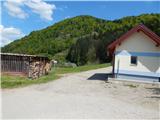 2
2 3
3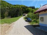 4
4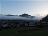 5
5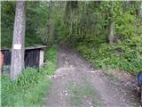 6
6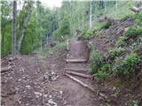 7
7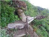 8
8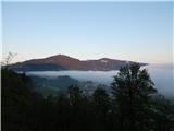 9
9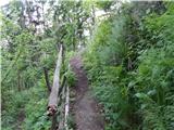 10
10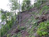 11
11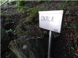 12
12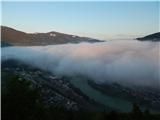 13
13
Discussion about the trail Dravograd (Meža) - Skala (above Dravograd)