Starting point: Dovje (760 m)
| Lat/Lon: | 46,4688°N 13,9602°E |
| |
Time of walking: 1 h 5 min
Difficulty: easy marked way
Altitude difference: 365 m
Altitude difference po putu: 365 m
Map: Kranjska Gora 1:30.000
Recommended equipment (summer):
Recommended equipment (winter): ice axe, crampons
Views: 1.040
 | 2 people like this post |
Access to the starting point:
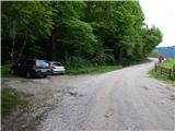
a) Leave the Gorenjska motorway at exit Jesenice West (Hrušica), then continue in the direction of Kranjska Gora. Follow the main road towards Kranjska Gora to the first road turnoff towards Dovjem, and follow the signs for Dovško Baba through the village. After crossing the stream Mlinca, where the MHP (small hydroelectric power plant) is located, park at a suitable place along the road, where there are also mountain direction signs.
b) First drive to Kranjska Gora, then continue to Jesenice. Leave the main road to Jesenice when the signs for Dovje direct you to the left, and follow the signs for Dovško Baba through the village. After crossing the stream Mlinca, where the MHP (small hydroelectric power plant) is located, park at a suitable place along the road, where there are also mountain direction signs.
Path description:
From the starting point, continue left in the route Frauenkogel, where you first cross a small stream and then climb through the forest. Quickly reach cart track, which leads you along the edge of the hayfield, and through lane of the forest to reach a more recent cottage. After the cottage, go left to climb over a short grassy slope, which, looking back, gives a fine view of Julian Alps, after which the path climbs steeply through the forest. At a higher level, cross an older fence, after which you reach the mountain pasture of Goreljše, where the path first turns left upwards, then right, and climbs, with wonderful views, to a newer, as yet unfinished hut, situated on the upper edge of the aforementioned mountain pasture.
Description and pictures refer to the situation as of May 2020.
Pictures:
 1
1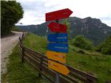 2
2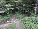 3
3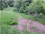 4
4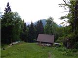 5
5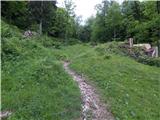 6
6 7
7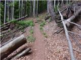 8
8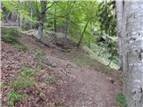 9
9 10
10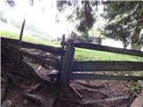 11
11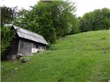 12
12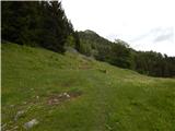 13
13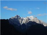 14
14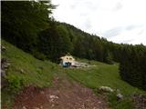 15
15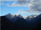 16
16
Discussion about the trail Dovje - Planina Goreljše