Dom Planinka - Mariborska koča (via the Fram waterfall)
Starting point: Dom Planinka (890 m)
| Lat/Lon: | 46,4935°N 15,568°E |
| |
Name of path: via the Fram waterfall
Time of walking: 1 h
Difficulty: easy marked way
Altitude difference: 196 m
Altitude difference po putu: 250 m
Map: Pohorje 1:50.000
Recommended equipment (summer):
Recommended equipment (winter):
Views: 23.780
 | 1 person likes this post |
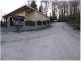
Access to the starting point:
From the four-lane road between Maribor and Slivnica, turn right at the semaphoreised junction in the direction of the village of Hoče (from the direction of Slivnica, turn left). Follow the road through Spodnje and Zgornje Hoče towards Slivnica Pohorje. In the upper part of the village Slivniško Pohorje, the road to the Planinka house turns sharp right uphill. After 100m, this road leads to a crossroads at the Prepihu bar. Turn right here towards Planinka and park in the parking lot by the road. Only guests are allowed to park in the parking lot in front of Planinka and the Prepih bar.
Path description:
From the parking lot, return to the crossroads and continue past the bar at Prepih to the next crossroads, where the signs for Mariborska koča direct you to the road on the left. After a few minutes' walk, the road ends and the route continues along cart track, which goes into a dense spruce forest. There is a 15-minute walk along the pleasant cart track, at the end of which you come out on a tarmac road. Continue right in the direction of the waterfall to a crossroads, where signs for the Skalca waterfall direct you left, onto a footpath that begins to descend. After 5 minutes of descending, the path leads to Framski slap waterfall (Skalca waterfall).
From the waterfall, we return to the crossroads and continue along the road towards Maribor hut. Soon, however, the markings direct us to the left to a meadow where there are several paths. Lok carefully where the markings are and after a short climb across the meadow you will come to the forest where the path climbs steeply for a short time and then leads you to Maribor hut in a few minutes.

Pictures:
 1
1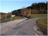 2
2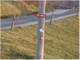 3
3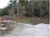 4
4 5
5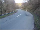 6
6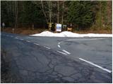 7
7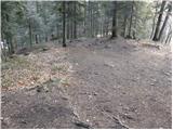 8
8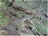 9
9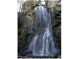 10
10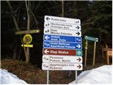 11
11 12
12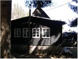 13
13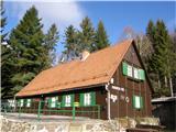 14
14
Discussion about the trail Dom Planinka - Mariborska koča (via the Fram waterfall)
|
| balon8. 06. 2014 |
Zanima me, če je kdo že šel po poti: Dom Planinka-Mariborska koča-Ruška koča in nazaj, ter koliko časa se hodi. Hvala in lep pozdravček, Balončki 
|
|
|
|
| pohodnik388. 06. 2014 |
Od Mariborske koče pa do Ruške koče na Arehu je cca 2 uri odvisno pač kakšen je tempo hoje.
|
|
|
|
| balon1. 07. 2014 |
Hvala za podatek. Balončki
|
|
|
|
| anazala20. 06. 2017 |
Zdravo. a, kdo lahko da informacijo kje točno se začne jutrišnji pohod OD VZHODA DO VZHODA. če se pripeljem iz Krškega za Celje in kje potem zavijem pri Mariboru, da pridem do točke START. Saj vem, da ne tekmujemo, pa vseeno, tja kjer bo začetek.
|
|
|