Dom Planincev v Logarski dolini - Koča na Klemenči jami
Starting point: Dom Planincev v Logarski dolini (837 m)
| Lat/Lon: | 46,3836°N 14,6216°E |
| |
Time of walking: 1 h 5 min
Difficulty: partly demanding marked way
Altitude difference: 371 m
Altitude difference po putu: 371 m
Map: Kamniške in Savinjkse Alpe 1:50.000
Recommended equipment (summer):
Recommended equipment (winter): ice axe, crampons
Views: 40.346
 | 1 person likes this post |
Access to the starting point:
a) Via the Volovljek Pass (Kranjski Rak) or from Mozirje, drive to Luce, and from there continue towards the Logar Valley. A few kilometres after Solčava, you will reach a crossroads where you turn left towards Logarska dolina (toll). Continue along Logarska dolina, and we will drive to Dom planincev v Logarska dolina. Park in the parking lot on the left side of the road. The parking lot on the right side is for the guests of the Planincev Dom Planincev.
b) Via Border crossing Jezerski vrh (Jezerski vrh) drive into Austria, and there in the Bela Valley / Vellach turn right in the direction of Border crossing Pavličev vrh (Pavličevo sedlo) / Paulitchsattel. When you reach the Slovenian side, first descend to the valley, then turn right at the junction a little before Solčava towards the Logar valley (toll). Continue along the Logar valley, and we drive to the Home of the Mountaineers in the Logar valley. Park in the parking lot on the left side of the road. The parking lot on the right side is for the guests of the Planincev Dom Planincev.
c) We drive to Črna na Koroškem (to get here from Raven na Koroškem or from Šoštanj via the Spodnje Sleme pass) and then continue driving to Luče. Initially still an asphalt road, higher up it becomes macadam and leads to a crossroads of several roads at Spodnje Sleme Pass. Continue along the main road, which begins to descend crosswise towards the settlement of Podolševa. At the crossroads below, take a sharp left (Solčava Panorama Road on the right - you can also reach the starting point by this road, in which case join the road over the Pavličev Vrh Pass) in the direction of Solčava. When you reach Solčava, continue right at the junction where you join the main road. A few kilometres after Solčava you will come to a crossroads where you turn left in the direction of the Logarska dolina (toll). Continue along the Logarska dolina, and we will drive to the Home of the Mountaineers in the Logarska dolina. Park in the parking lot on the left side of the road. The parking lot on the right side is for the guests of the Planincev Dom Planincev.
Path description:
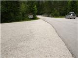
From the parking lot, continue along the main road, which leads us over the bridge, and after the bridge, signs for Klemenča Cave direct us left to the forest road, which we continue along the path, which leads us in a few minutes to the crossroads, where we continue to the right in the direction of Klemenča Cave. From the crossroads, walk along the road for only a short time, as you then continue left along the initially wide and gently sloping mountain path. Only a few steps further on, the path passes onto a slope and gradually starts to climb steeper and steeper. The steep path continues up the steep slope, then crosses a torrential ravine and, a little further on, a small stream. After the stream, the path becomes even steeper and climbs up a very steep slope, which is particularly dangerous for slipping in wet conditions. After less than an hour's walk from the starting point, you reach a bench by a small well and just a little further on to a crossroads, where you join the trail from the starting point at the crossroads.
Here the steepness eases, and we continue slightly up the wide path, which soon leads us out of the forest. From here it is just a short climb up a grassy slope to Koča na Klemenči jami below Ojstrica.
From the hut you can continue to the thickest larch tree in Slovenia. To reach it, turn left from the hut into the forest and follow the signs for the larch tree. The larch tree can be reached in less than 10 minutes on foot.

Pictures:
 1
1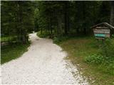 2
2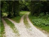 3
3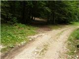 4
4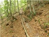 5
5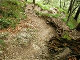 6
6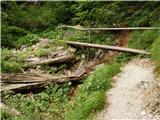 7
7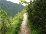 8
8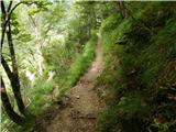 9
9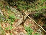 10
10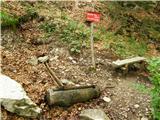 11
11 12
12 13
13 14
14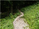 15
15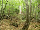 16
16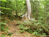 17
17
Discussion about the trail Dom Planincev v Logarski dolini - Koča na Klemenči jami
|
| grdksmrt11. 08. 2012 |
To je zelo lahka pot, ki traja slabo uro. Razgled izpred koče pa je čudovit. Pohvalil pa bi tudi oskrbnika in njegovo lepo zbirko domačih rož, ki jim ponuja zavetje.
|
|
|
|
| slavkovoda6. 07. 2014 |
Res je precej lahka pot, predvsem kratka, se je pa malo le treba "pretegnit". Primerna za družinski izlet. Na vrhu čudovit pogled na bližnje vršace, prijeten klepet z oskrbnikom, ki ima pravo zalogo prav posebnih "šnopčkov".
|
|
|
|
| aditaker8. 08. 2021 09:03:23 |
Vprasal bi zakaj je potemtakem zgoraj v opisu pod zahtevnost napisano da je ta pot delno zahtevna oznacena pot, sprasujem zato ce je primerna za take kot sem sam za vrtoglave oziroma ki imamo strah pred izpostavljenimi prepadnimi deli ali kjer so kake zajle, na slikah tega ni za opazit??
|
|
|
|
| garmont8. 08. 2021 10:24:15 |
Pot je označena kot delno zahtevna, zaradi strmine, kjer je predvsem v mokrem možnost zdrsa. Ni pa to neka prepadna pot, tako, da kar pogumno. 
|
|
|
|
| pikica924. 09. 2022 08:58:59 |
Od koče smo šli na Strelovec in je pot lepa vendar na mestu kjer je lestev potrebna popravila razpada. Lepa pot čudoviti razgledi. Pozneje smo šli od koče čez Plesnikovo planino in se spuščali do hotela Plesnik, je pot zaraščena in strma je boljše iti po cesti
|
|
|
|
| goretz4. 04. 2023 13:41:04 |
Živjo,
kakšna je situacija glede snega? Je pot do koče kopna?
Lp
|
|
|