Dom na Mirni gori - Mirna gora (all thousanders in Bela krajina)
Starting point: Dom na Mirni gori (1000 m)
Name of path: all thousanders in Bela krajina
Time of walking: 10 h
Difficulty: easy unmarked way
Altitude difference: 47 m
Altitude difference po putu: 1300 m
Map: kočevska
Recommended equipment (summer):
Recommended equipment (winter):
Views: 3.010
 | 1 person likes this post |
Access to the starting point:
Forest road Vrčice Home on Mirna Gora. Approx. 10 km.
Path description:
Bela krajina is a hilly landscape in south-eastern Slovenia, sandwiched between the Žumberačka gora and the forests of the Kočevje Roga. On its border, in the direction of Kočevje, there are also several hills, 8 of which exceed 1000 m in height. And these are the only Belokranj thousanders that were our target. The role of the Kočevje Roga is known to many from the NOB period, but the history of the Kočevje region before the Second World War, when "Kočevarians" lived in the area for 600 years, is even less so. The life of the inhabitants of the Kočevje region, who have preserved their customs and German language for 600 years, is well described in Rosa Mohar's book "They Lived Here". In short, when you walk through the forests, which are full of the remains of villages that were abandoned in 1941 and the remnants of the war, you have the feeling that you are entering a sacred space where you are accompanied at every step by trees, especially the enormous trees that grow in the Kopa primeval forest.
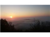
Our journey on Saturday morning started at the Mirna gora Mountain Home, from where it is only a few minutes' walk to the top of Mirna gora, which, at 1047 m, is considered by many to be the highest hill in the White Carpathian region. In reality, it is only ranked 4th. Its first neighbour, Kovače hill, 20 minutes away, is already higher than it with a height of 1051 m. We continue southwards and soon cross the road in the direction of Ponikev and there we come across the markings of the Shepherd's Path around Mirna Gora. Next to the markings of the Shepherd's Path are the markings of the Partisan Hospitals Path, which we follow in the direction of the Kremen Hospital, from which we continue in the direction of the Dr. Mihelčič Hospital. Cross again one of the countless forest paths and orientate yourself in the direction of Lochpichl or Golobinjek, which is 1036 m high. In front of the hill we can see the remains of the Kočevar Church of St. Ulrich in Starološko Hill. Right below us is the large forest clearing Golobinjek where there are the remains of an old village. To the left we can see in the direction of Brezovica and Kočevje. We continue walking towards Kroglinšek, which is 1052 m high. From it, we can see the peaks we have already passed and all the next destinations, while in the distance Trdinov vrh, which is the highest but does not belong to the White Landscape, rises above them all. From Kroglinšek we walk westwards and start to climb towards Kopa, which at 1077 m is the highest peak in the White Landscape. Kopa is a protected primeval forest where nature takes its course in an eternal cycle of birth and death without human help. The entire ridge of Kroglinšek, Kopa runs westwards and ends behind Kopa on an unnamed peak with a height of 1025 m. Here we start our way back towards Mirna Gora, descending into the valley on the right. A good orientation is the ski resort TC Gače, which we can see on our left. Walking over the dirt and scree, we come to the huge forest clearing of Ponikve, where we see the remains of a former village, German name, Sporeben (flowering meadow). At the beginning of the war, the village had 8 houses, the Church of the Holy Trinity and a steam sawmill. Today we can only see the remains, which are overgrown by forest, but are beautifully marked by the restored water intake of the village. We leave Ponikve past the remains of the sawmill and climb to Vinica, which at 1020 is one of the closest neighbours of Mirna Gora. The summit is Thanks to the Tempoo association from Semič, all the peaks with names are marked with a plaque. And so our historical hiking circuit of all the Belokranjska Thousand Hills was completed in 7 hours and 24 km. Orientation in autumn is not difficult, but the Kočevsko map is useful. And of course a warning. You are in a carnivore area, as there are bears, wolves and lynxes, and of course many more friendly animals.

Pictures:
 1
1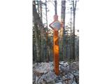 2
2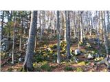 3
3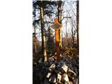 4
4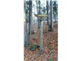 5
5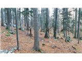 6
6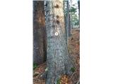 7
7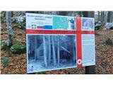 8
8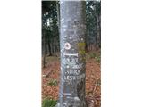 9
9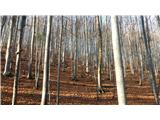 10
10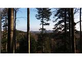 11
11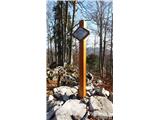 12
12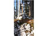 13
13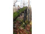 14
14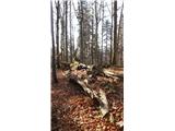 15
15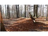 16
16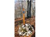 17
17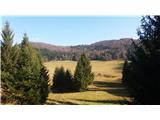 18
18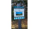 19
19 20
20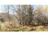 21
21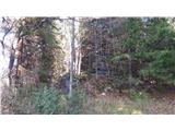 22
22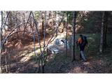 23
23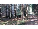 24
24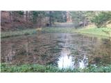 25
25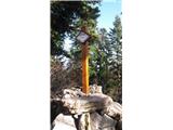 26
26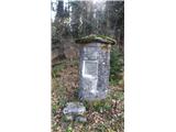 27
27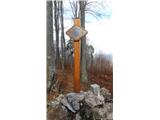 28
28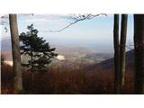 29
29
Discussion about the trail Dom na Mirni gori - Mirna gora (all thousanders in Bela krajina)