Dobrovnik - Bukovniško jezero
Starting point: Dobrovnik (175 m)
| Lat/Lon: | 46,6559°N 16,3409°E |
| |
Time of walking: 20 min
Difficulty: easy marked way
Altitude difference: 14 m
Altitude difference po putu: 14 m
Map:
Recommended equipment (summer):
Recommended equipment (winter):
Views: 5.334
 | 1 person likes this post |
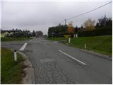
Access to the starting point:
a) Take the Pomurska motorway towards Lendava, leaving at the Gančani exit. From the point where you leave the motorway, follow the road in the direction of Moravske Toplice. After a few kilometres of further driving, we reach a slightly larger junction in Bogojina, where we turn right in the direction of Dobrovnik (left Moravske Toplice, straight Plečnik's church to Bogojina). We follow the main road for a few more kilometres and then arrive in Dobrovnik (Dobronak in Hungarian), where we see signs for Bukovniško jezero. There are no suitable parking places at the starting point (if you want to park in a suitable place, take the asphalt road towards Bukovniško jezero and then park in the pay parking lot near the lake - this reduces the walk to the lake to just 5 minutes).
b) First drive to Lendava, then continue along the old regional road to Murska Sobota, and we drive along Murska Sobota to Dobrovnik, where the signs for Bukovniško jezero direct us to the right. There are no suitable parking places at the starting point (if you want to park in a suitable place, take the asphalt road towards Bukovniško jezero and then park in the pay parking lot near the lake - this cuts the walk to the lake to just 5 minutes).
Path description:
From the crossroads in Dobrovnik, follow the local road towards Bukovnik Lake. The road initially leads us between meadows and fields, then past a few houses takes us to the edge of the forest, where it begins to climb barely noticeably. The road then leads past a parking lot, after which you quickly reach the embankment in front of Lake Bukovnik. From here, you can follow a well-maintained path up to the embankment, and from there you can continue on a circular path around the lake, which will take you a good 20 minutes for the full circuit.
Pictures:
 1
1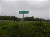 2
2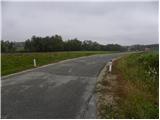 3
3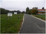 4
4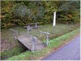 5
5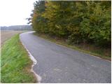 6
6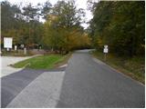 7
7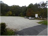 8
8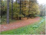 9
9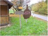 10
10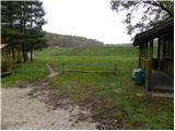 11
11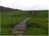 12
12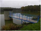 13
13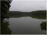 14
14
Discussion about the trail Dobrovnik - Bukovniško jezero