Črni Kal - Blegoš (by road, via hut)
Starting point: Črni Kal (1103 m)
| Lat/Lon: | 46,1724°N 14,1243°E |
| |
Name of path: by road, via hut
Time of walking: 1 h 30 min
Difficulty: easy marked way
Altitude difference: 459 m
Altitude difference po putu: 459 m
Map: Škofjeloško in Cerkljansko hribovje 1:50.000
Recommended equipment (summer):
Recommended equipment (winter): ice axe, crampons
Views: 159.624
 | 6 people like this post |
Access to the starting point:
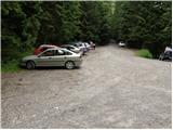
a) First drive to Škofja Loka, then continue driving towards Gorenjska vas. Before arriving in Gorenjska vas, turn right at the traffic lights into Poljane above Škofja Loka, then follow the signs for Javorje. The ascending road takes you higher into the village, then follow the signs for Blegoš at the next crossroads. Continue along a narrower, but still asphalted road. After Gorenja Žetina, the asphalt ends, and it is only a few minutes of cross-country climbing before you reach Črnega kalo, where there is a large parking lot and the junction of several roads.
b) From Žiri, Sovodnja or Horjul, drive to Gorenjska vas, then continue to Škofja Loka. Just after Gorenjska vasja, at the semaphore crossroads, turn left into Poljane above Škofja Loka, then follow the signs for Javorje. The ascending road leads us higher into the village, then at the next crossroads follow the signs for Blegoš. Continue along a narrower, but still asphalted road. After Gorenja Žetina, the asphalt ends, and it is only a few minutes of cross-country climbing before you reach Črnega kalo, where there is a large parking lot and the junction of several roads.
c) From Železniki, drive towards Podbrdo, then turn left towards Davča before Zali Log. At a crossroads a few 100 metres away, at the confluence of the Davča and Muštrva grapa, take the road on the left, which leads you higher up through the hamlet of Potok, and after it, before crossing Matevžkovo grapa, take a sharp left onto the road, which leads you across to the parking lot at Črnji kal.
d) From Petrovy Brdo or Sorice, descend to Podrošto, then continue towards Železniki. After Zali Log, turn right towards Davča. At a crossroads a few 100 metres away, at the confluence of the Davča and Muštrova grapa, take the road on the left, which leads you higher up through the hamlet of Potok, and after this, before crossing Matevžkovo grapa, take a sharp left onto the road, which leads you across to the parking lot at Črnji kal.
Path description:
From the parking lot, turn onto the road, above which is a sign saying "from here on, walk". Just by the sign, the markers for Blegoš direct us to the right onto a wide footpath, which ascends in a few steps to a forest road. Follow the road to the right, and we walk along it for some time. After about half an hour, we leave the road and continue our ascent along the marked footpath in the direction of Hut na Blegošu. The path soon approaches the road and then turns slightly to the left, where it starts to climb steeply. Higher up, the path from the village of Potok joins us from the right, and we continue straight on along the path, which lays down a little, and then leads us over a pasture fence to the Cottage on Blegoš in a few minutes of further walking.
From the hut we continue along the gently sloping path, which crosses a scenic grassy slope behind which the path goes into a short lane of a forest and climbs steeply. After a few minutes of walking, the steepness eases and the path leads us out of the forest and onto the top slopes of the Blegoš. This increasingly scenic route is then followed to the top of Blegoš.

Pictures:
 1
1 2
2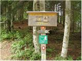 3
3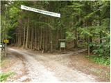 4
4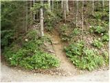 5
5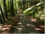 6
6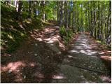 7
7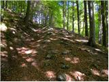 8
8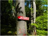 9
9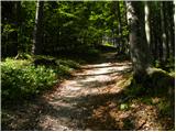 10
10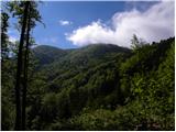 11
11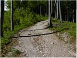 12
12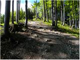 13
13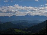 14
14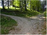 15
15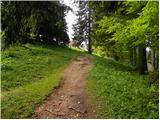 16
16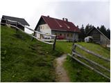 17
17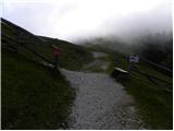 18
18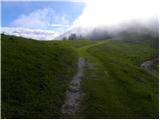 19
19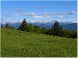 20
20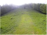 21
21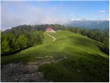 22
22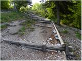 23
23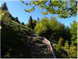 24
24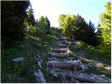 25
25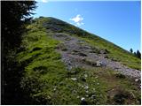 26
26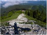 27
27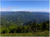 28
28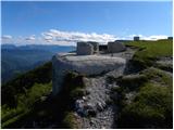 29
29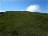 30
30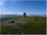 31
31 32
32
Discussion about the trail Črni Kal - Blegoš (by road, via hut)
|
| mt18. 10. 2006 |
MT-Šel sem v nasprotni smeri in sicer od lovske koče Č.K. po široki cesti in nato desno po gozdni cesti proti vrhu. Iz vrha sem se spustil nazaj proti lovski koči s postankom v koči na Blegošu.Čudovit nenaporen jesenski izlet z prelepimi razgledi. Zanimivo je videti tudi bunkerje t.i. Rupnikove obrambne linije.
|
|
|
|
| Damijan13. 05. 2007 |
Čudovit izlet, večino poti hodiš po široki cesti, od koče pa je samo kakšnih 10-15minut pot travi do vrha. Lep razgled, se splača!
|
|
|
|
| Lucy9. 04. 2011 |
Tudi jaz sem bila na Blegošu in lahko vam povem da je to krasen izlet.Lahko se gre po cesti ali pa navkreber.Gre za sprehajalno planinsko pot ki se zlagoma vzpenja zato je primerna za vse.Koča je lepa in ima lepo lokacijo.Ob vikendih je zelo dobro obiskana sam pogled z vrha pa je fantastičen.
|
|
|
|
| Holcar214. 03. 2013 |
Kolk je oz. bo (zapadlo) snega na Blegošu?
A ga je zadost za krple oz. smuči?
|
|
|
|
| isantl22. 04. 2015 |
Pozdravljeni,mene pa zanima,če se da priti iz Prtovč na Ratitovec in iz Ratitovca na Blegoš in potem nazaj po isti poti in kako dolga je ta pot časovno.Lp
|
|
|
|
| serznoz23. 04. 2015 |
Prtovč je glavno izhodišče za Ratitovec. Do vrha okrog uro in pol. Hriba loči Selška dolina na višini okrog 400 m, tako da krožna pot ni smiselna. Je pa smiselno dolino prečiti z avtomobilom. Potem je oba hriba možno osvojiti v enem dnevu, če si primerno hiter in se zapelješ primerno visoko pod Blegoš. Poglej zemljevid, ti bo vse jasno.
|
|
|
|
| nusa23. 04. 2015 |
Pred leti sem štartala iz Črnega Kala na Blegoš, nadaljevala na Porezen,spustila v Petrovo Brdo, dvignila na Soriško planino, od tam pa na Ratitovec in do Prtovča.To je okrog 1o-12 ur hoje.
|
|
|
|
| sirt123. 04. 2015 |
Najkrajša varianta:
Zali log 522m->Ratitovec 1667m->Zali log 522m->Blegoš 1562m-<Zali log 522m!
|
|
|