Ciganija - Uršlja gora (Plešivec)
Starting point: Ciganija (1115 m)
| Lat/Lon: | 46,4532°N 14,9571°E |
| |
Time of walking: 2 h 15 min
Difficulty: easy marked way
Altitude difference: 584 m
Altitude difference po putu: 685 m
Map: Kamniške in Savinjske Alpe 1:50.000
Recommended equipment (summer):
Recommended equipment (winter): ice axe, crampons
Views: 18.876
 | 3 people like this post |
Access to the starting point:
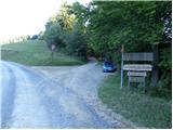
a) First drive to Šoštanj (to get here from Velenje or Savinja Valley), then continue driving to Črna na Koroškem. The road then starts to climb towards the Spodnje Sleme Pass (1081 m), which is reached after a few kilometres of winding road. Here, the road to Andrejev dom na Slemenu branches off to the left, and we continue towards Črna na Koroškem. From the pass we drive on for another 100 metres, then the signs for Uršlja gora direct us right onto the ascending road, which loses its asphalt coating just a little higher up. Continue on the wider macadam road (the road is usually ploughed and gritted in winter), and we follow it for about 1500 metres, or to a junction where a worse macadam road branches off to the right towards Križan and Uršlja gora (there are a number of mountain signs and a cross at the junction). Park in a suitable place on the roadside.
b) First drive to Črna na Koroškem and from there continue to Šoštanj and Velenje. Before you reach the Spodnje Sleme pass, the signs for Uršlja gora direct you sharp left onto the ascending and then wider dirt road (the turnoff from the main road is located a few 100 metres before the pass, and there is a larger chapel above the crossroads). Continue on the wider dirt road (the road is usually ploughed and gravelled in winter), and follow it for about 1500 metres, or to a junction where a minor dirt road branches off to the right towards Križan and Uršlja gora (there are a number of mountain signs and a cross at the junction). Park in a suitable place on the side of the road.
Path description:
From the starting point, continue along the right-hand road in the direction of Uršlja gora and Naravske ledin, which begins to climb gently through the forest. Continue for some time, crossing the slopes to the right, and then arrive at a small preval (Kotnikov vrh), where the road turns left and starts to descend more steeply. There is a slightly longer descent, which ends at Križan (you can also drive here, this shortens the journey by just over 30 minutes).
From Križan, where there is a crossroads of several roads, continue straight on the marked footpath in the direction of Uršlja gora (to the left, Koča na Naravskih ledinah). The way ahead climbs through the forest for a while, then crosses a pasture fence and continues climbing over a scenic pasture. After a few minutes of further ascent, you reach the upper edge of the pasture, where you can see the ruins of the former farm Šišernik on the left and the brick chapel on the right. Continue along the left side of the chapel, crossing a pasture fence and two more successive dirt roads (the upper one leads from Naravske Ledin towards Uršlji Gora). Above the road, the path begins to climb steeply through the forest, which splits into two parts after a few minutes.
Continue along the left path (slightly right along the old logging trail - winter path), which starts to climb a little steeper. After about half an hour of steep climbing, you will reach the road leading to Uršlja gora. Follow the road to the left, and we walk along it for only a few steps, as the signs then direct us to the right onto the footpath. A few 10 metres higher, the marked path from Ivarčko lake and Poštarski dom pod Plešivcem joins us from the right, and we continue straight along the path, which quickly leads us out of the increasingly sparse forest and onto the grassy slopes of Uršlja gora or Plešivec. There is a short, steep climb and we arrive at the Church of St Ursula and the nearby mountain lodge.
On the other side of the highest church in Slovenia, continue towards the top of Uršlja gora, which is a 10-minute easy walk away.

Pictures:
 1
1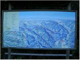 2
2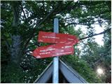 3
3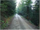 4
4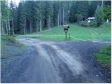 5
5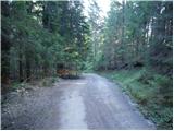 6
6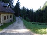 7
7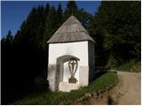 8
8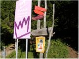 9
9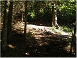 10
10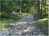 11
11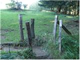 12
12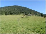 13
13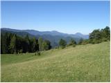 14
14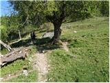 15
15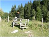 16
16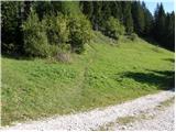 17
17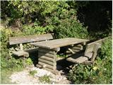 18
18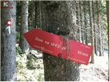 19
19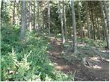 20
20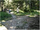 21
21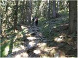 22
22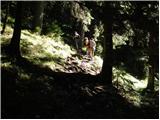 23
23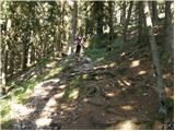 24
24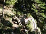 25
25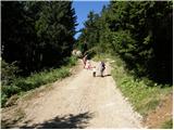 26
26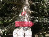 27
27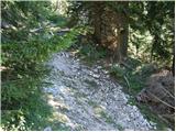 28
28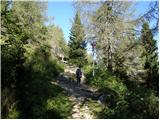 29
29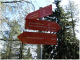 30
30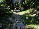 31
31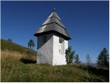 32
32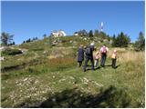 33
33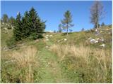 34
34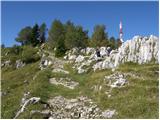 35
35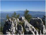 36
36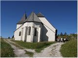 37
37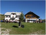 38
38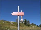 39
39 40
40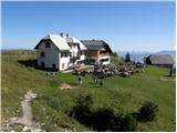 41
41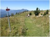 42
42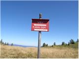 43
43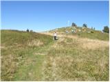 44
44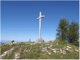 45
45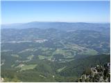 46
46 47
47
Discussion about the trail Ciganija - Uršlja gora (Plešivec)
|
| Darxta13. 11. 2012 |
Bi znal kdo povedati, kakšen teren naj pričakujemo na tej trasi v soboto, če bo od jutri naprej sončno? Razmočen in blaten, suh in lepo prehoden, ali nekaj vmes? 
|
|
|
|
| dogma13. 11. 2012 |
do križana št.7 se gre itak po cesti verjetn bo kaka lužica,naprej ne bi smelo bit kakih težav če ne do dežja,možno je da bo pot čez travnih še mal blatna,naprej po stezi skozi gozd se bo pa do sobote že odteklo-priporočam.
lp
|
|
|
|
| Darxta13. 11. 2012 |
dogma, HVALA!!!! 
|
|
|
|
| Darxta17. 11. 2012 |
Danes smo šli gor. Začetek bolj meglen, pri kmetiji Šišernik pa smo prišli nad oblake in razgledi so bili neverjetni. Morje oblakov, z vrha se je celo videl Grosslockner 180km stran.  Na začetku poti se po krajšem vzponu spustiš za kar 100 višinskih metrov, preden pri Križanu začneš neprekinjeno hojo v hrib. Ta spust se ob povratku spremeni v tisti končni vzpon, za katerega se ti zdi da je popolnoma odveč  Na koncu se nabere na poti na vrh in nazaj skupaj 850 višinskih metrov. Pa zgornji opis poti in slike so zelo uporabni!
|
|
|
|
| Stamp5. 09. 2019 |
Kraća varijanta uspona, od Križana gore na Vrh, pa preko Koče na ledinah natrag, 11km, opisano tu ; Na linku Ako nekom treba gpx - pošaljem u PM.
|
|
|