Starting point: Čezsoča (350 m)
| Lat/Lon: | 46,3209°N 13,5619°E |
| |
Time of walking: 1 h 30 min
Difficulty: easy unmarked way
Altitude difference: 460 m
Altitude difference po putu: 460 m
Map: Julijske Alpe - zahodni del 1:50.000
Recommended equipment (summer): lamp
Recommended equipment (winter): ice axe, crampons, lamp
Views: 8.149
 | 2 people like this post |
Access to the starting point:
First drive to Bovec, then continue to Čezsoča. In Čezsoča, at the Vančar Guesthouse, turn left towards Jablence and the Valley of the Dwarfs and follow the narrow asphalted road to the parking lot near the Slatenik swimming pool.
Path description:
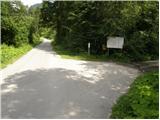
From the parking lot, continue along the asphalted road, which just a few metres further on crosses the Slatenik stream via a bridge and leads to a marked crossroads. Continue to the right on the less good macadam road towards the Valley of the Dwarfs and the Posočje Peace Trail. The road, which climbs gently at first and then moderately, gradually turns into the cart track, which climbs up the western slopes of Humčič. After a good hour's walk along the above-mentioned cart track, you will reach an unmarked crossroads (at the crossroads there is a smaller cairn and direction signs for the valley of the goblins, water and the Slatenik swimming pool), where you turn left along the otherwise marked path (straight ahead - the valley of the goblins and Javoršček, the latter is closed - August 2009).
The ascent continues along a slightly less visible path, which starts to climb steeply towards the saddle between Humčič and Javorščko. The path then gently lays down and leads us to the next crossroads at which we see a small wooden pole, but there are no marked directions for further walking. Continue sharp left along the initially gently sloping path, which quickly leads us under the top of Humčič. Here the path climbs steeply and leads us to a short protected passage ending with a passage into a cavern. The path then crosses the cavern, turns to the right and, after a few steps of further walking, leads to a registration box at the top of Humčič.

Pictures:
 1
1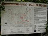 2
2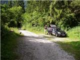 3
3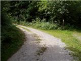 4
4 5
5 6
6 7
7 8
8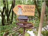 9
9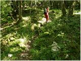 10
10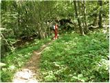 11
11 12
12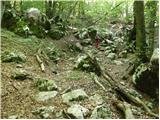 13
13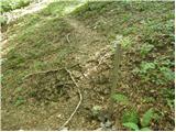 14
14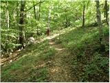 15
15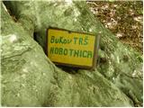 16
16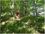 17
17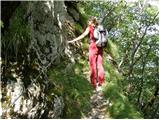 18
18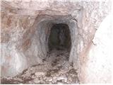 19
19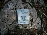 20
20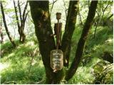 21
21
Discussion about the trail Čezsoča - Humčič
|
| Al3nka7. 07. 2014 |
Izleta ne priporočam, saj je pot zelo slabo vidna.
|
|
|
|
| boma26. 10. 2014 |
Danes smo imeli idejo da obiščemo Humčič a je zaradi res slabo označenih poti nismo uspeli najti vrha.Bo treba ponoviti vajo lokalno planinsko društvo pa naprošam za ponovno označbo poti.
|
|
|
|
| slavkoo27. 10. 2014 |
Ja, v bistvu sploh ni pravega vrha, pot pa resnično izjemno slabo označena oziroma komaj vidna, zaraščena. Kolikor vem se le redko kdo odpravi gor, v bistvu je pravo brezpotje. Bolje se je odpraviti na planino Golobar in po želji še naprej na Javoršček, kjer se ponuja res lep pogled na bovško kotlino na eni strani in na drugi v dolino Zaprikraj, Krna...
|
|
|
|
| darinka46. 12. 2022 20:38:18 |
Tura v kratkem dnevu je bila prav zanimiva. Gor smo šli po zgornji poti ki pelje do podora. Spustili smo se po dolini Slatenika v Čezsočo. Si ogledali kaverne pod vrhom.
|
|
|