Čepulje - Sveti Jošt above Kranj
Starting point: Čepulje (672 m)
| Lat/Lon: | 46,2326°N 14,2832°E |
| |
Time of walking: 45 min
Difficulty: easy marked way
Altitude difference: 173 m
Altitude difference po putu: 210 m
Map: Škofjeloško in Cerkljansko hribovje 1:50.000
Recommended equipment (summer):
Recommended equipment (winter): crampons
Views: 13.550
 | 1 person likes this post |
Access to the starting point:
a) First drive to Kranj (Labore) and from there continue in the direction of Stražišče, Pševo and Svetje Jošto nad Kranjem. Higher up, we reach the village of Javornik, from which a road branches off to the right towards the top of Jošto, and we continue straight on in the direction of Čepulje. When you reach Čepulje, continue to the right (Planica and Lavtarski Vrh on the left) and continue driving for about 100 m to a marked parking area.
b) Take the road to Škofja Loka and then continue driving towards Železniki. After Bukovica, leave the main road towards Železniki and turn right towards Ševlje and Bukovščica. After Bukovščica, the road starts to climb steeply, passing through the settlement of Strmica. After this settlement, the asphalt ends briefly, and when it reappears, you will quickly reach a marked parking area just before the beginning of the village of Čepulje.
c) First drive to Železniki, then continue towards Škofja Loka. At Dolenjja vas or a little beyond, leave the main road and turn left in the direction of Šavlje and then towards Bukovščice. After Bukovščica, the road starts to climb steeply, and in the meantime it leads through the village of Strmica. After this settlement, the asphalt ends briefly, and when it reappears, you will quickly reach a marked parking area just before the beginning of the village of Čepulje.
Path description:
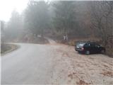
On the west side of the parking lot we see signs for Špičasti hrib and Sv. Mohor, which direct us to the ascending forest road, and at the beginning of the road we continue to the sharp right, on the path leading to Sv. Jošto (the turn-off to Sv. Jošto is not marked). At first we climb moderately through the lane of a forest, and then, when we leave the forest, the path leads us upwards, along the right-hand edge of a vast hayfield. On the other side of the hay meadow, the marked path leading from Planica towards Sv. Jošto joins us from the right, and we follow it to the left and enter the forest a few steps higher. In the forest we quickly reach a marked crossroads, where we continue to the right (Špičasti hrib and Sv. Mohor on the left). There is a short crossing, then the path widens into cart track, which leads down to a nearby water supply structure, from where you continue straight into the forest. From the path through the forest, quickly ascend to an asphalt road, which you follow to the left, and then walk along it to the first right turn, and from there straight on to cart track. Continue ascending gently at first, then a little steeper after a couple of crossroads where you follow the signs. The steep climb is cut by an asphalt road leading to the summit, and we continue straight across the road, onto a path that continues over an increasingly scenic grassy slope. After a further short climb, we reach the Dom na Joštu, and a few 10 steps further on, the Church of St. Jošta.
Description and pictures refer to the situation in 2015 (December).

Pictures:
 1
1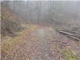 2
2 3
3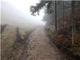 4
4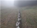 5
5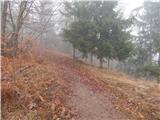 6
6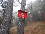 7
7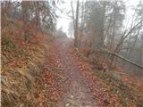 8
8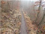 9
9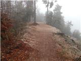 10
10 11
11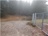 12
12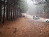 13
13 14
14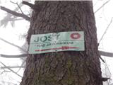 15
15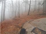 16
16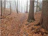 17
17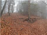 18
18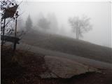 19
19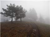 20
20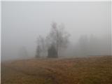 21
21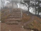 22
22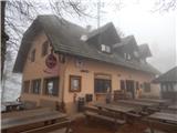 23
23 24
24 25
25
Discussion about the trail Čepulje - Sveti Jošt above Kranj
|
| Tinca524. 02. 2024 14:53:23 |
Če kdo pogreša avtomobilske kjuče VW, visijo na znaku pri parkirišču na Čepuljah.
|
|
|