Carbonin - Helltaler Schlechten
Starting point: Carbonin (1451 m)
| Lat/Lon: | 46,62143°N 12,21116°E |
| |
Time of walking: 3 h 50 min
Difficulty: easy pathless terrain
Altitude difference: 1260 m
Altitude difference po putu: 1270 m
Map: Tabacco 03 1:25.000
Recommended equipment (summer):
Recommended equipment (winter): ice axe, crampons
Views: 2.712
 | 1 person likes this post |
Access to the starting point:
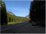
Access from Gorenjska: Take the Border crossing Rateče road to Trbiž / Tarvisio, where you take the motorway towards Udine. Leave the motorway at the exit for Tolmezzo and follow the road to the above-mentioned place. From Tolmezzo, continue in the direction of Ampezzo and the Passo della Mauria mountain pass. The road then begins to descend and leads into the Cadore valley, where you continue to the right (Belluno and Cortina d'Ampezzo on the left) in the direction of Auronzo. After a few more kilometres, you reach the next major crossroads, where you turn right towards Misurina (left Tre Croci Pass). From here, you follow the road downhill to a major crossroads (right Dobbiaco and Austria, left Cortina d'Ampezzo). From the crossroads, you continue for a few more 100 metres towards Cortina d'Ampezzo, and then you park in a small parking lot on the right-hand side of the road.
From the Primorska side: Take the motorway that leads via Border crossing Sežana to Trieste. Continue on the Italian motorway towards Padua, but only as far as the motorway junction, where you continue towards Veneto and Belluno. Near Belluno the motorway ends and we continue towards Cortina d'Ampezzo and Auronzo. As the road enters the Cadore valley, we come to a large junction where the road towards Cortina d'Ampezzo goes left and the road towards Auronzo goes right. Here we continue to the right towards Auronzo. Continue as described above.
Path description:
From the parking lot, turn right onto the dirt road, where you will be directed by signs for "Dürrensteinhütte / Rif. Vallandro". After a short climb, you will quickly reach a gate where you enter the Fanes Sennes Prags Nature Park. Continue for some time along the road, which alternates between macadam and asphalt. From the road, which mostly passes through the forest, we have some nice views of the Cristallo mountain group. The road then leads to a crossroads, where signs direct you to the right onto a footpath.
The footpath then climbs mostly through the forest and later crosses the road a few times. The relatively gentle path leads us in the last part of the way towards the cottage to grassy slopes from which we get even better views of the surrounding peaks. From the footpath we briefly rejoin the road, and then there is a short steeper climb up to the hut.
From the hut, continue north along route 34, following the signs for Strudelkopf, Helltal. The path is relatively level and wide and soon leads to a marked crossroads. Bear left after the "Höhenweg, Alta Via" signs and take the path to Strudelkopf on the right. The path narrows slightly further and crosses grassy slopes to the north. The scenic route across the grassy slopes soon leads to another crossroads, where the path from the Plätzwiesehütte / Rifugio Pratopiazzo hut joins from the left.
The path from the crossroads then crosses a fence and starts to climb slightly steeper. Walk along the path leading to Durrenstein for a while, then leave the marked path and turn right onto a trackless path. When you leave the marked path, head southeast and start to climb cross-climbing towards the ridge. There are also some less visible paths to climb. It does not matter exactly where you climb, it is only important that you reach the ridge. Keep in mind that the further south you go, the steeper the slope will be.
When you reach the ridge, bear left and then keep climbing up along the ridge. The cairns, which are placed along the ridge, also help you to find your way. While ascending the ridge, we have a good view of the Cristallo and Croda Rossa mountain ranges, and the ridge also offers beautiful views to the east, where the Three Cines stand out. In the last part of the ascent towards the summit, the grassy slopes turn to rocky ones and soon we can see the summit, which is not far away.

Pictures:
 1
1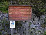 2
2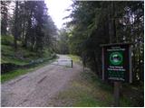 3
3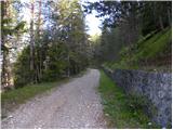 4
4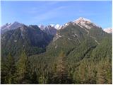 5
5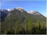 6
6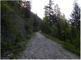 7
7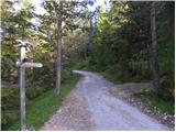 8
8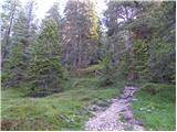 9
9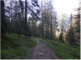 10
10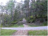 11
11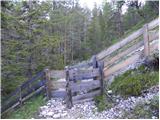 12
12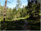 13
13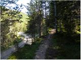 14
14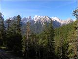 15
15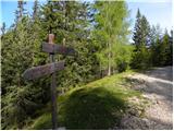 16
16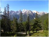 17
17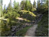 18
18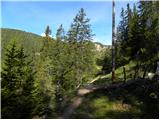 19
19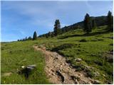 20
20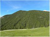 21
21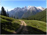 22
22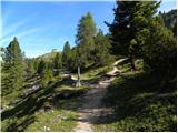 23
23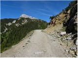 24
24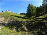 25
25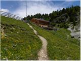 26
26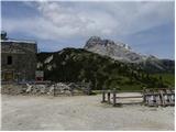 27
27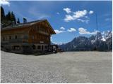 28
28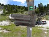 29
29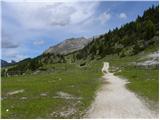 30
30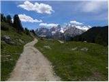 31
31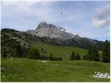 32
32 33
33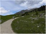 34
34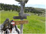 35
35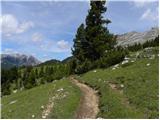 36
36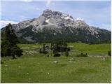 37
37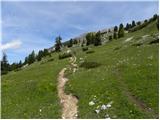 38
38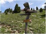 39
39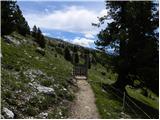 40
40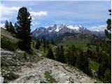 41
41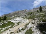 42
42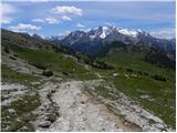 43
43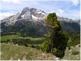 44
44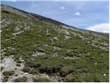 45
45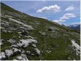 46
46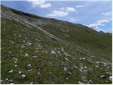 47
47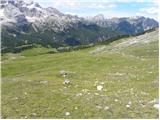 48
48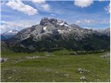 49
49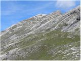 50
50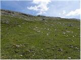 51
51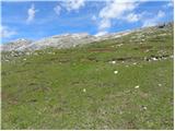 52
52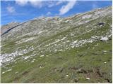 53
53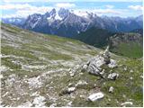 54
54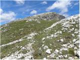 55
55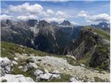 56
56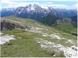 57
57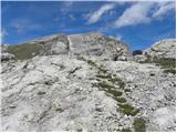 58
58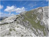 59
59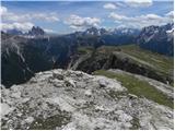 60
60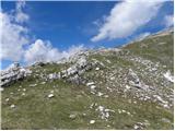 61
61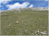 62
62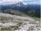 63
63 64
64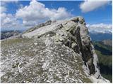 65
65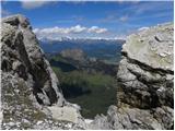 66
66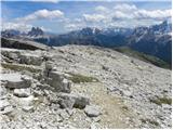 67
67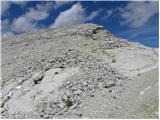 68
68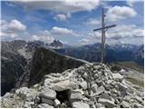 69
69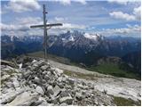 70
70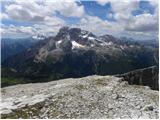 71
71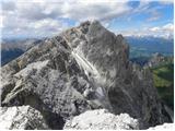 72
72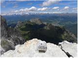 73
73
Discussion about the trail Carbonin - Helltaler Schlechten